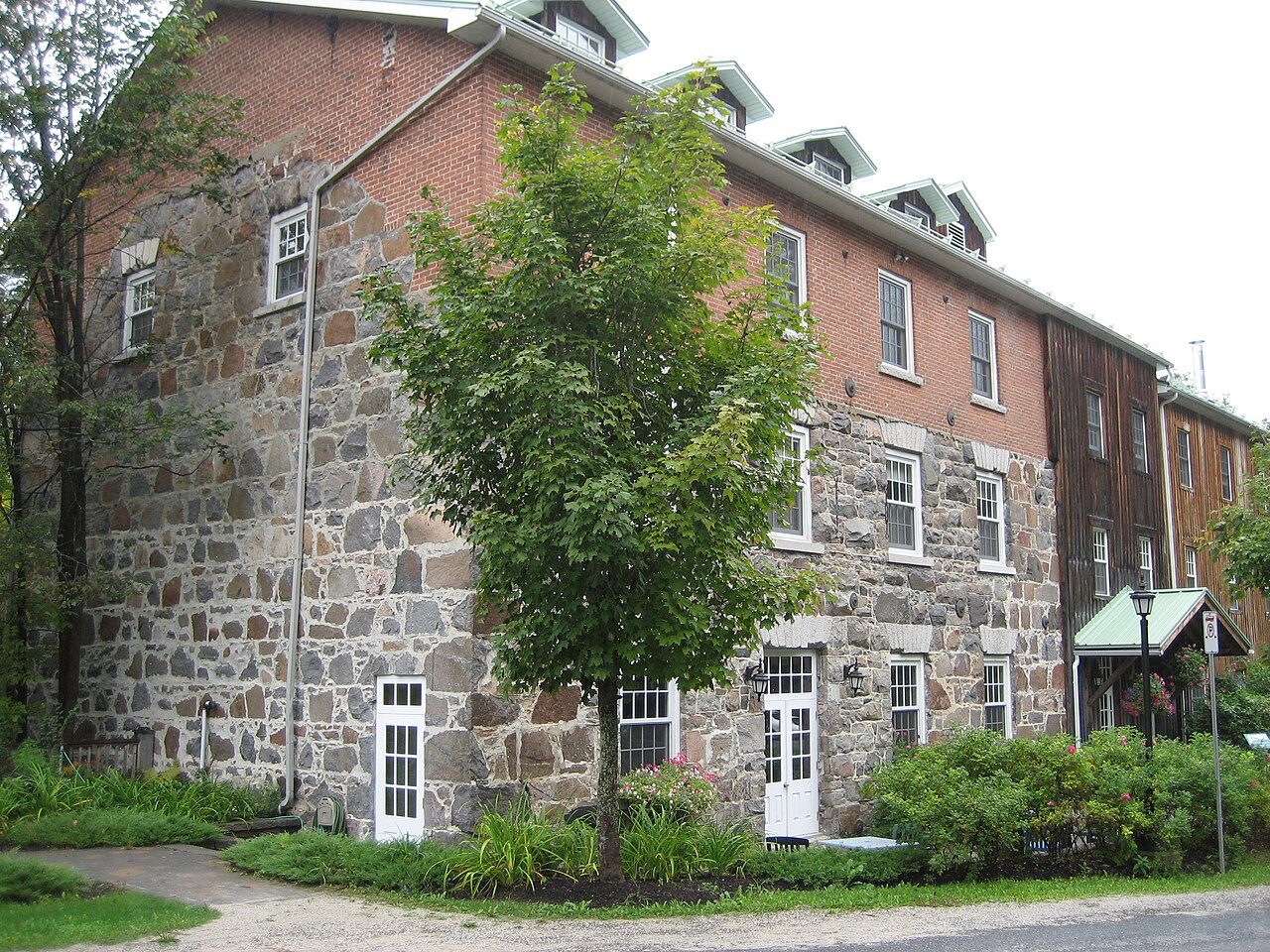
Grist Mill
In French: Moulin Wakefield
60 Mill Road, La Pêche
About Grist Mill
Grist Mill is one of 3 Recognized Federal Heritage Buildings in La Pêche. Grist Mill dates from 1838–1839. Its maker on the record: William Fairbairn. One other place on the registers stands within 400 m.
West of the town of Wakefield on a sloping riverbank adjacent to the La Peche River, the Grist Mill is a simple, rough cut stone and brick, rectangular building that rises three stories above its stone foundation at the front façade and four plus a basement at the rear. The structure’s additions at the south and west facades are sheathed in wood board and batten siding and abuts the original stone structure. The stone portion of the building has evenly spaced double sash windows, which are topped with stone lintels. At water level there are turbines to drive the mill machinery. The designation is confined to the footprint of the building.
From the Canadian Register of Historic Places, Grist Mill · Open Government Licence – Canada · the register’s own words, unchanged
Recognized federal heritage buildings are owned by the Government of Canada and reviewed for their heritage value.
Make it a walk: 2 historic places in about 5 minutes
La Pêche · about 100 m on foot, as the crow flies


- 1Grist MillStart here
- 2Maclaren HouseRecognized Federal Heritage Building · 100 m on
1 within 300 m
Every place on the record within this distance; each opens its own page.
Questions about Grist Mill
When was Grist Mill built?
The record of Grist Mill gives 1838–1839.
What is Grist Mill?
Grist Mill is a Recognized Federal Heritage Building, designated in 1985.
Is Grist Mill protected?
While the federal government owns it, changes go through its heritage review.
Can you visit Grist Mill?
It can be seen from the street; whether you can go inside depends on its owner.
Contains information licensed under the Open Government Licence – Canada (Parks Canada).
Sources: Parks Canada, Directory of Federal Heritage Designations · Canadian Register of Historic Places (federal extract) · Photos: Wikimedia Commons, each credited with its licence and copied to our own server · Wikidata (CC0) for map points, other names and articles.
Adapted from Statistics Canada (Census of Population 2021, population estimates 2025, 2021 census boundaries) under the Statistics Canada Open Licence; this does not constitute an endorsement by Statistics Canada. Neighbourhood names in some cities © OpenStreetMap contributors (ODbL).