 Photo: Robert Garry · CC BY-SA 4.0
Chibougamau in 3 old photographs, 1904–1910
The nearest town to Chibougamau with a top designation is Eeyou Istchee Baie-James, 93 km away. Wikidata’s date for the municipality is 1952; it may record a founding, an incorporation or an amalgamation.
Chibougamau from 1904 to 1910
Here in time order: 3 old photographs of the town. Hover a dot for its date; tap a picture to see it full screen.
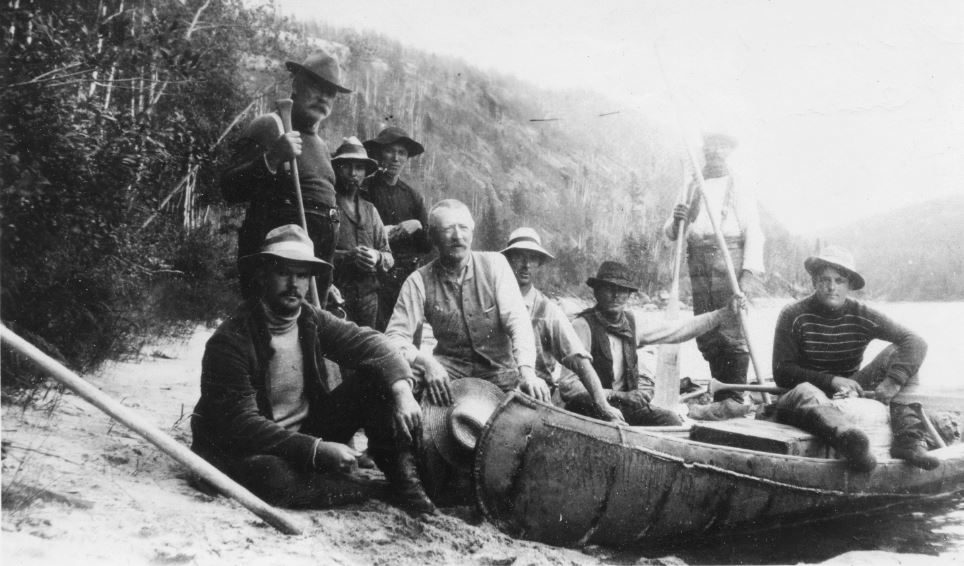 1904
 1910
 1910
Public domain or CC0, made before 1950, from Wikimedia Commons; old views of places can be drawings, prints or maps of their time. Each credit opens the image’s page.
Only 2.5% of Chibougamau’s homes were built from 2016 to 2021 (4.1% is typical)
Chibougamau has an unusual share of homes built from 1961 to 1980: 53%, where most towns have 27%. Few of Chibougamau’s homes date from 2001 to 2015: 6.9%, the norm 15%. 16% of Chibougamau’s homes predate 1961, close to the typical town’s 18%.
2021 Census, private dwellings by period of construction (Statistics Canada); the typical town is the middle Canadian town of 2,500 or more.
How Chibougamau compares with 16 towns its size
Towns of 7,200 to 7,300 residents, by places on the registers.
Their median is 0. For 16, the registers list nothing.
Chibougamau in brief
The census dates only 16% of its homes before 1961, against 18% in the typical town. Towns its size usually have more historic places; the middle one has 0.
What this data can and can’t tell you
- Québec’s register. In Québec the ministry of culture publishes its register openly: provincial classements, declared sites and the municipalities’ citations all appear, with their descriptions.
- The federal register. Every federal designation is in Parks Canada’s directory, and the Canadian Register of Historic Places gives most of them a bilingual statement of significance.
- People and events. Parks Canada’s open file gives its national historic persons no place. A town’s page names one only when the person was born there (matched by name and both life years) or one of its own historic places carries the name and its record speaks of them; national historic events stay off.
- The grade. History isn’t one of Canada’s graded pillars, so this page describes and compares without a letter.
- Protection. Québec’s classements and citations carry legal protection: work on a classified building needs the minister’s authorization, on a cited one the municipality’s. Federal designations commemorate.
- The tiers. National Historic Sites and the most protected buildings form the top tier; recognized federal buildings, stations and lighthouses the second; provincial and municipal listings the third.
Questions about Chibougamau’s history
When did Chibougamau become a municipality?
The date Wikidata holds for Chibougamau is 1952, whether founding, incorporation or merger.
How old are the homes in Chibougamau?
Before 1961: 16% of its homes; the typical town has 18%.
Contains information licensed under the Open Government Licence – Canada (Parks Canada).
Sources: Parks Canada, Directory of Federal Heritage Designations · Canadian Register of Historic Places (federal extract) · Wikidata (CC0) for map points, other names and articles · Statistics Canada, 2021 Census (homes by period of construction). Under the Statistics Canada Open Licence.
Adapted from Statistics Canada (Census of Population 2021, population estimates 2025, 2021 census boundaries) under the Statistics Canada Open Licence; this does not constitute an endorsement by Statistics Canada. Neighbourhood names in some cities © OpenStreetMap contributors (ODbL).