National Historic Sites, classified federal buildings and Québec’s classements
Provincial and local listings
3
municipal citations on Québec’s register
Oldest building
1676
the first construction date on its record
Homes built before 1961
27%
typical town: 18%
In pictures
Photos of 2 of the 3 top-tier places in Chambord
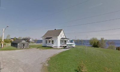
Of the places pictured in Chambord, “819, route de la Pointe” is the oldest, from 1863. The photos cover 4 of Chambord’s designated places; the rest keep their register record. 2 of the top-tier places in Chambord have a photo.
Photos from Wikimedia Commons, each credited to its photographer with its licence; names open the place’s page. Tap a photo to step through them full screen.
How old
In Chambord, the decades after Confederation left the most behind
Each place by the first construction date on its record.
New France before 17601
British North America 1760–18661
After Confederation 1867–19134
Wars and Depression 1914–19450
Since 1946 1946 on0
2 of the 6 dated places were built before Confederation.
How it began
Back to 1973: Chambord’s first record
As a municipality, Chambord carries the date December 8, 1973 on Wikidata: a founding, an incorporation or an amalgamation. Chambord and Saint-Louis-de-Chambord gave way to the present municipality in 1973.
Every place on the registers inside the town, by its designation.
Highest designationsProvincial and local listings
Hover a dot for its name; tap one to open its page.
The 6, by tier
3 Highest designations3 Provincial and local listings
The federal directory and the Répertoire du patrimoine culturel du Québec are both open, so every federal, provincial and municipal designation here has its point.
Points from Wikidata (Parks Canada’s files carry none) and from Québec’s register, as mapped there.
Highest designations
3 places in Chambord with the highest designation
The group holds 2 places classified by Québec and a National Historic Site. National Historic Sites and Classified Federal Heritage Buildings, Canada’s highest federal recognition. They date from 1676 (Métabetchouane archaeological site) to 1901. Each one opens its own page.
Second on the list: mills, shops and works, 2 of them. At the head of the list: Historic Village of Val-Jalbert and Métabetchouane archaeological site.
Houses3
Mills, shops and works2
Other places1
The groups come from each place’s name and its recorded functions, by what it was built as.
Provincial and local listings
3 local listings in Chambord
Citations the municipality has made, registered with Québec’s ministry of culture. They date from 1863 (“819, route de la Pointe”) to 1906. Each one opens its own page.
Municipal citation (Québec) · 1875Auberge Saint-Louis158 rue de la Gare¤160 rue de la Gare
Homes by age
Old houses stand out in Chambord: 27% predate 1961, where most towns have 18%
More of Chambord’s homes were built from 1961 to 1980 than in any other period: 29%. New building is strong in Chambord: 7.1% of homes date from 2016–21, where most towns have 4.1%. Over half of the homes in Chambord were already standing by 1981.
27%
Before 1961
29%
1961–80
21%
1981–2000
17%
2001–15
7.1%
2016–21
ChambordTypical town
2021 Census, private dwellings by period of construction (Statistics Canada); the typical town is the middle Canadian town of 2,500 or more.
Before 1961: 27% of Chambord’s homes, against 18% in the typical town. All told, the registers hold 6 historic places, 3 with the highest designation. 4 of the 6 dated places belong to the decades after Confederation. For the rest, one person of its past, Joseph Miville Dechene (1879); and the list grew between 1988 and 2019.
How to read these numbers
What this data can and can’t tell you
•
Québec’s register. Québec is the one province whose register is open: classements, declarations and municipal citations, described by the ministry in French.
•
The federal register. The federal list is complete and open: Parks Canada’s directory for the designations, the Canadian Register of Historic Places for what each one is and why it matters.
•
Map points. Parks Canada publishes no coordinates, so federal places are pinned where Wikidata puts them.
•
Protection. In Québec, a classement or a municipal citation under the Loi sur le patrimoine culturel protects the building in law; a federal designation recognises significance and binds only federal owners.
•
The tiers. Tiers follow the designation: national recognition and classement first, other federal designations next, provincial and local listings last.
•
The grade. There is no history grade: the page sets out the record and compares it with other towns.
•
People and events. National historic persons carry no place in the open file. They appear on a town’s page when born there (same name, same birth and death years) or when a historic place inside it carries their name and its record names them with their dates; national historic events don’t appear.
Questions about Chambord’s history
What is the oldest building in Chambord?
By its record, Métabetchouane archaeological site, from 1676 (Classified heritage site (Québec)).
Which places in Chambord have the highest designation?
They are Historic Village of Val-Jalbert, Métabetchouane archaeological site and Val-Jalbert.
How old are the homes in Chambord?
27% of its homes were built before 1961, against 18% in the typical Canadian town.
Contains information licensed under the Open Government Licence – Canada (Parks Canada). Québec register data: Ministère de la Culture et des Communications du Québec, CC BY 4.0.
Sources: Parks Canada, Directory of Federal Heritage Designations · Canadian Register of Historic Places (federal extract) · Répertoire du patrimoine culturel du Québec (MCC, Données Québec) · Wikidata (CC0) for map points, other names and articles · Statistics Canada, 2021 Census (homes by period of construction). Under the Statistics Canada Open Licence.


 Top
 Local
 Local