KingstonPrince Edward Island
Population 1,308: a town on Prince Edward Island. The population grew 6% between 2016 and 2021.
Is Kingston a good place to live?
Jobs and pay hold up well (A+). Recorded crime is low (A−). Most journeys need a car (D−). At $348,000, the median home value in 2021 came to 3.2 times local household income.
Figures: home values and income: Statistics Canada, Census 2021. An overall grade comes at 2,500 residents for Canadian towns; Kingston has its subject grades alone.
Safety is the police detachment's figure, shared with the towns and countryside around it. No School Grade: this province doesn't publish comparable results school by school. Health is graded on the health region's survey figures and life expectancy, with the distance to hospital giving the town its own spread.
How Kingston grades
Each subject compares Kingston with Canadian towns of 2,500 or more, ordered by how far it is from the middle. Towns in other countries are graded separately.
An overall grade comes at 2,500 residents for Canadian towns; Kingston has its subject grades alone.
How TownRatings grades Canadian towns →
What makes Kingston stand out
The 3 things Kingston does most differently from other towns.
The data
Data highlights are ordered by what stands out in Kingston.
Household incomes in Kingston top those of 91% of Canadian towns
The car took 97% of commuters, about level with Prince Edward Island’s towns (95%) and above Canadian towns (89%). Getting to work takes 24 min on average.
How working residents got to work · census 2021
| Census 2021 | Kingston | Prince Edward Island | Canada |
|---|---|---|---|
| Car or van | 97% | 95% | 89% |
| Average trip | 24 min | 23 min | 26 min |
Statistics Canada, Census 2021 (labour and commuting) · The 2021 census was taken in May 2021, during COVID-19 restrictions: more people than usual worked from home or were off work.
Kingston faces fewer hazards than 88% of Canadian towns
Fewer homes than usual carry radon here, 3.5% over the guideline where the typical town has 6.6%. The national inventory holds 2 flood maps for it, the newest from Department of Environment, Energy and Climate Action - Government of Prince Edward Island. Seismic risk in Kingston sits near the middle: $0.018 of expected damage per $1,000 of buildings a year, the typical town $0.030.
Radon tests above the guideline · share of tested homes, 200 Bq/m³
| Hazards | Kingston | Prince Edward Island | Canada |
|---|---|---|---|
| Radon tests above the guideline | 3.5% | 3.5% | 6.6% |
| Earthquake loss per $1,000 of buildings a year | $0.018 | $0.020 | $0.030 |
NRCan seismic risk model and burned areas, Health Canada radon survey, the Flood Hazard Map Inventory · Not measured by town: radon tests (the Prince Edward Island Health Region)
The nearest high school to Kingston is 85 km away
Young children have 53 km to the nearest elementary school, close to Prince Edward Island’s towns (56 km) and above Canadian towns (0.5 km).
| School | Level | Students | System |
|---|---|---|---|
| Bluefield High SchoolIn KingstonElementary | Elementary | – | English public |
| Schools within 3 km | Kingston | Prince Edward Island | Canada |
|---|---|---|---|
| Nearest secondary school | 85 km | 76 km | 1.2 km |
| Nearest elementary school | 53 km | 56 km | 0.5 km |
Statistics Canada’s Open Database of Educational Facilities · Source note: the province publishes no results school by school, so there’s no schools grade on Prince Edward Island.
For safety, Kingston gets an A−
Measured across the Queens District detachment area: Crime Severity Index, Violent Crime Severity Index, violent crime and property crime per 1,000
The violent index for its police area came to 51, below Prince Edward Island’s towns (54) and Canadian towns (86) alike. Property crime in the area its police cover: 16.3 per 1,000 people a year.
Year by year · Crime Severity Index for each year
| 2023–2025 | Kingston | Prince Edward Island | Canada |
|---|---|---|---|
| Property crime per 1,000 | 16.3 | 19.4 | 31.2 |
| Violent Crime Severity Index | 51 | 54 | 86 |
| Crime Severity Index | 47 | 47 | 67 |
Statistics Canada, Uniform Crime Reporting Survey, 2023–2025 average
More households own their home in Kingston than in Prince Edward Island’s towns or across Canadian towns: 96%
Rent took 15% of household income, lower than both Prince Edward Island’s towns (18%) and Canadian towns (20%). Behind rent as a share of income and monthly rent for a two-bedroom sits data gathered across the Charlottetown metro area, with Kingston one part of it.
What homes were worth · The median owner’s estimate at the 2021 census
| Census 2021 | Kingston | Prince Edward Island | Canada |
|---|---|---|---|
| Households spending 30%+ on shelter | 0% | 11% | 18% |
| Households owning their home | 96% | 86% | 74% |
| Rent as a share of income | 15% | 18% | 20% |
| Median home value, 2021 | $348,000 | $288,000 | $406,000 |
Statistics Canada, Census 2021; CMHC Rental Market Survey via Statistics Canada · The 2021 census asked owners what their home was worth; those values, and 2020 incomes, are what this compares.
More rain and snow fall on Kingston than on 93% of Canadian towns: 1,290 mm a year
A normal winter brings 313 cm of snow, above Prince Edward Island’s towns (285 cm) and Canadian towns (141 cm) alike. Rain and snow peak in December, at 143 mm. Most of the snow comes in January, about 74 cm. A July afternoon in Kingston typically reaches 23.7°C.
Average high by season · ECCC normals, 1991–2020
| Normals, 1991–2020 | Kingston | Prince Edward Island | Canada |
|---|---|---|---|
| Snowfall a year | 313 cm | 285 cm | 141 cm |
| Precipitation a year | 1,290 mm | 1,136 mm | 883 mm |
| July afternoon high | 23.7°C | 23.7°C | 25.5°C |
| January night low | −11.0°C | −11.4°C | −13.5°C |
Environment and Climate Change Canada, Canadian Climate Normals 1991–2020 (Elmwood)
A town of families: 21% of people in Kingston are under 15, more than in Prince Edward Island’s towns or Canadian towns
16% speak both English and French, above Prince Edward Island’s towns (13%) and Canadian towns (7.5%) alike. People 65 and over make up 14% of the town.
Ages · Share of residents in each age group, Census 2021
Schooling · Highest qualification, residents 15 and over
Women and men · all residents
48.2% of Kingston’s residents are women
The 2021 census counted 535 women and 575 men here, where women make up 50.9% of Canada.
| Kingston | Prince Edward Island | Canada | |
|---|---|---|---|
| Under 15 | 21% | 17% | 16% |
| 15 to 64 | 64% | 63% | 64% |
| 65+ | 14% | 19% | 19% |
| No certificate, diploma or degree | 11% | 14% | 16% |
| Postsecondary qualification | 67% | 61% | 56% |
Statistics Canada, Census 2021; Prince Edward Island and Canada: medians of towns of 2,500+
A normal November in Kingston runs from freezing to 7°C
Snow is normal by November, about 21 cm over the month. Looking ahead to December, expect highs near 1°C and lows near −6°C. A normal November brings 119 mm of rain and snow. Across the year, normals run from −11°C nights in January to 24°C afternoons in July.
Normal highs, the months ahead · ECCC normals, 1991–2020
| Season | High | Low | Rain and snow |
|---|---|---|---|
| Winter | −2°C | −9°C | 356 mm |
| Spring | 8°C | −1°C | 296 mm |
| Summer | 22°C | 13°C | 288 mm |
| Autumn | 13°C | 5°C | 351 mm |
ECCC normals, 1991–2020 (Elmwood); the forecast is on the Weather page
Turnout in Malpeque reached 75% in 2021, above 99% of ridings
No provincial riding is named for Kingston, because the Legislative Assembly of Prince Edward Island’s boundary file gives no terms of reuse.
Wikidata, MAMH, MMAH, Statistics Canada
No public library stands in Kingston: the closest, Tiny Library (Seasonal), is 12 km away
The next is Robertson Library (Charlottetown), 13 km away.
Provincial library statistics, OpenStreetMap, the CRA and Statistics Canada
Prince Edward Island National Park is 17 km from Kingston
7 mapped walking routes pass within 2 km, among them the Confederation Trail - Tignish to Elmira and Confederation Trail (all spurs). 8.6 km out lies the largest, Scallop Buffer Zone (SFA 22), at 285,278 ha. A provincial park, Fox Harbour Provincial Park, lies 44 km away. OpenStreetMap shows 3 unnamed beaches within 5 km.
Protected land · of the land within 10 km
| Outdoors | Kingston | Prince Edward Island | Canada |
|---|---|---|---|
| Protected land within 10 km | 1.8% | 4% | 2.3% |
| Public protected areas within 10 km | 6 | 7 | 4 |
Canadian Protected and Conserved Areas Database (CPCAD), OpenStreetMap routes and beaches
Around Kingston, 51% of adults call their health very good or excellent
Statistics Canada puts the region’s life expectancy at 81.2, women 83.3 and men 79.1 (2022/2024). For Kingston itself the measure is access, and it lags: 17 km to the nearest hospital, where 3.7 km is typical.
Very good or excellent health · adults, age-standardised
| Health | Kingston | Prince Edward Island | Canada |
|---|---|---|---|
| Very good or excellent health | 51% | 51% | 52% |
| Life expectancy at birth | 81.2 | 81.2 | 81.5 |
Statistics Canada, Canadian Community Health Survey 2023/2024 and life expectancy 2022/2024; Open Database of Healthcare Facilities · Data for health survey and life expectancy covers the Prince Edward Island health region
Everything we know about Kingston
Island Hill Farm and 6 more within 40 km
One place to visit is mapped within 5 km of Kingston; with it, the best known within 40 km.
 National park · Parks CanadaPrince Edward Island National Park28 km north
 ChurchSt. Dunstan's Roman Catholic Basilica14 km east
 Museum · Parks CanadaGreen Gables House26 km northwest
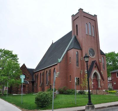 CathedralSt. Peter's Cathedral14 km east
 MuseumFarmers' Bank of Rustico18 km north
Photos: each place’s Wikidata image, from Wikimedia Commons under the licence below (our copy, resized).
Photo credits (5)
- Prince Edward Island National Park: Rick McCharles, CC BY 2.0, Wikimedia Commons
- St. Dunstan's Roman Catholic Basilica: SoftwareSimian (changes by Rabanus Flavus ), CC BY-SA 4.0, Wikimedia Commons
- Green Gables House: JAKclapclap47, CC BY-SA 2.5, Wikimedia Commons
- St. Peter's Cathedral: Robert Cutts from Bristol, England, UK, CC BY-SA 2.0, Wikimedia Commons
- Farmers' Bank of Rustico: Fralambert, CC BY-SA 3.0, Wikimedia Commons
Famous people from around Kingston
No notable person born in Kingston is on our list; these were born in the towns around it.


Photo credits
Brian Tracy: Daniel Wikberg, CC BY 2.0 · Martha MacIsaac: Brian Solis, CC BY 4.0 · Brett Gallant: Krazytea, CC BY-SA 4.0 · Adam McQuaid: goaliej54, CC BY-SA 2.0 · Alysha Corrigan: Like tears in rain, CC BY-SA 4.0
About Kingston
Town in Prince Edward Island
For Kingston, TownRatings uses Statistics Canada’s census-subdivision boundary on Prince Edward Island, and every figure on its pages covers that whole area.
Statistics Canada: population estimates 2025 (17-10-0155), Census of Population 2021, 2021 census boundaries.
- Population
- 1,308 (people, 2025 estimate)
- Province or territory
- Prince Edward Island
- Census division
- Queens
- Metro area
- Charlottetown
- Census subdivision
- 1102022
Kingston’s neighbours
The nearest places of 1,000 or more. Statistics Canada
| Town | People | km | Overall | Cost | Safety | Health |
|---|---|---|---|---|---|---|
| Kingston | 1,308 | — | — | B+ | A− | B− |
| Miltonvale Park | 1,279 | 7.6 | — | C | A− | B |
| Cornwall | 7,920 | 8.8 | B+ | C | B+ | B |
| West River | 4,155 | 12 | A− | B− | A− | B− |
| Charlottetown | 48,118 | 13 | C+ | D | C | B |
| Crapaud, Part 1 | 1,781 | 13 | — | B− | A− | C+ |
| New Glasgow | 5,502 | 13 | B− | C | A− | B− |
People: Statistics Canada, Census 2021. Distances: centre to centre.
Questions about Kingston
What kind of homes are in Kingston?
A household averages 2.8 people; 17% are one person living alone.
Who are the people of Kingston?
Visible minorities are 0% of the population, where the middle of Canadian towns is 15%. Immigrants make up 6%, and Indigenous people 0%.
Do people in Kingston speak French?
16% of residents can hold a conversation in both English and French, against 8% for the median of Canadian towns; 0% speak French but not English.
Is Kingston growing?
It added people: 1,047 in 2016, 1,111 in 2021, 6.1% more, where the middle of Canadian towns grew 4.1%. Statistics Canada’s 2025 estimate is 1,308.
Sources: Statistics Canada, Census of Population 2021 · population estimates 2025 (17-10-0155) and 2021 census boundaries · Uniform Crime Reporting Survey 2023–25 (35-10-0026, 35-10-0183 to 35-10-0190) · CMHC rents as published by Statistics Canada (34-10-0133) · grades by TownRatings. Under the Statistics Canada Open Licence.
Adapted from Statistics Canada (Census of Population 2021, population estimates 2025, 2021 census boundaries) under the Statistics Canada Open Licence; this does not constitute an endorsement by Statistics Canada. Neighbourhood names in some cities © OpenStreetMap contributors (ODbL).