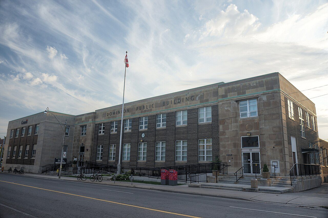
Postal Station “D”
In French: Succursale postale « D »
328 Keele Street, Junction Area
About Postal Station “D”
The federal government recognizes Postal Station “D” for its heritage, the only such building in Junction Area. The register gives 1935–1937 for Postal Station “D”. James Henry Craig designed it.
Postal Station “D” is a modern classical, stone and brick building located in the commercial centre of West Toronto. It is a long, two-storey, flat-roofed structure with a single-storey annex attached at the back. The principal façade, which faces Keele Street, is composed of a seven bay central section, flanked on either end by slightly projecting entrance pavilions clad in cut stone. The central portion rises slightly above the entrance pavilions and is clad in brick. A broad, stone frieze runs across the front of the building, unifying the three sections of the design. The footprint is confined to the footprint of the building.
From the Canadian Register of Historic Places, Postal Station “D” · Open Government Licence – Canada · quoted as the register has it
The federal government rates the heritage buildings it owns as Classified or Recognized.
Finding Postal Station “D”
Junction Area


To reach another historic place from here you will need more than a short walk.
Questions about Postal Station “D”
Can you visit Postal Station “D”?
You can see it from the street, while entry depends on its current use.
When was Postal Station “D” built?
Work on Postal Station “D” is recorded as 1935–1937.
What is Postal Station “D”?
Postal Station “D” has been a Recognized Federal Heritage Building since 1988.
Is Postal Station “D” protected?
The federal heritage policy applies while Canada owns it.
Contains information licensed under the Open Government Licence – Canada (Parks Canada).
Sources: Parks Canada, Directory of Federal Heritage Designations · Canadian Register of Historic Places (federal extract) · Photos: Wikimedia Commons, each credited with its licence and copied to our own server · Wikidata (CC0) for map points, other names and articles.
Adapted from Statistics Canada (Census of Population 2021, population estimates 2025, 2021 census boundaries) under the Statistics Canada Open Licence; this does not constitute an endorsement by Statistics Canada. Neighbourhood names in some cities © OpenStreetMap contributors (ODbL).