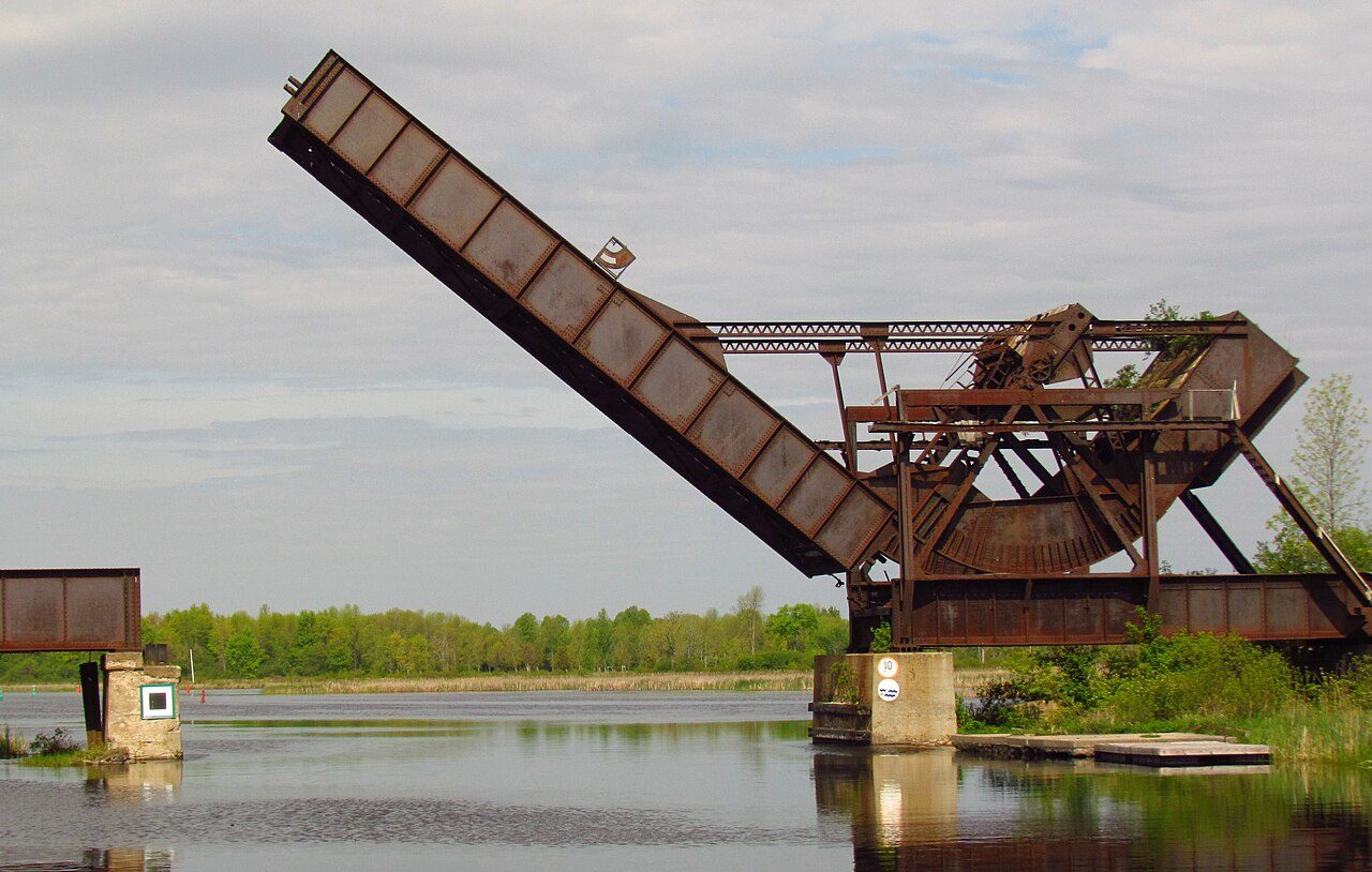
Smiths Falls Bascule Bridge
In French: Pont basculant de Smiths Falls
5 Abbot Street, Smiths Falls
About Smiths Falls Bascule Bridge
National Historic Site status goes to 2 places in Smiths Falls, Smiths Falls Bascule Bridge among them. The register gives 1912–1914 for Smiths Falls Bascule Bridge.
Smiths Falls Bascule Bridge National Historic Site of Canada is an early movable concrete bridge built in the early twentieth century to carry rail traffic over the Rideau Canal. Located within the town of Smiths Falls, today it stands with its roadbed span permanently raised, its massive counterweight stretching almost perpendicular to the sky, and its adjacent bridge tender's tower unmanned.
From the Canadian Register of Historic Places, Smiths Falls Bascule Bridge National Historic Site of Canada · Open Government Licence – Canada · in the register’s words, not edited
National Historic Site status comes on the advice of the Historic Sites and Monuments Board of Canada.
Finding Smiths Falls Bascule Bridge
Smiths Falls


It is a stop on its own: the next historic place is a longer trip.
Questions about Smiths Falls Bascule Bridge
Is Smiths Falls Bascule Bridge protected?
National Historic Site status commemorates; legal protection, where there is any, comes from the province or municipality, or from federal ownership.
What is Smiths Falls Bascule Bridge?
Smiths Falls Bascule Bridge is a National Historic Site of Canada, designated in 1983.
When was Smiths Falls Bascule Bridge built?
The record of Smiths Falls Bascule Bridge gives 1912–1914.
Can you visit Smiths Falls Bascule Bridge?
The outside is easy to see; inside, it depends on the owner’s rules.
Contains information licensed under the Open Government Licence – Canada (Parks Canada).
Sources: Parks Canada, Directory of Federal Heritage Designations · Canadian Register of Historic Places (federal extract) · Photos: Wikimedia Commons, each credited with its licence and copied to our own server · Wikidata (CC0) for map points, other names and articles.
Adapted from Statistics Canada (Census of Population 2021, population estimates 2025, 2021 census boundaries) under the Statistics Canada Open Licence; this does not constitute an endorsement by Statistics Canada. Neighbourhood names in some cities © OpenStreetMap contributors (ODbL).