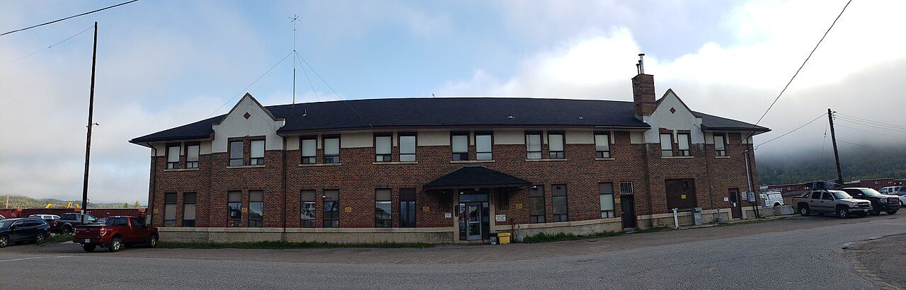
Canadian Pacific Railway Station, Schreiber, Ontario · Photo: Ryan Sutherland · CC BY-SA 4.0
1historic place on the registers
History of Schreiber · Canada’s heritage registers
Older housing stands out in Schreiber: 51% predates 1961
Schreiber’s share is 2.9 times the typical 18%. On the registers, the town counts 1 historic place. The one entry is Canadian Pacific Railway Station, Schreiber, Ontario (1924), a heritage railway station.
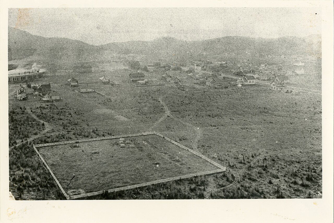
On one line by date: one old photograph of the town and the oldest view of one of its historic places. Point at a dot for its year, or tap a picture to enlarge it.
1875190019251950Confederation to 1900Boom yearsThe wars and betweenAfter the war
Public domain or CC0, made before 1950, from Wikimedia Commons; old views of places can be drawings, prints or maps of their time. Each credit opens the image’s page.
How it began
Schreiber’s beginnings, from 1883
Schreiber got its start in 1883. That was 143 years ago. Schreiber railway station, the earliest station on record, opened in 1924.
Every place on the registers inside the town, by its designation.
Other federal designations
Hover a dot for its name; tap one to open its page.
The 1, by tier
1 Other federal designations
The federal directory kept by Parks Canada supplies most of these places; provincial and municipal lists outside Québec aren’t open data, so only the ones Wikidata documents with an article appear.
Points from Wikidata (Parks Canada’s files carry none) and from Québec’s register, as mapped there.
Other federal designations
Federal heritage in Schreiber: one more place
Recognized Federal Heritage Buildings, heritage railway stations and lighthouses. Each one opens its own page.
The registers find 3 places within 100 km of Schreiber
Pic River Site, 75 km off, is the oldest: 1780. Nearest comes Lamb Island Lighthouse, 68 km off, in Thunder Bay, Unorganized. For the highest designation, go 75 km to Pic River Site.
The 3 nearest, within 100 km
Lamb Island LighthouseHeritage Lighthouse · 1961 · 68 km away, in Thunder Bay, Unorganized
Pic River SiteNational Historic Site · 1780 · 75 km away, in Thunder Bay, Unorganized
Nothing new from 2016 to 2021 in Schreiber, against 4.1% elsewhere
Homes built from 2001 to 2015 make up just 0% of Schreiber’s, against 15% in the typical town. Half of the homes standing in Schreiber today were built before 1961. Building from 1961 to 1980 gave Schreiber 28% of its homes, near the usual 27%.
51%
Before 1961
28%
1961–80
19%
1981–2000
0%
2001–15
0%
2016–21
SchreiberTypical town
2021 Census, private dwellings by period of construction (Statistics Canada); the typical town is the middle Canadian town of 2,500 or more.
Counted by age, 51% of Schreiber’s homes predate 1961, against 18% in the typical town. Together that makes 1 historic place. Otherwise the figures are ordinary: its designation dates from 1994.
How to read these numbers
What this data can and can’t tell you
•
Map points. Where a federal place sits on the map is Wikidata’s placing; the directory itself has no coordinates.
•
People and events. Persons of national historic significance come with no location; a town gets one only by birthplace (name and both life years agreeing) or by one of its own places that bears the name and whose record tells the story. Events, which can’t be tied, are left out.
•
The grade. History is described, not graded, for every Canadian town.
•
Provincial and municipal lists. Outside Québec, provinces’ and municipalities’ heritage registers aren’t open data; their places are known only through Wikidata items with a register number, and only those with an encyclopedia article get a page.
•
The federal register. Federal places come from Parks Canada’s directory, which counts National Historic Sites, federal heritage buildings, stations and lighthouses; their statements are the register’s own.
•
The tiers. Three tiers: the top for National Historic Sites, classified federal buildings and Québec’s classements, a second for the other federal designations, a third for provincial and municipal listings.
•
Protection. Being on these registers doesn’t mean a building can’t change. Federal designation commemorates; protection is provincial or municipal, and those lists aren’t open here.
Questions about Schreiber’s history
How old are the homes in Schreiber?
The 2021 Census dates 51% of its homes before 1961 (18% in the typical town).
How many historic places does Schreiber have on the registers?
Inside Schreiber: 1 historic place.
What is the oldest building in Schreiber?
Canadian Pacific Railway Station, Schreiber, Ontario — its record dates it to 1924 (Heritage Railway Station).
Contains information licensed under the Open Government Licence – Canada (Parks Canada).
Sources: Parks Canada, Directory of Federal Heritage Designations · Canadian Register of Historic Places (federal extract) · Wikidata (CC0) for map points, other names and articles · Statistics Canada, 2021 Census (homes by period of construction). Under the Statistics Canada Open Licence.
 1884
 c. 1890
 Fed