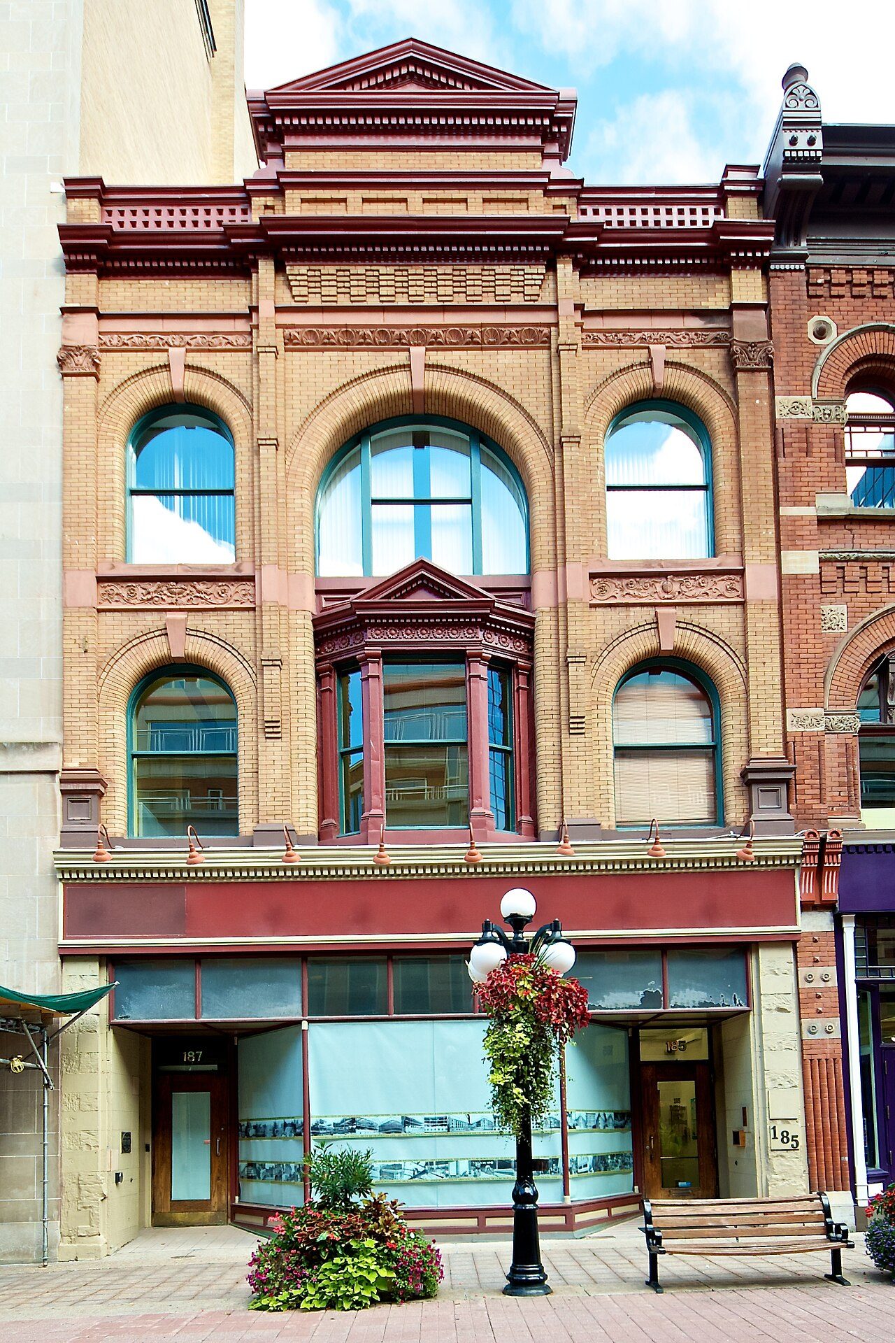
Dover Building
185-187 Sparks Street, Centretown
About Dover Building
The federal government recognizes Dover Building for its heritage, one of 12 such buildings in Centretown. Construction of Dover Building is recorded as 1896–1897. King Arnoldi designed it. 21 more historic places stand within 400 m of it.
Located in the core of Ottawa’s central business district, the Dover Building is a handsome, three-storey commercial building with a distinctive Romanesque Revival façade. Constructed in sandstone it is three bays wide and features large round-headed windows, a strong cornice and, and a decorative pediment. The designation is confined to the footprint of the building.
From the Canadian Register of Historic Places, Dover Building · Open Government Licence – Canada · the register’s own words, unchanged
Recognized is one of two ranks the federal government gives the heritage buildings it owns; Classified is the higher.
Make it a walk: 5 historic places in about 10 minutes
Centretown · about 500 m on foot, as the crow flies


- 1Dover BuildingStart here
- 2Victoria BuildingRecognized Federal Heritage Building · 100 m on
- 3Parliament Hill, West BlockClassified Federal Heritage Building · 100 m on
- 4Public Grounds of the Parliament BuildingsNational Historic Site · 100 m on
- 5Marshall BuildingRecognized Federal Heritage Building · 100 m on
13 within 300 m
Every place on the record within this distance; each opens its own page.
Questions about Dover Building
What is Dover Building?
Dover Building became a Recognized Federal Heritage Building in 1986.
Is Dover Building protected?
The federal heritage policy applies while Canada owns it.
Can you visit Dover Building?
Its exterior is visible from public ground; access inside is up to the owner.
When was Dover Building built?
Work on Dover Building is recorded as 1896–1897.
Contains information licensed under the Open Government Licence – Canada (Parks Canada).
Sources: Parks Canada, Directory of Federal Heritage Designations · Canadian Register of Historic Places (federal extract) · Photos: Wikimedia Commons, each credited with its licence and copied to our own server · Wikidata (CC0) for map points, other names and articles.
Adapted from Statistics Canada (Census of Population 2021, population estimates 2025, 2021 census boundaries) under the Statistics Canada Open Licence; this does not constitute an endorsement by Statistics Canada. Neighbourhood names in some cities © OpenStreetMap contributors (ODbL).