Places to visit near Bridlewood - Emerald Meadows
One place to visit we list is in Bridlewood - Emerald Meadows or within 5 km of its edge: Valleyview Little Animal Farm. For a day out, National Gallery of Canada is 20 km away. Within 40 km you can choose from 12, 9 museums and an art gallery among them.
Nearest place to visit
Plotted
From 1 to 7, each number is a tile below.
Bridlewood - Emerald Meadows is the orange dot. © OpenStreetMap contributors · Statistics Canada 2021 outline
Which kinds
There are more museums or galleries (10) than anything else, then forts or historic sites (2).
Green: inside Bridlewood - Emerald Meadows. Grey: the rest, within 40 km.
Place after place
All 13 on the list lie within 40 km.
Canada Science and Technology Museum
Science museum in Ottawa, Ontario, Canada.
Canadian Children's Museum
Children's museum in Gatineau, Quebec, Canada.
Notre-Dame Roman Catholic Basilica
Church in Ottawa, Ontario, Canada.
Rideau Hall and Landscaped Grounds
(officially Governor House) is the official residence of the Canadian monarch.
Canada Aviation and Space Museum
Aviation museum in Ottawa, Ontario, Canada.
Diefenbunker / Central Emergency Government Headquarters
Diefenbunker, Canada's Cold War museum in Carp, Ontario.
What is in or close to Bridlewood - Emerald Meadows comes first, then the best known within 40 km, close and well known first. Provincial and city parks are on the Outdoors page instead.
Historic places in Bridlewood - Emerald Meadows → · Parks, footpaths and green space in Bridlewood - Emerald Meadows →
Day trips
 2Art galleryNational Gallery of Canada20 km northeast · 237K visitors a year (2014)
 3MuseumCarleton University17 km northeast
 Big draw4MuseumCanadian Museum of History20 km north · 1.3M visitors a year
 5MuseumCanadian Museum of Nature19 km northeast
 6MuseumCanadian War Museum18 km north
 7MuseumCanada Science and Technology Museum23 km northeast · 348K visitors a year
 Big drawMuseumCanadian Children's Museum20 km north · 500K visitors a year
 ChurchNotre-Dame Roman Catholic Basilica20 km northeast
 CastleRideau Hall and Landscaped Grounds22 km north
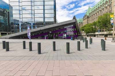 MuseumBank of Canada Museum19 km northeast
 MuseumCanada Aviation and Space Museum26 km northeast
 MuseumDiefenbunker / Central Emergency Government Headquarters17 km west
The best known within 40 km, the closest and best known first.
The nearest town with more to see: Glen Cairn →
Bridlewood - Emerald Meadows: questions and answers
Does Bridlewood - Emerald Meadows have a museum?
No museum or gallery is mapped in or within 5 km of Bridlewood - Emerald Meadows.
Is there a Parks Canada property near Bridlewood - Emerald Meadows?
None is recorded within 5 km of Bridlewood - Emerald Meadows.
What are the best-known days out near Bridlewood - Emerald Meadows?
Within 40 km: Carleton University (17 km), Canadian Museum of History (20 km), Canadian Museum of Nature (19 km), Canadian War Museum (18 km).
How is this list made?
Four open sources feed it (OpenStreetMap, Wikidata, ODCAF and the federal and Québec heritage registers), merged so each place appears once. Forts, houses, lighthouses and churches stay only with a sign they are open to visitors, and businesses such as hotels, restaurants and tour operators are left out. Every place is tied to the town by its 2021 outline, or by lying within 5 km of it.
Places to visit: Canada publishes no open tourism list, so this one is assembled from OpenStreetMap (© OpenStreetMap contributors, ODbL), Wikidata (CC0), Statistics Canada’s ODCAF museums and galleries (2020, Open Government Licence – Canada), the federal and Québec heritage registers and CPCAD’s national parks, and it reflects what mappers and editors have recorded. Forts, houses, lighthouses and churches count only with a sign that visitors are welcome. Places sit in each town’s 2021 census outline; visitor counts are Wikidata’s latest, with their year.
Photos: each place’s Wikidata image, from Wikimedia Commons under the licence below (our copy, resized).
Photo credits (6)
- National Gallery of Canada: Wladyslaw [Disk.], CC BY-SA 3.0, Wikimedia Commons
- Carleton University: Harleyd613, CC BY-SA 4.0, Wikimedia Commons
- Canadian Museum of History: Wojciech Dittwald, CC BY-SA 3.0, Wikimedia Commons
- Canadian Museum of Nature: RealGrouchy, Public domain, Wikimedia Commons
- Canadian War Museum: Balcer~commonswiki, CC BY 2.5, Wikimedia Commons
- Canada Science and Technology Museum: Ajadams94, CC BY-SA 4.0, Wikimedia Commons
Adapted from Statistics Canada (Census of Population 2021, population estimates 2025, 2021 census boundaries) under the Statistics Canada Open Licence; this does not constitute an endorsement by Statistics Canada. Neighbourhood names in some cities © OpenStreetMap contributors (ODbL).