
Out from Mississauga Valleys: Art Gallery of Mississauga and more
Mississauga Valleys’ list takes in 4 museums, 2 historic sites and an attraction. The neighbourhood outline has no place on our list of its own; 11 are within 5 km of its edge. Beyond the town, the best known is CN Tower, 19 km off.
The best known around Mississauga Valleys
Each has a page of its own: what it is, who runs it, the weather month by month and what else is near it.
The map view
The outermost point is Port Credit Business Association, at 5.7 km.
The dashed line is Mississauga Valleys’ neighbourhood outline; orange marks its middle (where most people live). Numbers match the list below. © OpenStreetMap contributors · Statistics Canada 2021 outline
What is on offer
5 are museums or galleries; forts or historic sites come next with 3.
Green: inside Mississauga Valleys. Grey: within 5 km of its edge.
Every entry
Close and well known first. Provincial and city parks are on the Outdoors page instead.
Historic places in Mississauga Valleys → · Parks, footpaths and green space in Mississauga Valleys →
Beyond Mississauga Valleys
 Big drawAttractionCN Tower19 km northeast · 1.5M visitors a year
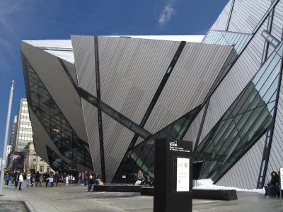 Big drawMuseumRoyal Ontario Museum20 km northeast · 281.4M visitors a year (2025)
 Big drawArt galleryArt Gallery of Ontario19 km northeast · 873K visitors a year (2016)
 Historic houseCasa Loma19 km northeast
 GardenHigh Park14 km northeast
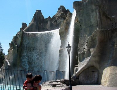 Big drawTheme parkCanada's Wonderland28 km north · 3.2M visitors a year (2025)
 MuseumBata Shoe Museum19 km northeast
 Art galleryThe Aga Khan Museum27 km northeastArt galleryArt galleryThe Power Plant20 km northeast · 130K visitors a year
 CathedralSt. Michael's Cathedral21 km northeast
 MuseumDesign Exchange20 km northeast · 225K visitors a year
 GardenQueen's Park20 km northeast
Places well known beyond Mississauga Valleys (Wikipedia articles in several languages, published visitor counts, or a Parks Canada property), close and famous first. Distances are straight lines from the middle of the town.
Planning a visit to Mississauga Valleys
What is there to see near Mississauga Valleys?
Look just beyond Mississauga Valleys: within 5 km are Lithuanian Museum-Archives of Canada, Paramount Fine Foods Centre and Creative Campus Galleries, though none is inside it.
Does Mississauga Valleys have a museum?
Look at Mimuseum and Pazan Gallery & Frame, in Mississauga Valleys or within 5 km.
Is there a Parks Canada property near Mississauga Valleys?
No: none lies within 5 km of Mississauga Valleys on our list.
What are the best-known days out near Mississauga Valleys?
Within 40 km: Royal Ontario Museum (20 km), Art Gallery of Ontario (19 km), Casa Loma (19 km), High Park (14 km).
How is this list made?
Museums, galleries, national historic sites, forts, lighthouses, gardens, national parks, waterfalls, ski hills, zoos and theme parks from OpenStreetMap, Wikidata, ODCAF and the heritage registers are merged into one list. A historic building needs a sign it welcomes visitors (opening hours, a fee, a website, a heritage operator or a Wikipedia article); hotels, restaurants and tour operators are left out. Each place is put in the town’s 2021 outline or within 5 km of its edge.
Places to visit: Canada publishes no open tourism list, so this one is assembled from OpenStreetMap (© OpenStreetMap contributors, ODbL), Wikidata (CC0), Statistics Canada’s ODCAF museums and galleries (2020, Open Government Licence – Canada), the federal and Québec heritage registers and CPCAD’s national parks, and it reflects what mappers and editors have recorded. Forts, houses, lighthouses and churches count only with a sign that visitors are welcome. Places sit in each town’s 2021 census outline; visitor counts are Wikidata’s latest, with their year.
Photos: each place’s Wikidata image, from Wikimedia Commons under the licence below (our copy, resized).
Photo credits (11)
- CN Tower: Chris Woodrich, CC BY-SA 4.0, Wikimedia Commons
- Royal Ontario Museum: Staka, CC BY-SA 4.0, Wikimedia Commons
- Art Gallery of Ontario: Owen Byrne from Ottawa, Canada, CC BY 2.0, Wikimedia Commons
- Casa Loma: Evelyncyuzu, CC BY-SA 4.0, Wikimedia Commons
- High Park: Chensiyuan at English Wikipedia, CC BY-SA 3.0, Wikimedia Commons
- Canada's Wonderland: Mathew Ingram, CC BY 2.0, Wikimedia Commons
- Bata Shoe Museum: Gisling, CC BY-SA 3.0, Wikimedia Commons
- The Aga Khan Museum: JohnOyston, CC BY-SA 4.0, Wikimedia Commons
- St. Michael's Cathedral: Oleg Yunakov, CC BY-SA 4.0, Wikimedia Commons
- Design Exchange: nodomain.cc, CC BY 2.0, Wikimedia Commons
- Queen's Park: Jeff Hitchcock from Seattle, WA, USA, CC BY 2.0, Wikimedia Commons
Adapted from Statistics Canada (Census of Population 2021, population estimates 2025, 2021 census boundaries) under the Statistics Canada Open Licence; this does not constitute an endorsement by Statistics Canada. Neighbourhood names in some cities © OpenStreetMap contributors (ODbL).