Georgina Pioneer Village
Open air museum in Georgina, Ontario, Canada.
Each edition grades its towns against each other only.
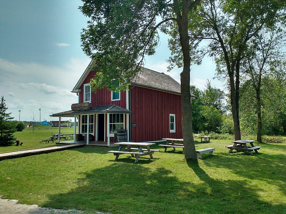
Museums or galleries make up 4 of the 5 places on the list. Every one of them is in Keswick itself. Drive 38 km to reach Base Borden Military Museum.
 MuseumGeorgina Pioneer Villagein townMuseumMuseumEildon Hallin townMuseumMuseumGeorgina Military Museumin townMuseumMuseumEildon Hall Sibbald Memorial Museumin townSki hillSki hillROCin town
Each has a page of its own: what it is, who runs it, the weather month by month and what else is near it.
The farthest of them, Eildon Hall, is 11 km out.
The dashed line is Keswick’s municipal boundary; orange marks its middle (where most people live). Numbers match the list below. © OpenStreetMap contributors · Statistics Canada 2021 outline
Green: inside Keswick. Grey: within 5 km of its edge.
The 5 inside Keswick come first, best known first; then the places within 5 km, close and well known first. Provincial and city parks are on the Outdoors page instead.
Historic places in Keswick → · Parks, footpaths and green space in Keswick →
 MuseumBase Borden Military Museum38 km west
 Heritage railwayYork–Durham Heritage Railway30 km southeast
 Ski hillHorseshoe Valley Resort37 km northwest
 MuseumSharon Temple19 km south
 MuseumLeaskdale Manse23 km east
Places well known beyond Keswick (Wikipedia articles in several languages, published visitor counts, or a Parks Canada property), close and famous first. Distances are straight lines from the middle of the town.
None on our list stands in Keswick or up to 5 km away.
Within 40 km: York–Durham Heritage Railway (30 km), Horseshoe Valley Resort (37 km), Sharon Temple (19 km), Leaskdale Manse (23 km).
One list is built from OpenStreetMap, Wikidata, ODCAF and the heritage registers: museums, galleries, national historic sites, forts, lighthouses, gardens, national parks, waterfalls, ski hills, zoos and theme parks. Historic buildings need a visitor sign such as opening hours, a fee, a website, a heritage operator or a Wikipedia article, and hotels, restaurants and tour operators never count. A place belongs to the town when it lies inside its 2021 outline or within 5 km of the edge.
Places to visit: Canada publishes no open tourism list, so this one is assembled from OpenStreetMap (© OpenStreetMap contributors, ODbL), Wikidata (CC0), Statistics Canada’s ODCAF museums and galleries (2020, Open Government Licence – Canada), the federal and Québec heritage registers and CPCAD’s national parks, and it reflects what mappers and editors have recorded. Forts, houses, lighthouses and churches count only with a sign that visitors are welcome. Places sit in each town’s 2021 census outline; visitor counts are Wikidata’s latest, with their year.
Photos: each place’s Wikidata image, from Wikimedia Commons under the licence below (our copy, resized).
Adapted from Statistics Canada (Census of Population 2021, population estimates 2025, 2021 census boundaries) under the Statistics Canada Open Licence; this does not constitute an endorsement by Statistics Canada. Neighbourhood names in some cities © OpenStreetMap contributors (ODbL).