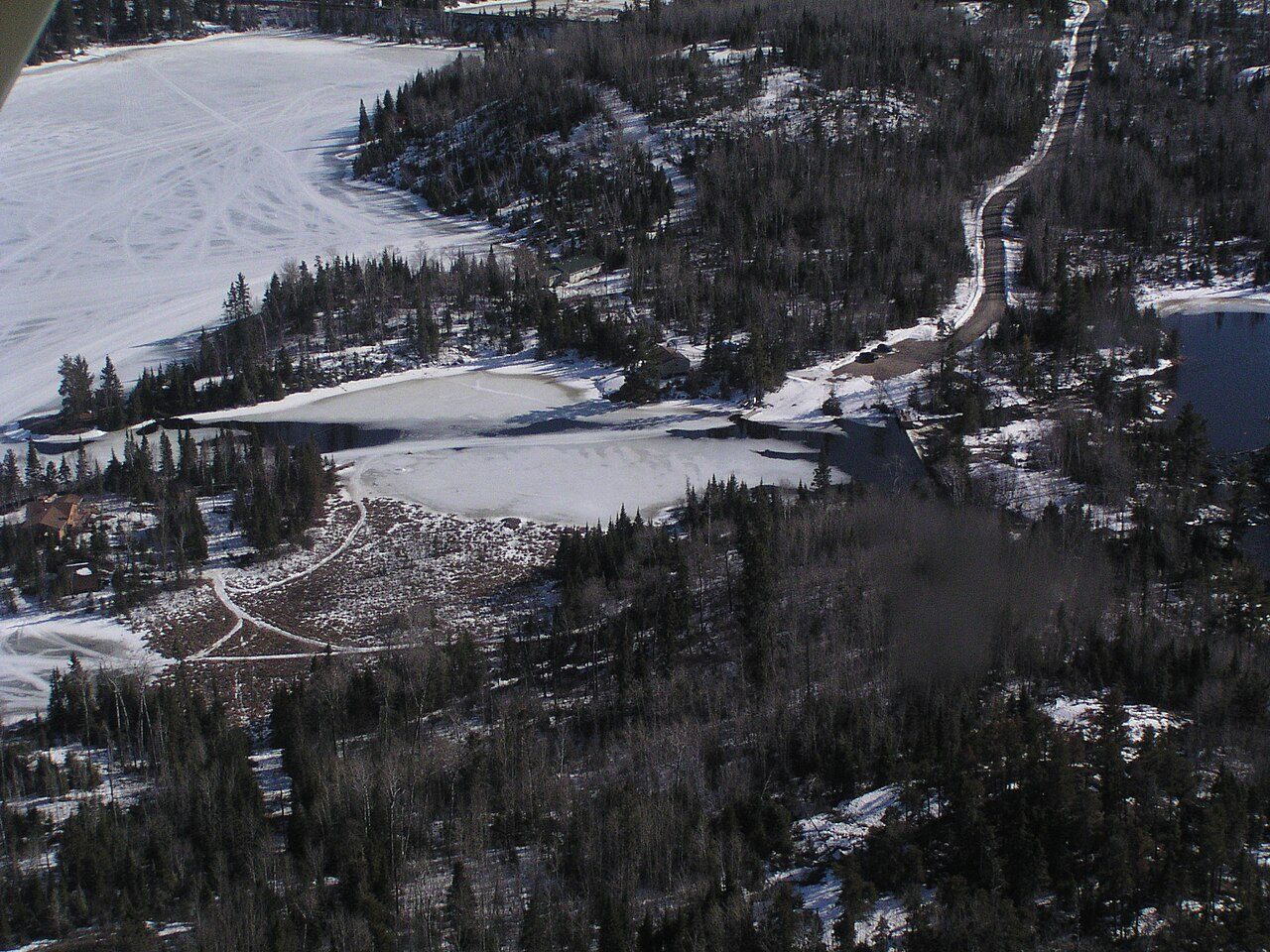
Kenora, UnorganizedOntario
Its census division is Kenora. Some 7,877 people live in this town, in Ontario.
Is Kenora, Unorganized a good place to live?
Homes are affordable here, though not without reasons. Health is a weak point (D). Getting around depends on the car (D). Cost of living is its strong suit (A−). The overall grade lands at C, #683 of 858 in Ontario. That leaves it better than 31% of Canadian towns. Its remaining grades are unremarkable: B for jobs & income and B for hazard risk.
This town's rent is the 2021 census rent scaled to 2025 by its province's ratio of surveyed to census rents: no rental survey covers it, so its Cost Grade is less sure. Safety less sure: no police service names this town, so its crime figure is the nearest police detachment's, shared with a wider area. Crime here is counted against the people who live here, but many visitors or second-home owners add to it, so the rate per resident runs higher than residents' own risk. Health is graded on the health region's survey figures and life expectancy, with the distance to hospital giving the town its own spread.
What makes Kenora, Unorganized stand out
The 3 things Kenora, Unorganized does most differently from other towns.
How Kenora, Unorganized grades
Each subject compares Kenora, Unorganized with Canadian towns of 2,500 or more, ordered by how far it is from the middle. Towns in other countries are graded separately.
How TownRatings grades Canadian towns →
The data
Data highlights are ordered by what stands out in Kenora, Unorganized.
Expect 73.7 years of life in the region around Kenora, Unorganized, 7.8 under the typical Canadian town
For Kenora, Unorganized itself the measure is access, and it lags: 19 km to the nearest hospital, where 3.7 km is typical. Smoking takes in 16% of adults, age-standardised, higher than both Ontario’s towns (10%) and Canadian towns (12%). Adults here are less upbeat about their health than the province: 44% very good or excellent, against 51% in Ontario.
Very good or excellent health · adults, age-standardised
| Health | Kenora, Unorganized | Ontario | Canada |
|---|---|---|---|
| Life expectancy at birth | 73.7 | 82.8 | 81.5 |
| Very good or excellent health | 44% | 51% | 52% |
| Smokers | 16% | 10% | 12% |
| Chronic conditions (average share) | 16% | 17% | 17% |
Statistics Canada, Canadian Community Health Survey 2023/2024 and life expectancy 2022/2024; Open Database of Healthcare Facilities · Health survey and life expectancy: the Northwestern Health Unit
Kenora, Unorganized has more protected land around it than 9 in 10 Canadian towns
Within 5 km are 38 beaches; Johnson's Beach is the nearest. There is no national park within 100 km of the town. Public parks and reserves within 10 km: 94, higher than both Ontario’s towns (4) and Canadian towns (4). Some protected land is inside the town: just over a tenth of its area.
Protected land · of the land within 10 km
| Outdoors | Kenora, Unorganized | Ontario | Canada |
|---|---|---|---|
| Public protected areas within 10 km | 94 | 4 | 4 |
| Protected land within 10 km | 12% | 2.3% | 2.3% |
Canadian Protected and Conserved Areas Database (CPCAD), OpenStreetMap routes and beaches
Rent takes less of local pay in Kenora, Unorganized than in Ontario’s towns or Canadian towns: 13% of household income
Owners make up 87% of households, above both Ontario’s towns (76%) and Canadian towns (74%). Shelter took 30% or more of income for nearly one in ten households, lower than both Ontario’s towns (22%) and Canadian towns (18%).
What homes were worth · The median owner’s estimate at the 2021 census
| Census 2021 | Kenora, Unorganized | Ontario | Canada |
|---|---|---|---|
| Households spending 30%+ on shelter | 9% | 22% | 18% |
| Rent as a share of income | 13% | 22% | 20% |
| Median home value, 2021 | $300,000 | $695,000 | $406,000 |
| Households owning their home | 87% | 76% | 74% |
Statistics Canada, Census 2021; CMHC Rental Market Survey via Statistics Canada · Values come from owners at the 2021 census and incomes from 2020, so they predate the later rise in rates.
Kenora, Unorganized has colder winters than Ontario’s towns or Canadian towns: January lows of −20.1°C
Counting rain and snow alike, 754 mm falls in a year, lower than both Ontario’s towns (902 mm) and Canadian towns (883 mm). Gardeners get 144 frost-free days, from 10 May to 2 October. In July, daytime highs in Kenora, Unorganized average 24.4°C. December is the snowiest month, with 32 cm on average.
Average high by season · ECCC normals, 1991–2020
| Normals, 1991–2020 | Kenora, Unorganized | Ontario | Canada |
|---|---|---|---|
| January night low | −20.1°C | −9.1°C | −13.5°C |
| July afternoon high | 24.4°C | 26.7°C | 25.5°C |
| Days with frost a year | 181 | 139 | 159 |
| Snowfall a year | 175 cm | 146 cm | 141 cm |
Environment and Climate Change Canada, Canadian Climate Normals 1991–2020 (Kenora)
Kenora, Unorganized’s schools mostly sit under the middle in Ontario, 7 of the 11 with results
They come under 4 school boards. Teenagers have 34 km to go to the closest secondary school, above both Ontario’s towns (1.2 km) and Canadian towns (1.2 km). Its elementary schools are small, 199 students on average, against 365 in Ontario. Counting a 3 km margin, Kenora, Unorganized has 10 elementary schools and 4 secondary schools, for 2,630 students.
| School | Level | Students | System |
|---|---|---|---|
| St Josephs Separate School CatholicLargest elementary schoolElementary · Grades JK–8 | Elementary · Grades JK–8 | 355 | English Catholic |
| Dryden High School Bottom fifth in OntarioLargest secondary schoolSecondary · Grades 9–12 | Secondary · Grades 9–12 | 575 | English public |
| École secondaire catholique des satellites FrenchTeaches in FrenchSecondary · Grades 9–12 | Secondary · Grades 9–12 | – | French Catholic |
| New Prospect Public School Top fifth in OntarioResults in the top fifth in OntarioElementary · Grades JK–8 | Elementary · Grades JK–8 | 315 | English public |
Schools by system · Schools within 3 km
| Schools within 3 km | Kenora, Unorganized | Ontario | Canada |
|---|---|---|---|
| Nearest secondary school | 34 km | 1.2 km | 1.2 km |
| Nearest elementary school | 6.7 km | 0.5 km | 0.5 km |
| School boards | 4 | 4 | 3 |
Provincial school lists and results, 2024-25
Kenora, Unorganized’s hazards at a glance: a moderate wildfire record and 14% of area homes over the radon guideline
Averaged over the years, quake damage costs $0.006 per $1,000 of buildings, lower than Ontario’s towns ($0.043) and near Canadian towns ($0.030). Fire reaches the land around Kenora, Unorganized now and then: 3% within 25 km since 1986 (0.08% a year), below the high band. No one has filed a flood map for Kenora, Unorganized on the national inventory.
Radon tests above the guideline · share of tested homes, 200 Bq/m³
| Hazards | Kenora, Unorganized | Ontario | Canada |
|---|---|---|---|
| Radon tests above the guideline | 14% | 4% | 6.6% |
| Earthquake loss per $1,000 of buildings a year | $0.006 | $0.043 | $0.030 |
NRCan seismic risk model and burned areas, Health Canada radon survey, the Flood Hazard Map Inventory
Kenora, Unorganized gets a C+ for safety
No police detachment reports under Kenora, Unorganized’s name, so these are the nearest detachment’s figures, not the town’s own · Area-wide: Crime Severity Index, Violent Crime Severity Index, violent crime and property crime per 1,000, counted over the Dryden detachment area
Its police area recorded 14.7 violent incidents per 1,000 residents a year, above Ontario’s towns (10.5) and Canadian towns (12) alike. The force’s area logs 17.6 thefts, break-ins and acts of damage per 1,000 residents a year.
Year by year · Crime Severity Index for each year
| 2023–2025 | Kenora, Unorganized | Ontario | Canada |
|---|---|---|---|
| Property crime per 1,000 | 17.6 | 30.5 | 31.2 |
| Violent crime | 14.7 | 10.5 | 12 |
| Crime Severity Index | 74 | 56 | 67 |
| Violent Crime Severity Index | 96 | 76 | 86 |
Statistics Canada, Uniform Crime Reporting Survey, 2023–2025 average
Commuters in Kenora, Unorganized have a short way to work, 24 min on average, less than in Ontario’s towns and Canadian towns
How working residents got to work · census 2021
| Census 2021 | Kenora, Unorganized | Ontario | Canada |
|---|---|---|---|
| Average trip | 24 min | 29 min | 26 min |
Statistics Canada, Census 2021 (labour and commuting) · Counted in May 2021, under pandemic rules: fewer commutes and more people between jobs than in a normal year.
More of Kenora, Unorganized’s residents have an Indigenous identity than in Ontario’s towns or Canadian towns: 22%
Visible minorities make up 0.7% of the population, lower than both Ontario’s towns (26%) and Canadian towns (15%). Immigrants make up 5.6% of residents, lower than both Ontario’s towns (7.6%) and Canadian towns (6.4%).
Ages · Share of residents in each age group, Census 2021
Schooling · Highest qualification, residents 15 and over
Women and men · all residents
Women make up 48.0% of Kenora, Unorganized
3,890 men and 3,590 women lived here in 2021, against a share of women of 50.9% for Canada.
| Kenora, Unorganized | Ontario | Canada | |
|---|---|---|---|
| Under 15 | 13% | 15% | 16% |
| 15 to 64 | 59% | 65% | 64% |
| 65+ | 28% | 19% | 19% |
| No certificate, diploma or degree | 19% | 15% | 16% |
| Postsecondary qualification | 50% | 56% | 56% |
Statistics Canada, Census 2021; Ontario and Canada: medians of towns of 2,500+
What November brings in Kenora, Unorganized: −7°C at night, −1°C by day
The month after, December, normally sees −8°C afternoons and −16°C nights. Rain and snow over a typical November come to 38 mm. Expect around 31 cm of snow in November. ECCC’s forecast for Dryden is on the Weather page, hour by hour.
Normal highs, the months ahead · ECCC normals, 1991–2020
| Season | High | Low | Rain and snow |
|---|---|---|---|
| Winter | −9°C | −18°C | 76 mm |
| Spring | 8°C | −2°C | 158 mm |
| Summer | 23°C | 14°C | 321 mm |
| Autumn | 9°C | 1°C | 199 mm |
ECCC normals, 1991–2020 (Kenora); the forecast is on the Weather page
Kenora—Kiiwetinoong, which takes in Kenora, Unorganized, is held by Eric Melillo (Conservative Party of Canada)
Kenora, Unorganized is in the north, where the Legislative Assembly of Ontario’s ridings don’t follow the 2013 federal map and have no open boundary file.
Wikidata, MAMH, MMAH, Statistics Canada
Kenora, Unorganized has no public library of its own; the nearest is Dryden Public Library, 34 km away
Kenora, Unorganized has no library board of its own in the provincial statistics, so no visit or loan figures appear here.
Provincial library statistics, OpenStreetMap, the CRA and Statistics Canada
The registers record 1 historic place in Kenora, Unorganized
Older housing, built before 1961, accounts for 15% of homes, lower than both Ontario’s towns (22%) and Canadian towns (18%).
Historic places by designation · inside the town
Among them
| Heritage | Kenora, Unorganized | Ontario | Canada |
|---|---|---|---|
| Homes built before 1961 | 15% | 22% | 18% |
Canadian Register of Historic Places, Directory of Federal Heritage Designations, Québec’s Répertoire du patrimoine culturel, Wikidata; Census 2021 homes by period
St. Alban's Cathedral and 5 more in and around Kenora, Unorganized
A first look at Kenora, Unorganized’s museums, historic sites and days out, and a few just outside town.
Everything we know about Kenora, Unorganized
Kenora, Unorganized’s neighbours
The nearest places of 1,000 or more. Statistics Canada
| Town | People | km | Overall | Cost | Safety | Health |
|---|---|---|---|---|---|---|
| Kenora, Unorganized | 7,877 | — | C | A− | C+ | D |
| Machin | 1,060 | 14 | — | B+ | B− | D |
People: Statistics Canada, Census 2021. Distances: centre to centre.
Questions about Kenora, Unorganized
Who are the people of Kenora, Unorganized?
Visible minorities are 1% of the population, where the middle of Canadian towns is 15%. Immigrants make up 6%, and Indigenous people 22%.
Is Kenora, Unorganized growing?
Yes: the census counted 6,692 in 2016 and 7,475 in 2021, a rise of 11.7%, against 4.1% for the median of Canadian towns. The 2025 estimate is 7,877.
What kind of homes are in Kenora, Unorganized?
Single-detached houses make up 94% of the homes here, where Canadian towns sit at 64%; 0% are in high-rise apartments. 26% of households are one person, and the average is 2.3.
Is Kenora, Unorganized a young town or an old one?
Its median age is 54.8, where Canadian towns sit at 45.2. Under-15s are 13% of residents; over-65s, 28%.
About Kenora, Unorganized
Town in Ontario
TownRatings follows Statistics Canada’s map: Kenora, Unorganized is one municipality in Ontario, figures and all.
Statistics Canada: population estimates 2025 (17-10-0155), Census of Population 2021, 2021 census boundaries.
- Population
- 7,877 (people, 2025 estimate)
- Province or territory
- Ontario
- Census division
- Kenora
- Census subdivision
- 3560090
Sources: Statistics Canada, Census of Population 2021 · population estimates 2025 (17-10-0155) and 2021 census boundaries · Uniform Crime Reporting Survey 2023–25 (35-10-0026, 35-10-0183 to 35-10-0190) · CMHC rents as published by Statistics Canada (34-10-0133) · grades by TownRatings. Under the Statistics Canada Open Licence.
Adapted from Statistics Canada (Census of Population 2021, population estimates 2025, 2021 census boundaries) under the Statistics Canada Open Licence; this does not constitute an endorsement by Statistics Canada. Neighbourhood names in some cities © OpenStreetMap contributors (ODbL).