Mount RoyalBrampton
The neighbourhood has 6,421 residents and lies in Brampton. It is one of the 53 neighbourhoods that make up Brampton.
Is Mount Royal a good place to live?
With a B overall, Mount Royal is better than 64% of Canadian towns and ranks #316 of 858 in Ontario. Health is where it shines (A−). Housing is expensive (C). Elsewhere it is close to typical: B for safety and B for walkability.
Rents here are the metro area's average, shared by every town and neighbourhood in it. Safety less sure: this is the whole city's figure, because the city doesn't publish open neighbourhood crime rates. Health is graded on the health region's survey figures and life expectancy, with the distance to hospital giving the town its own spread.
How Mount Royal grades
Each subject compares Mount Royal with Canadian towns of 2,500 or more, ordered by how far it is from the middle. Towns in other countries are graded separately.
How TownRatings grades Canadian towns →
What makes Mount Royal stand out
The 3 things Mount Royal does most differently from other towns.
The data
Data highlights are ordered by what stands out in Mount Royal.
Hazard risk in Mount Royal is lower than in 89% of Canadian towns
Flood mapping exists: a study by Toronto Regional Conservation Authority. Seismic risk in Mount Royal sits near the middle: $0.030 of expected damage per $1,000 of buildings a year, the typical town $0.030.
Radon tests above the guideline · share of tested homes, 200 Bq/m³
| Hazards | Mount Royal | Ontario | Canada |
|---|---|---|---|
| Radon tests above the guideline | 0% | 4% | 6.6% |
| Earthquake loss per $1,000 of buildings a year | $0.030 | $0.043 | $0.030 |
NRCan seismic risk model and burned areas, Health Canada radon survey, the Flood Hazard Map Inventory · Area behind the earthquake risk figures: the city of Brampton
Mount Royal’s region outlives the typical Canadian town by 3.8 years: life expectancy 85.3
For Mount Royal itself the measure is access: 4.8 km to the nearest hospital, much like the typical 3.7 km. In the health survey, 49% of adults in the region rate their health very good or excellent, close to Ontario’s 51%. The survey counts nearly one in ten adults as smokers, lower than both Ontario’s towns (10%) and Canadian towns (12%). For health survey and life expectancy, the only official count covers all of the Peel Regional Health Unit, Mount Royal included.
Very good or excellent health · adults, age-standardised
| Health | Mount Royal | Ontario | Canada |
|---|---|---|---|
| Life expectancy at birth | 85.3 | 82.8 | 81.5 |
| Smokers | 8.2% | 10% | 12% |
| Chronic conditions (average share) | 19% | 17% | 17% |
| Very good or excellent health | 49% | 51% | 52% |
Statistics Canada, Canadian Community Health Survey 2023/2024 and life expectancy 2022/2024; Open Database of Healthcare Facilities
Results around Mount Royal split both ways in Ontario: 4 of 18 schools high, 5 low
10,125 students attend the 16 elementary schools and 2 secondary schools in or within 3 km of Mount Royal. The largest is Mayfield Secondary School, with 1,865 students. None of them teaches in French, though one in ten schools in Ontario do.
| School | Level | Students | System |
|---|---|---|---|
| Mount Royal Public School Middle fifth in OntarioLargest elementary schoolElementary · Grades JK–8 | Elementary · Grades JK–8 | 825 | English public |
| Mayfield Secondary School Second fifth in OntarioLargest secondary schoolSecondary · Grades 9–12 | Secondary · Grades 9–12 | 1,865 | English public |
Schools by system · Schools within 3 km
| Schools within 3 km | Mount Royal | Ontario | Canada |
|---|---|---|---|
| School boards | 2 | 4 | 3 |
| Nearest secondary school | 3 km | 1.2 km | 1.2 km |
Provincial school lists and results, 2024-25
Most households in Mount Royal own their home: 95%, more than in both Ontario’s towns and Canadian towns
The rent as a share of income and monthly rent for a two-bedroom numbers here cover the Toronto metro area
Rent took 16% of household income, below Ontario’s towns (22%) and Canadian towns (20%) alike. Shelter took 30% or more of income for 26% of households, higher than both Ontario’s towns (22%) and Canadian towns (18%).
What homes were worth · The median owner’s estimate at the 2021 census
| Census 2021 | Mount Royal | Ontario | Canada |
|---|---|---|---|
| Households owning their home | 95% | 76% | 74% |
| Rent as a share of income | 16% | 22% | 20% |
| Households spending 30%+ on shelter | 26% | 22% | 18% |
Statistics Canada, Census 2021; CMHC Rental Market Survey via Statistics Canada · Home values are owners’ own estimates at the May 2021 census, and incomes are for 2020.
Trips to work from Mount Royal take longer than from Ontario’s towns or Canadian towns: 34 min on average
The car carried 92% of commuters at the census.
How working residents got to work · census 2021
| Census 2021 | Mount Royal | Ontario | Canada |
|---|---|---|---|
| Average trip | 34 min | 29 min | 26 min |
| Car or van | 92% | 88% | 89% |
Statistics Canada, Census 2021 (labour and commuting) · Census day was in May 2021, mid-pandemic, so commuting and work figures carry the lockdowns’ mark.
Summer runs warm in Mount Royal: July highs of 27.4°C, above Ontario’s towns and Canadian towns
Most of the snow comes in January, about 32 cm. There are 131 days of frost in a typical year, below Ontario’s towns (139) and Canadian towns (159) alike. Midwinter nights in Mount Royal bottom out at −8.9°C on average. Gardeners get 174 frost-free days, from 27 April to 20 October.
Average high by season · ECCC normals, 1991–2020
| Normals, 1991–2020 | Mount Royal | Ontario | Canada |
|---|---|---|---|
| July afternoon high | 27.4°C | 26.7°C | 25.5°C |
| Days with frost a year | 131 | 139 | 159 |
| January night low | −8.9°C | −9.1°C | −13.5°C |
| Snowfall a year | 115 cm | 146 cm | 141 cm |
Environment and Climate Change Canada, Canadian Climate Normals 1991–2020 (Toronto Pearson (Airport))
For safety, Mount Royal gets a B
Crime Severity Index, Violent Crime Severity Index, violent crime and property crime per 1,000 for the Peel Region (Mississauga/Brampton) service area
Violence across its police area runs at 8.5 per 1,000 residents a year. Property crime in its police area ran at 22.6 per 1,000 residents a year, below Ontario’s towns (30.5) and Canadian towns (31.2) alike.
Year by year · Crime Severity Index for each year
| 2023–2025 | Mount Royal | Ontario | Canada |
|---|---|---|---|
| Property crime per 1,000 | 22.6 | 30.5 | 31.2 |
| Violent crime | 8.5 | 10.5 | 12 |
Statistics Canada, Uniform Crime Reporting Survey, 2023–2025 average
More of Mount Royal belongs to a visible minority than Ontario’s towns or Canadian towns: 83%
Ages · Share of residents in each age group, Census 2021
Schooling · Highest qualification, residents 15 and over
Women and men · all residents
50.1% of Mount Royal’s residents are women
Here the census found 3,205 men and 3,220 women; the figure for women across Canada is 50.9%.
| Mount Royal | Ontario | Canada | |
|---|---|---|---|
| Under 15 | 18% | 15% | 16% |
| 15 to 64 | 69% | 65% | 64% |
| 65+ | 13% | 19% | 19% |
| No certificate, diploma or degree | 21% | 15% | 16% |
| Postsecondary qualification | 55% | 56% | 56% |
Statistics Canada, Census 2021; Ontario and Canada: medians of towns of 2,500+
Mount Royal in November: highs near 8°C, lows near freezing
December follows at 2°C by day and −5°C by night. Precipitation in November averages 72 mm. Expect around 9 cm of snow in November. ECCC’s forecast for Brampton is on the Weather page, hour by hour.
Normal highs, the months ahead · ECCC normals, 1991–2020
| Season | High | Low | Rain and snow |
|---|---|---|---|
| Winter | 0°C | −7°C | 170 mm |
| Spring | 12°C | 2°C | 205 mm |
| Summer | 26°C | 15°C | 223 mm |
| Autumn | 15°C | 6°C | 208 mm |
ECCC normals, 1991–2020 (Toronto Pearson (Airport)); the forecast is on the Weather page
70,710 residents per council seat in Brampton, a higher ratio than 99% of Ontario municipalities
Brampton East is the riding Mount Royal votes in for the Legislative Assembly of Ontario, and its MPP (Member of Provincial Parliament, at Queen’s Park in Toronto) isn’t named here because no open list records the members.
| Turnout | Mount Royal | Ontario | Canada |
|---|---|---|---|
| Municipal election, 2022 | 25% | 31% | 31% |
Wikidata, MAMH, MMAH, Statistics Canada
Mount Royal has no public library of its own; the nearest is Brampton Library - Springdale Branch, 3.7 km away
Brampton public library serves the whole of Brampton, so the library figures on this page are the city’s: 708,210 people, Mount Royal among them.
Provincial library statistics, OpenStreetMap, the CRA and Statistics Canada
Rouge National Urban Park is 42 km from Mount Royal
The protected share of the 10 km around the town is 6.5%, above both Ontario’s towns (2.3%) and Canadian towns (2.3%). 19 km from town is Forks of the Credit Provincial Park, the nearest provincial park. 17 areas within 10 km are protected for nature. There is a beach within 5 km, unnamed on the map.
Protected land · of the land within 10 km
| Outdoors | Mount Royal | Ontario | Canada |
|---|---|---|---|
| Protected land within 10 km | 6.5% | 2.3% | 2.3% |
| Public protected areas within 10 km | 8 | 4 | 4 |
Canadian Protected and Conserved Areas Database (CPCAD), OpenStreetMap routes and beaches
Everything we know about Mount Royal
CN Tower and 11 more within 40 km
Nothing to visit is mapped within 5 km of Mount Royal; these are the best known within 40 km.
 Big drawAttractionCN Tower35 km east · 1.5M visitors a year
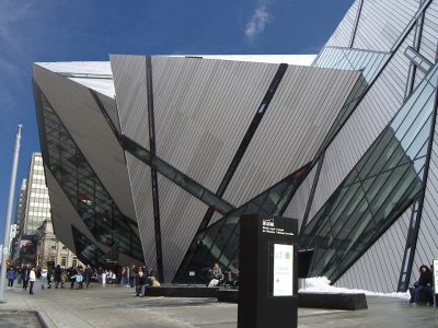 Big drawMuseumRoyal Ontario Museum33 km east · 281.4M visitors a year (2025)
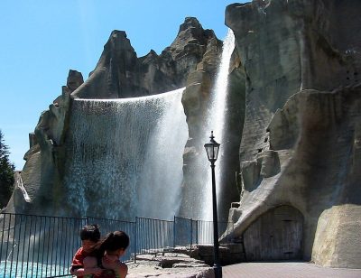 Big drawTheme parkCanada's Wonderland18 km northeast · 3.2M visitors a year (2025)
 Big drawArt galleryArt Gallery of Ontario34 km east · 873K visitors a year (2016)
 Historic houseCasa Loma31 km east
 MuseumBata Shoe Museum32 km east
Photos: each place’s Wikidata image, from Wikimedia Commons under the licence below (our copy, resized).
Photo credits (6)
- CN Tower: Chris Woodrich, CC BY-SA 4.0, Wikimedia Commons
- Royal Ontario Museum: Staka, CC BY-SA 4.0, Wikimedia Commons
- Canada's Wonderland: Mathew Ingram, CC BY 2.0, Wikimedia Commons
- Art Gallery of Ontario: Owen Byrne from Ottawa, Canada, CC BY 2.0, Wikimedia Commons
- Casa Loma: Evelyncyuzu, CC BY-SA 4.0, Wikimedia Commons
- Bata Shoe Museum: Gisling, CC BY-SA 3.0, Wikimedia Commons
About Mount Royal
Neighbourhood in Brampton
Statistics Canada counts Brampton as one municipality, so TownRatings builds Mount Royal and its other neighbourhoods from census dissemination areas, named from the city’s map or OpenStreetMap.
Statistics Canada: population estimates 2025 (17-10-0155), Census of Population 2021, 2021 census boundaries.
- Population
- 6,421 (people, 2021 estimate)
- Province or territory
- Ontario
- City
- Brampton
- Census subdivision
- 3521010
Mount Royal’s neighbours
The nearest places of 1,000 or more. Statistics Canada
| Town | People | km | Overall | Cost | Safety | Health |
|---|---|---|---|---|---|---|
| Mount Royal | 6,421 | — | B | C | B | A− |
| Vales of Castlemore | 14,894 | 2.3 | B+ | C− | B | A− |
| Sandalwood East (mountainash) | 21,801 | 2.5 | B | D | B | A− |
| Wildfield | 8,511 | 2.7 | B | C− | B | B+ |
| Castlemore Estates | 2,587 | 3.1 | A− | C+ | B | A− |
| Sandalwood West (sunny Meadow) | 27,171 | 3.4 | B | D | B | A− |
| Countryside | 5,595 | 4.2 | B− | D | B | A− |
People: Statistics Canada, Census 2021. Distances: centre to centre.
Questions about Mount Royal
Is Mount Royal a young town or an old one?
Its median age is 38.1, where Canadian towns sit at 45.2. Under-15s are 18% of residents; over-65s, 13%.
Sources: Statistics Canada, Census of Population 2021 · population estimates 2025 (17-10-0155) and 2021 census boundaries · Uniform Crime Reporting Survey 2023–25 (35-10-0026, 35-10-0183 to 35-10-0190) · CMHC rents as published by Statistics Canada (34-10-0133) · grades by TownRatings. Under the Statistics Canada Open Licence.
Adapted from Statistics Canada (Census of Population 2021, population estimates 2025, 2021 census boundaries) under the Statistics Canada Open Licence; this does not constitute an endorsement by Statistics Canada. Neighbourhood names in some cities © OpenStreetMap contributors (ODbL).