
A-B-C-D-Section (bramalea)Brampton
16,400 people live in this neighbourhood in Brampton. It is one of 53 neighbourhoods of Brampton.
Is A-B-C-D-Section (bramalea) a good place to live?
A-B-C-D-Section (bramalea) grades C+ overall and ranks #576 of 858 in Ontario. It comes out better than 44% of Canadian towns. Its weakest is cost of living (D−). Incomes are on the low side (C−). Walking, cycling and public transport work well here (A+). People here tend to be in good health (A−). Its remaining grades are unremarkable: B for safety and C+ for schools.
Rents here are the metro area's average, shared by every town and neighbourhood in it. Safety less sure: this is the whole city's figure, because the city doesn't publish open neighbourhood crime rates. Health is graded on the health region's survey figures and life expectancy, with the distance to hospital giving the town its own spread.
How A-B-C-D-Section (bramalea) grades
Each subject compares A-B-C-D-Section (bramalea) with Canadian towns of 2,500 or more, ordered by how far it is from the middle. Towns in other countries are graded separately.
How TownRatings grades Canadian towns →
What makes A-B-C-D-Section (bramalea) stand out
The 3 things A-B-C-D-Section (bramalea) does most differently from other towns.
The data
Data highlights are ordered by what stands out in A-B-C-D-Section (bramalea).
Renting in A-B-C-D-Section (bramalea) eats 26% of household income, more than in both Ontario’s towns and Canadian towns
64% of households are owner-occupiers. Shelter took 30% or more of income for 28% of households, higher than both Ontario’s towns (22%) and Canadian towns (18%). A-B-C-D-Section (bramalea) doesn’t get its own rent as a share of income and monthly rent for a two-bedroom figures; the ones here come from the Toronto metro area.
What homes were worth · The median owner’s estimate at the 2021 census
| Census 2021 | A-B-C-D-Section (bramalea) | Ontario | Canada |
|---|---|---|---|
| Households spending 30%+ on shelter | 28% | 22% | 18% |
| Rent as a share of income | 26% | 22% | 20% |
| Households owning their home | 64% | 76% | 74% |
Statistics Canada, Census 2021; CMHC Rental Market Survey via Statistics Canada · The 2021 census asked owners what their home was worth; those values, and 2020 incomes, are what this compares.
A-B-C-D-Section (bramalea) faces fewer hazards than 89% of Canadian towns
Seismic risk in A-B-C-D-Section (bramalea) sits near the middle: $0.030 of expected damage per $1,000 of buildings a year, the typical town $0.030. The national inventory holds one flood map for it, from Toronto Regional Conservation Authority.
Radon tests above the guideline · share of tested homes, 200 Bq/m³
| Hazards | A-B-C-D-Section (bramalea) | Ontario | Canada |
|---|---|---|---|
| Radon tests above the guideline | 0% | 4% | 6.6% |
| Earthquake loss per $1,000 of buildings a year | $0.030 | $0.043 | $0.030 |
NRCan seismic risk model and burned areas, Health Canada radon survey, the Flood Hazard Map Inventory · Earthquake risk: one figure for all of the city of Brampton
Expect 85.3 years of life in the region around A-B-C-D-Section (bramalea), 3.8 above the typical Canadian town
Source area for health survey and life expectancy: the Peel Regional Health Unit
By their own account, nearly half of adults here are in very good or excellent health, lower than both Ontario’s towns (51%) and Canadian towns (52%). Smoking is rarer than in the province: nearly one in ten adults, against 11% for Ontario. Measured from where A-B-C-D-Section (bramalea)’s residents live, the nearest hospital is 2.1 km away, under the typical 3.7 km.
Very good or excellent health · adults, age-standardised
| Health | A-B-C-D-Section (bramalea) | Ontario | Canada |
|---|---|---|---|
| Life expectancy at birth | 85.3 | 82.8 | 81.5 |
| Smokers | 8.2% | 10% | 12% |
| Chronic conditions (average share) | 19% | 17% | 17% |
| Very good or excellent health | 49% | 51% | 52% |
Statistics Canada, Canadian Community Health Survey 2023/2024 and life expectancy 2022/2024; Open Database of Healthcare Facilities
A-B-C-D-Section (bramalea) has a smaller share of its working-age people in jobs than 86% of Canadian towns
Getting to work takes 30 min on average. The car took just over four in five commuters, lower than both Ontario’s towns (88%) and Canadian towns (89%).
How working residents got to work · census 2021
| Census 2021 | A-B-C-D-Section (bramalea) | Ontario | Canada |
|---|---|---|---|
| Average trip | 30 min | 29 min | 26 min |
| Car or van | 82% | 88% | 89% |
Statistics Canada, Census 2021 (labour and commuting) · The 2021 census was taken in May 2021, during COVID-19 restrictions: more people than usual worked from home or were off work.
A-B-C-D-Section (bramalea) has warmer summers than Ontario’s towns or Canadian towns: July afternoons reach 27.4°C
Between the last spring frost, 27 April, and the first in autumn, 20 October, lie 174 days. The thermometer drops below freezing on 131 days a year, below both Ontario’s towns (139) and Canadian towns (159). The coldest nights come in January, when A-B-C-D-Section (bramalea) averages a low of −8.9°C. A normal January brings 32 cm of snow, the most of any month.
Average high by season · ECCC normals, 1991–2020
| Normals, 1991–2020 | A-B-C-D-Section (bramalea) | Ontario | Canada |
|---|---|---|---|
| July afternoon high | 27.4°C | 26.7°C | 25.5°C |
| Days with frost a year | 131 | 139 | 159 |
| January night low | −8.9°C | −9.1°C | −13.5°C |
| Snowfall a year | 115 cm | 146 cm | 141 cm |
Environment and Climate Change Canada, Canadian Climate Normals 1991–2020 (Toronto Pearson (Airport))
A-B-C-D-Section (bramalea) earns a B for safety
Measured across the Peel Region (Mississauga/Brampton) service area: Crime Severity Index, Violent Crime Severity Index, violent crime and property crime per 1,000
Its police area recorded 8.5 violent incidents per 1,000 residents a year, below both Ontario’s towns (10.5) and Canadian towns (12). Property crime in the area its police cover: 22.6 per 1,000 people a year.
Year by year · Crime Severity Index for each year
| 2023–2025 | A-B-C-D-Section (bramalea) | Ontario | Canada |
|---|---|---|---|
| Property crime per 1,000 | 22.6 | 30.5 | 31.2 |
| Violent crime | 8.5 | 10.5 | 12 |
Statistics Canada, Uniform Crime Reporting Survey, 2023–2025 average
Results around A-B-C-D-Section (bramalea) lean low: 27 of 43 schools in the lower two fifths in Ontario
The largest is St Thomas Aquinas Secondary School, with 1,425 students. Its schools answer to 3 boards. Of the 43, one teaches in French (10% of schools in Ontario). The 3 km around A-B-C-D-Section (bramalea) counts 34 elementary schools and 9 secondary schools, 21,530 students between them.
| School | Level | Students | System |
|---|---|---|---|
| Williams Parkway Senior Public School Middle fifth in OntarioLargest elementary schoolElementary · Grades 6–8 | Elementary · Grades 6–8 | 750 | English public |
| St Thomas Aquinas Secondary School CatholicLargest secondary schoolSecondary · Grades 9–12 | Secondary · Grades 9–12 | 1,425 | English Catholic |
| ÉÉC Sainte-Jeanne-d'Arc FrenchTeaches in FrenchElementary · Grades JK–8 | Elementary · Grades JK–8 | 225 | French Catholic |
| Chinguacousy Secondary School Top fifth in OntarioResults in the top fifth in OntarioSecondary · Grades 9–12 | Secondary · Grades 9–12 | 1,350 | English public |
Schools by system · Schools within 3 km
| Schools within 3 km | A-B-C-D-Section (bramalea) | Ontario | Canada |
|---|---|---|---|
| School boards | 3 | 4 | 3 |
Provincial school lists and results, 2024-25
Visible minorities make up more of A-B-C-D-Section (bramalea) than of Ontario’s towns or Canadian towns: 62%
15% of residents have reached 65. First Nations, Métis and Inuit people make up 1% of residents, below Ontario’s towns (1.6%) and Canadian towns (2.8%) alike.
Ages · Share of residents in each age group, Census 2021
Schooling · Highest qualification, residents 15 and over
Women and men · all residents
49.0% of A-B-C-D-Section (bramalea)’s residents are women
By the 2021 count the town had 8,035 women and 8,370 men, while Canada has 50.9% women.
| A-B-C-D-Section (bramalea) | Ontario | Canada | |
|---|---|---|---|
| Under 15 | 15% | 15% | 16% |
| 15 to 64 | 70% | 65% | 64% |
| 65+ | 15% | 19% | 19% |
| No certificate, diploma or degree | 16% | 15% | 16% |
| Postsecondary qualification | 50% | 56% | 56% |
Statistics Canada, Census 2021; Ontario and Canada: medians of towns of 2,500+
A-B-C-D-Section (bramalea) in November: highs near 8°C, lows near freezing
Then December: 2°C by day, −5°C at night. A typical November adds 9 cm of snow. November normally sees 72 mm of precipitation. For today and the week ahead, the Weather page carries ECCC’s Brampton forecast.
Normal highs, the months ahead · ECCC normals, 1991–2020
| Season | High | Low | Rain and snow |
|---|---|---|---|
| Winter | 0°C | −7°C | 170 mm |
| Spring | 12°C | 2°C | 205 mm |
| Summer | 26°C | 15°C | 223 mm |
| Autumn | 15°C | 6°C | 208 mm |
ECCC normals, 1991–2020 (Toronto Pearson (Airport)); the forecast is on the Weather page
Council seats in Brampton are spread thin, 70,710 residents each, more than in 99% of Ontario municipalities
Provincially, A-B-C-D-Section (bramalea) votes in Brampton Centre; the open record doesn’t name its MPP (Member of Provincial Parliament, at Queen’s Park in Toronto) in the Legislative Assembly of Ontario, so the legislature’s own list is linked below.
| Turnout | A-B-C-D-Section (bramalea) | Ontario | Canada |
|---|---|---|---|
| Municipal election, 2022 | 25% | 31% | 31% |
Wikidata, MAMH, MMAH, Statistics Canada
No public library stands in A-B-C-D-Section (bramalea): the closest, Chinguacousy Branch, is 1.2 km away
The library figures on this page are Brampton’s: Brampton public library serves all 708,210 people of the city, A-B-C-D-Section (bramalea) among them.
Provincial library statistics, OpenStreetMap, the CRA and Statistics Canada
Within 41 km of A-B-C-D-Section (bramalea): Rouge National Urban Park
One unnamed beach is mapped within 5 km. The largest named area nearby is Brampton Natural Heritage System, 1,126 ha, 2.0 km away. 7 protected areas lie within 10 km. The protected share within 10 km is 4.2%, where a typical Canadian town has 2.3%.
Protected land · of the land within 10 km
| Outdoors | A-B-C-D-Section (bramalea) | Ontario | Canada |
|---|---|---|---|
| Protected land within 10 km | 4.2% | 2.3% | 2.3% |
| Public protected areas within 10 km | 1 | 4 | 4 |
Canadian Protected and Conserved Areas Database (CPCAD), OpenStreetMap routes and beaches
Everything we know about A-B-C-D-Section (bramalea)
Peel Art Gallery, Museum and Archives and 9 more in and around A-B-C-D-Section (bramalea)
The best-known places to visit in and around A-B-C-D-Section (bramalea) come first; the full list is on the Attractions page.
Famous people from around A-B-C-D-Section (bramalea)
No notable person born in A-B-C-D-Section (bramalea) is on our list; these were born in the towns around it.
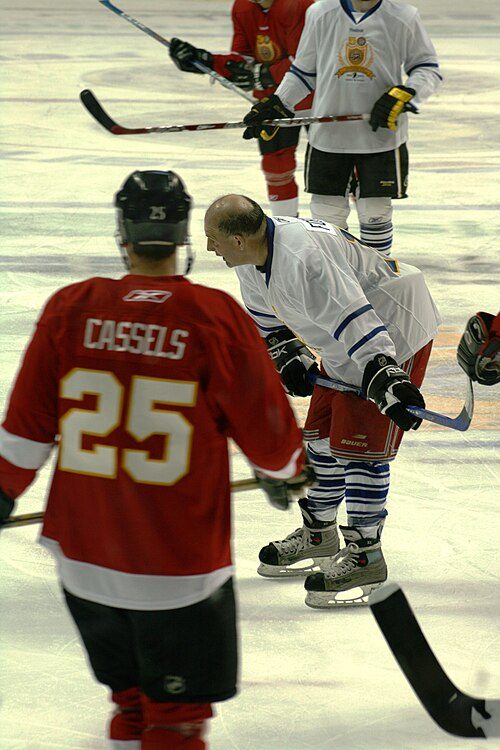


Photo credits
Andrew Cassels: Tsunami330, CC BY-SA 4.0 · Mike Weaver: Michael Miller, CC BY-SA 3.0 · Jason Collett: Sean Ian Denis Richardson, CC BY-SA 2.0
About A-B-C-D-Section (bramalea)
Neighbourhood in Brampton
TownRatings splits Brampton into neighbourhoods drawn from census dissemination areas; A-B-C-D-Section (bramalea) is one of them, named from the city’s map or OpenStreetMap.
Statistics Canada: population estimates 2025 (17-10-0155), Census of Population 2021, 2021 census boundaries.
- Population
- 16,400 (people, 2021 estimate)
- Province or territory
- Ontario
- City
- Brampton
- Census subdivision
- 3521010
A-B-C-D-Section (bramalea)’s neighbours
The nearest places of 1,000 or more. Statistics Canada
| Town | People | km | Overall | Cost | Safety | Health |
|---|---|---|---|---|---|---|
| A-B-C-D-Section (bramalea) | 16,400 | — | C+ | D− | B | A− |
| E-F-K-Section (bramalea) | 13,596 | 1.2 | C+ | D− | B | A− |
| Norton Park | 8,402 | 1.7 | C | D− | B | A− |
| H-Section (bramalea) | 9,040 | 2.1 | B− | D− | B | A− |
| G-Section (bramalea) | 8,224 | 2.7 | B− | D | B | A− |
| Bramalea Woods | 6,521 | 3 | B− | D | B | A− |
| M-Section (bramalea) | 9,901 | 3.7 | B− | D | B | A− |
People: Statistics Canada, Census 2021. Distances: centre to centre.
Sources: Statistics Canada, Census of Population 2021 · population estimates 2025 (17-10-0155) and 2021 census boundaries · Uniform Crime Reporting Survey 2023–25 (35-10-0026, 35-10-0183 to 35-10-0190) · CMHC rents as published by Statistics Canada (34-10-0133) · grades by TownRatings. Under the Statistics Canada Open Licence.
Adapted from Statistics Canada (Census of Population 2021, population estimates 2025, 2021 census boundaries) under the Statistics Canada Open Licence; this does not constitute an endorsement by Statistics Canada. Neighbourhood names in some cities © OpenStreetMap contributors (ODbL).