
Port-Royal opens Annapolis County, Subdivision A’s list
This is a list led by museums or galleries, 13 of its 17. The municipal boundary itself has 6 places on our list; 11 others are within 5 km of its edge. Among them, 3 are cared for by Parks Canada.
Top of the list in Annapolis County, Subdivision A
The rest of the best known are 3 museums, a theme park and a historic site.
 Museum · Parks CanadaPort-Royalin townTheme parkTheme parkAction Jax Family Fun Parkin town
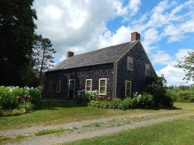 MuseumNorth Hills Museumin townHistoric siteHistoric sitePierre Thibaudeauin townMuseumMuseumOld St. Edward's Anglican Church And Museumin townMuseumMuseumTupperville School Museum (Marion L. Inglis)in town
Each has a page of its own: what it is, who runs it, the weather month by month and what else is near it.
The layout
The dashed line is Annapolis County, Subdivision A’s municipal boundary; orange marks its middle (where most people live). Numbers match the list below. © OpenStreetMap contributors · Statistics Canada 2021 outline
The mix
Green: inside Annapolis County, Subdivision A. Grey: within 5 km of its edge.
Place after place
 7
Fort Anne
Four-star fort built to protect the harbour of Annapolis Royal, Nova Scotia.
 8
South Powder Magazine
 9
Officers' Quarters
 10
Sinclair Inn / Farmer's Hotel
Bear River First Nation Heritage & Cultural Centre
James House Museum
Historic house museum in Bridgetown, Nova Scotia, Canada.
Antiques and Art Gallery
Ilio Fibre Art
Leslie Ericson Art Gallery
O'Dell House Museum
Round Hill Studio
The 6 inside Annapolis County, Subdivision A come first, best known first; then the places within 5 km, close and well known first. Provincial and city parks are on the Outdoors page instead.
Historic places in Annapolis County, Subdivision A → · Parks, footpaths and green space in Annapolis County, Subdivision A →
Practical questions about Annapolis County, Subdivision A
What are the main attractions in Annapolis County, Subdivision A?
The best known inside Annapolis County, Subdivision A’s municipal boundary are Action Jax Family Fun Park, North Hills Museum and Pierre Thibaudeau.
Does Annapolis County, Subdivision A have a museum?
Yes, Old St. Edward's Anglican Church And Museum, Tupperville School Museum (Marion L. Inglis) and Sinclair Inn / Farmer's Hotel, all in Annapolis County, Subdivision A or within 5 km.
Is there a Parks Canada property near Annapolis County, Subdivision A?
Yes: places in or within 5 km of Annapolis County, Subdivision A are in the care of Parks Canada; the chart above names them.
How is this list made?
One list is built from OpenStreetMap, Wikidata, ODCAF and the heritage registers: museums, galleries, national historic sites, forts, lighthouses, gardens, national parks, waterfalls, ski hills, zoos and theme parks. Historic buildings need a visitor sign such as opening hours, a fee, a website, a heritage operator or a Wikipedia article, and hotels, restaurants and tour operators never count. A place belongs to the town when it lies inside its 2021 outline or within 5 km of the edge.
Places to visit: Canada publishes no open tourism list, so this one is assembled from OpenStreetMap (© OpenStreetMap contributors, ODbL), Wikidata (CC0), Statistics Canada’s ODCAF museums and galleries (2020, Open Government Licence – Canada), the federal and Québec heritage registers and CPCAD’s national parks, and it reflects what mappers and editors have recorded. Forts, houses, lighthouses and churches count only with a sign that visitors are welcome. Places sit in each town’s 2021 census outline; visitor counts are Wikidata’s latest, with their year.
Photos: each place’s Wikidata image, from Wikimedia Commons under the licence below (our copy, resized).
Photo credits (6)
- Port-Royal: Dlanglois, CC BY-SA 3.0, Wikimedia Commons
- North Hills Museum: Fralambert, CC BY-SA 4.0, Wikimedia Commons
- Fort Anne: paulhami, CC BY-SA 2.0, Wikimedia Commons
- South Powder Magazine: Korona4Reel, CC BY-SA 1.0, Wikimedia Commons
- Officers' Quarters: Wladyslaw, CC BY-SA 3.0, Wikimedia Commons
- Sinclair Inn / Farmer's Hotel: Magicpiano, CC BY-SA 4.0, Wikimedia Commons
Adapted from Statistics Canada (Census of Population 2021, population estimates 2025, 2021 census boundaries) under the Statistics Canada Open Licence; this does not constitute an endorsement by Statistics Canada. Neighbourhood names in some cities © OpenStreetMap contributors (ODbL).