 Photo: Verne Equinox · CC BY 3.0
7 heritage places lie within 50 km of Weldford
Moncton, 54 km from Weldford, has the nearest place of the highest rank. Wikidata gives 1835 for the municipality, whether that is when it was founded, incorporated or merged.
Looking back at Weldford
The past in one picture: one old photograph of the town. Tap the picture to enlarge it.
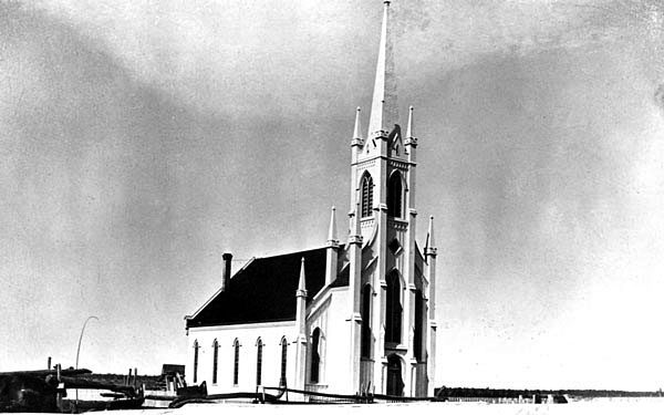 1886
Public domain or CC0, made before 1950, from Wikimedia Commons; old views of places can be drawings, prints or maps of their time. Each credit opens the image’s page.
Collège Saint-Louis, 20 km from Weldford, is the closest
All told, 7 places are within 50 km. Oldest of them is Saint Lawrence Anglican Church (1867), 28 km off. Between them, 6 towns share them, mainly Bouctouche, Saint-Louis de Kent and Wellington.
The 7 nearest, within 50 km
| Collège Saint-LouisLocal historic place · 1874 · 20 km away, in Saint-Louis de Kent |
| Saint Lawrence Anglican ChurchLocal historic place · 1867 · 28 km away, in Bouctouche |
| Musée de KentProvincial heritage place · 29 km away, in Bouctouche |
| Pointe à Jérôme Front Range LighthouseHeritage Lighthouse · 1916–1917 · 30 km away, in Wellington |
| Notre-Dame-de-l'Assomption MonumentProvincial heritage place · 34 km away, in Rogersville |
| Magnetic HillLocal historic place · 50 km away, in Moncton |
| Caissie Point LighthouseHeritage Lighthouse · 1872–1873 · 50 km away, in Dundas |
Old houses stand out in Weldford: 28% predate 1961, where most towns have 18%
From 2016 on, Weldford built only 3.2% of its homes; the typical town built 4.1%. Count back from today and half of Weldford’s homes are older than 1981. 27% of Weldford’s homes were built from 1961 to 1980, close to the typical town’s 27%.
2021 Census, private dwellings by period of construction (Statistics Canada); the typical town is the middle Canadian town of 2,500 or more.
Weldford and its neighbours
| Town | People | Places | Highest | Oldest |
|---|---|---|---|---|
| Weldford | 1,510 | 0 | 0 | — |
| Richibucto 15 | 2,126 | 0 | 0 | — |
| Rexton | 1,059 | 0 | 0 | — |
| Saint-Charles | 2,189 | 0 | 0 | — |
| Richibucto | 1,745 | 0 | 0 | — |
Weldford in brief
The pre-1961 share of Weldford’s homes is 28%, against 18% in the typical town.
What this data can and can’t tell you
- The tiers. Three tiers: the top for National Historic Sites, classified federal buildings and Québec’s classements, a second for the other federal designations, a third for provincial and municipal listings.
- Provincial and municipal lists. The local and provincial lists outside Québec aren’t published openly, so this page counts what Wikidata records and pages only the places an encyclopedia describes.
- The grade. History is described, not graded, for every Canadian town.
- Protection. Federal recognition isn’t a planning control: buildings the federal government owns follow its heritage policy, while others are protected only by a provincial or municipal designation.
- People and events. The open directory puts its national historic persons nowhere, so a town shows one only on firm ground: a birth there, matched by name and life years, or a historic place there named for the person whose record says so. Events are left out.
- The federal register. Parks Canada’s Directory of Federal Heritage Designations lists every National Historic Site, federal heritage building, heritage railway station and lighthouse; the Canadian Register of Historic Places adds their statements in English and French.
Questions about Weldford’s history
How many historic places does Weldford have on the registers?
Weldford has none of its own yet. Collège Saint-Louis, in Saint-Louis de Kent, is the nearest, 20 km away.
When did Weldford become a municipality?
By Wikidata, Weldford dates from 1835; the record doesn’t say whether that is a founding, an incorporation or a merger.
How old are the homes in Weldford?
28% of its homes were built before 1961, against 18% in the typical Canadian town.
Contains information licensed under the Open Government Licence – Canada (Parks Canada).
Sources: Parks Canada, Directory of Federal Heritage Designations · Canadian Register of Historic Places (federal extract) · Wikidata (CC0) for map points, other names and articles · Statistics Canada, 2021 Census (homes by period of construction). Under the Statistics Canada Open Licence.
Adapted from Statistics Canada (Census of Population 2021, population estimates 2025, 2021 census boundaries) under the Statistics Canada Open Licence; this does not constitute an endorsement by Statistics Canada. Neighbourhood names in some cities © OpenStreetMap contributors (ODbL).