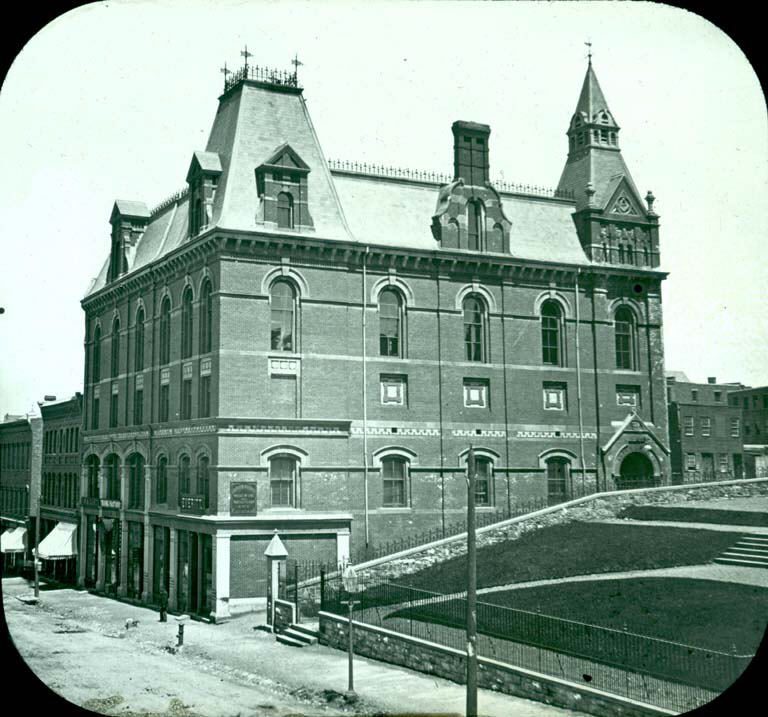
Saint John Masonic Temple
In French: Temple maçonnique de Saint-Jean
Saint John Masonic Temple, c. 1900 and today
Drag across to compare. The two views aren’t taken from exactly the same spot.
c. 1900: Photo: James Ramsay Woodburn · Public domain. Today: Photo: James Ramsay Woodburn · Public domain.
About Saint John Masonic Temple
Saint John Masonic Temple is one of 6 places in Saint John known from provincial or municipal registers. The register gives 1881 for Saint John Masonic Temple. 11 neighbours on the registers lie within 400 m.
This place is known here through Wikidata’s copy of its register number; the register itself isn’t open.
2 old views of Saint John Masonic Temple
Made before 1950, from 1900 to 1910: public domain or CC0. Tap one to see it full screen.
 c. 1910
From Wikimedia Commons, copied to our own server; some are drawings, prints or maps of their time. Each credit is in the viewer.
Make it a walk: 5 historic places in about 15 minutes
Saint John · about 800 m on foot, as the crow flies


- 1Saint John Masonic TempleStart here
- 2Saint John City MarketNational Historic Site · 100 m on
- 3Admiral Beatty HotelLocal historic place · 100 m on
- 4Number 2 Mechanics' Volunteer Company Engine HouseNational Historic Site · 100 m on
- 5Caverhill HallLocal historic place · 400 m on
11 within 300 m
Every place on the record within this distance; each opens its own page.
Questions about Saint John Masonic Temple
Is Saint John Masonic Temple protected?
A provincial or municipal register lists it; what that protects depends on the province’s law, and the register itself isn’t open data.
When was Saint John Masonic Temple built?
By its record, Saint John Masonic Temple dates from 1881.
What is Saint John Masonic Temple?
A provincial or municipal register includes Saint John Masonic Temple.
Can you visit Saint John Masonic Temple?
You can see it from the street, while entry depends on its current use.
Contains information licensed under the Open Government Licence – Canada (Parks Canada).
Sources: Parks Canada, Directory of Federal Heritage Designations · Photos: Wikimedia Commons, each credited with its licence and copied to our own server · Wikidata (CC0) for map points, other names and articles.
Adapted from Statistics Canada (Census of Population 2021, population estimates 2025, 2021 census boundaries) under the Statistics Canada Open Licence; this does not constitute an endorsement by Statistics Canada. Neighbourhood names in some cities © OpenStreetMap contributors (ODbL).