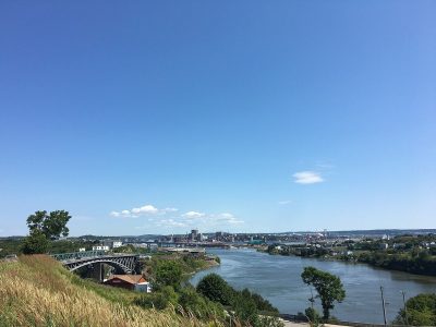
 Wolastoq · Photo: Enzo Francis Cameli · CC BY-SA 4.0
One place in Kingsclear, at the top of the registers
For its size Kingsclear is rich ground: 3.2 per 10,000 residents, ahead of 90% of Canadian towns. Few homes are old by the census: 9.7% before 1961, against 18%.
Where Kingsclear’s history is
Every place on the registers inside the town, by its designation.
Dots open their places’ pages; hover first to read the name.
What the map shows is the open record: the federal directory in full, and from provincial or municipal lists only the places Wikidata ties to an encyclopedia article.
Points from Wikidata (Parks Canada’s files carry none) and from Québec’s register, as mapped there.
One place in Kingsclear with the highest designation
National Historic Sites and Classified Federal Heritage Buildings, Canada’s highest federal recognition. Each one opens its own page.
 Top
Around Kingsclear, within 25 km, the dated heritage reaches back to 1691
Reaching 25 km out from Kingsclear: the historic places by their first construction date on record.
17 places within 25 km have a date. Before Confederation: 10. The earliest is Fort Nashwaak (Naxoat) in Fredericton, begun in 1691.
18 places on Canada’s registers lie 25 km or less from Kingsclear
They stand in 2 towns, Fredericton and Prince William among them. The first one out is Kings Landing Historical Settlement, 7.9 km away in Prince William. Among them are 12 National Historic Sites, 4 provincial or municipal listings and a heritage railway station.
The 12 nearest, within 25 km
| Kings Landing Historical SettlementProvincial heritage place · 7.9 km away, in Prince William |
| Old Government HouseNational Historic Site · 1826–1829 · 19 km away, in Fredericton |
| Canadian Pacific Railway Station, Fredericton, New BrunswickHeritage Railway Station · 1923–1924 · 19 km away, in Fredericton |
| St. Anne's Chapel of EaseNational Historic Site · 1846–1848 · 19 km away, in Fredericton |
| Arts BuildingNational Historic Site · 1826–1828 · 19 km away, in Fredericton |
| William Brydone Jack ObservatoryNational Historic Site · 1851–1852 · 19 km away, in Fredericton |
| St. Paul's United ChurchNational Historic Site · 1886–1887 · 20 km away, in Fredericton |
| Old Burial GroundLocal historic place · 1787 · 20 km away, in Fredericton |
| Fredericton City HallNational Historic Site · 1875–1877 · 20 km away, in Fredericton |
| Fredericton Military CompoundNational Historic Site · 1826–1883 · 20 km away, in Fredericton |
| Government of Canada BuildingRecognized Federal Heritage Building · 1950–1952 · 20 km away, in Fredericton |
| York County Court HouseNational Historic Site · 1857–1859 · 20 km away, in Fredericton |
Kingsclear built the most from 1981 to 2000, 37% of today’s homes
From 2016 to 2021 Kingsclear added 4.6% of its homes, close to the typical town’s 4.1%. Homes built from 2001 to 2015 make up 19% of Kingsclear’s, against 15% in the typical town. Count back from today and half of Kingsclear’s homes are older than 2001.
2021 Census, private dwellings by period of construction (Statistics Canada); the typical town is the middle Canadian town of 2,500 or more.
Kingsclear has the 2nd most of 16 towns its size
Towns of 3,100 to 3,200 residents, by places on the registers.
Just one has more: Sainte-Anne-de-Beaupré. The middle one has 0. 13 of them have nothing on the registers.
Kingsclear and its neighbours
| Town | People | Places | Highest | Oldest |
|---|---|---|---|---|
| Kingsclear | 3,158 | 1 | 1 | — |
| Starlight Village | 5,108 | 0 | 0 | — |
| Queensbury | 1,421 | 0 | 0 | — |
| Prince William | 1,233 | 1 | 0 | — |
| New Maryland | 3,198 | 0 | 0 | — |
| Bright | 3,648 | 0 | 0 | — |
| New Maryland | 4,455 | 0 | 0 | — |
Kingsclear in brief
The registers count 1 historic place in Kingsclear, one with the highest designation, Wolastoq first. Just one town of its size, out of 16, has more historic places. Most of its homes are post-1960: only 9.7% came earlier, against 18% in the typical town. Everything else is close to the norm: people of its past such as John Campbell Allen (1817) and Samuel Black Hunter (1855); and its one place was designated in 2011.
What this data can and can’t tell you
- Protection. National historic designation honours a place but binds only federal owners; a private building’s protection depends on its province or municipality.
- People and events. The open directory puts its national historic persons nowhere, so a town shows one only on firm ground: a birth there, matched by name and life years, or a historic place there named for the person whose record says so. Events are left out.
- The tiers. National Historic Sites and the most protected buildings form the top tier; recognized federal buildings, stations and lighthouses the second; provincial and municipal listings the third.
- The federal register. Parks Canada’s Directory of Federal Heritage Designations lists every National Historic Site, federal heritage building, heritage railway station and lighthouse; the Canadian Register of Historic Places adds their statements in English and French.
- The grade. History isn’t one of Canada’s graded pillars, so this page describes and compares without a letter.
- Provincial and municipal lists. Outside Québec, provinces’ and municipalities’ heritage registers aren’t open data; their places are known only through Wikidata items with a register number, and only those with an encyclopedia article get a page.
- Map points. Parks Canada publishes no coordinates, so federal places are pinned where Wikidata puts them.
Questions about Kingsclear’s history
Which places in Kingsclear have the highest designation?
Wolastoq.
How old are the homes in Kingsclear?
The 2021 Census dates 9.7% of its homes before 1961 (18% in the typical town).
Contains information licensed under the Open Government Licence – Canada (Parks Canada).
Sources: Parks Canada, Directory of Federal Heritage Designations · Canadian Register of Historic Places (federal extract) · Wikidata (CC0) for map points, other names and articles · Statistics Canada, 2021 Census (homes by period of construction). Under the Statistics Canada Open Licence.
Adapted from Statistics Canada (Census of Population 2021, population estimates 2025, 2021 census boundaries) under the Statistics Canada Open Licence; this does not constitute an endorsement by Statistics Canada. Neighbourhood names in some cities © OpenStreetMap contributors (ODbL).