Science East
Science East is a science museum in Fredericton, New Brunswick. The first to add nearby is Beaverbrook Art Gallery, at 300 m. Articles on it exist in 2 languages.
Museum in Fredericton
Inside Fredericton
Inside Fredericton’s municipal boundary: Science East. Towns near it ↓
Drawn from OpenStreetMap, Wikidata, ODCAF and the heritage registers, with Statistics Canada’s 2021 outlines and ECCC’s 1991–2020 normals.
How the seasons run
The warmest stretch in Fredericton is May to September, at 18–26°C in the afternoon.
Science East
You’ll find it in Fredericton, inside the town’s municipal boundary.
- Type
- Museum
- Wikipedias
- Covered in 2 languages
- Town
- in Fredericton
- Official site
- scienceeast.nb.ca
Getting in
- EntryA fee is charged
Where it sits
The orange dot is Science East; the numbers are the places near it, as listed below.
© OpenStreetMap contributors · The dashed line is Fredericton’s municipal boundary. · Statistics Canada 2021 outline
Which town is nearest
With 74,655 people, Fredericton is the largest of the 8. From nearest to farthest, these towns all list it.
Fredericton
Devon 30
Kingsclear
Saint Marys
Compare the 8 towns
| Town | Where Science East is | People | Places to visit |
|---|---|---|---|
| Fredericton | It’s in town | 74,655 | 16 |
| Devon 30 | 1.4 km north of it | 1,105 | 15 |
| Kingsclear | 3 km southwest of it | 3,158 | 18 |
| Saint Marys | 3.5 km north of it | 5,701 | 15 |
| New Maryland | 7.7 km south of it | 4,455 | 1 |
| Maugerville | 11 km east of it | 1,808 | 3 |
| Starlight Village | 12 km southwest of it | 5,108 | 3 |
| Lincoln | 13 km southeast of it | 8,093 | 2 |
More near Science East
Look within 15 km for 5 museums, an art gallery and a cathedral, among others.
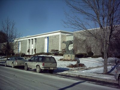 Art galleryBeaverbrook Art Gallery300 m away · 25K visitors a year2
 CathedralChrist Church Cathedral300 m away3MuseumMuseumYork Sunbury Museum400 m away4MuseumMuseumFredericton Region Museum400 m away5MuseumMuseumNew Brunswick Sports Hall of Fame400 m away6MuseumMuseumSchool Days Museum600 m away7AttractionAttractionBoyce Farmers Market100 m away8MuseumMuseumDiocese of Fredericton Archives300 m away
Within 15 km, close and well known first. Numbers match the map.
Science East: what to know
Where is Science East?
Inside the municipal boundary, Science East is in Fredericton (New Brunswick).
What is Science East?
Science museum in Fredericton, New Brunswick.
How well known is Science East?
Going by Wikipedia and its sister sites, Science East is #741 of the places we list in Canada.
When is the best time to visit Science East?
For warmth, aim for May to September: highs of 18–26°C in Fredericton (ECCC 1991–2020 normals).
Sources: © OpenStreetMap contributors (ODbL), Wikidata (CC0), Statistics Canada’s ODCAF (Open Government Licence – Canada), the federal and Québec heritage registers, Statistics Canada 2021 census boundaries, ECCC 1991–2020 climate normals (Open Government Licence – Canada).
Photos: each place’s Wikidata image, from Wikimedia Commons under the licence below (our copy, resized).
Photo credits (2)
- Beaverbrook Art Gallery: Vascobattuta at English Wikipedia, Public domain, Wikimedia Commons
- Christ Church Cathedral: Vascobattuta at en.wikipedia, Public domain, Wikimedia Commons
Adapted from Statistics Canada (Census of Population 2021, population estimates 2025, 2021 census boundaries) under the Statistics Canada Open Licence; this does not constitute an endorsement by Statistics Canada. Neighbourhood names in some cities © OpenStreetMap contributors (ODbL).