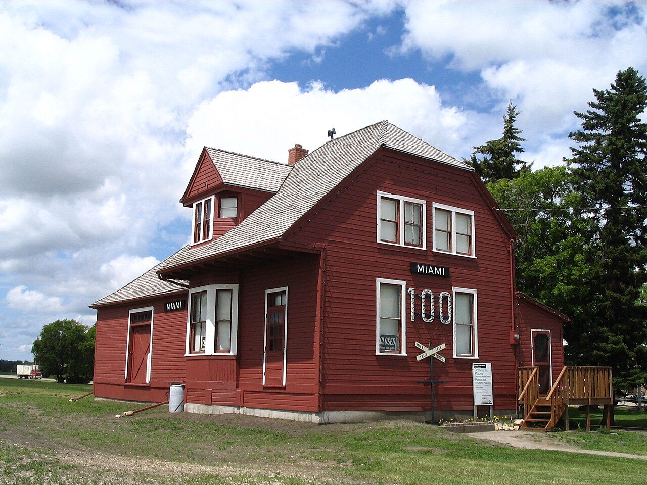
Miami Railway Station (Canadian Northern) · Photo: Loozrboy · CC BY-SA 2.0
1historic place on the registers
History of Thompson · Canada’s heritage registers
An older town: 41% of Thompson’s homes predate 1961
The typical town has 18%: Thompson has 2.4 times the share. The registers list 1 historic place inside the town, and it carries the highest designation. That place is Miami Railway Station (Canadian Northern), a national historic site, from 1889.
National Historic Sites and Classified Federal Heritage Buildings
Oldest building
1889
the first construction date on its record
Homes built before 1961
41%
typical town: 18%
How it began
The record of Thompson, from 1889 on
The date Wikidata keeps for Thompson is November 1, 1908; whether it was a founding or a legal act, the entry leaves open. Rail service is on record from 1889, when Miami railway station opened.
Every place on the registers inside the town, by its designation.
Highest designations
Hover a dot for its name; tap one to open its page.
The 1, by tier
1 Highest designations
What the map shows is the open record: the federal directory in full, and from provincial or municipal lists only the places Wikidata ties to an encyclopedia article.
Points from Wikidata (Parks Canada’s files carry none) and from Québec’s register, as mapped there.
Highest designations
One place in Thompson with the highest designation
National Historic Sites and Classified Federal Heritage Buildings, Canada’s highest federal recognition. Each one opens its own page.
Leave Thompson and the first historic place is Fort La Reine, 68 km away
The registers hold 17 within 100 km. Among them are 7 National Historic Sites, 5 provincial or municipal listings and 4 heritage railway stations. Portage la Prairie, Emerson-Franklin and Crescentwood hold most of them, among 10 towns.
The 12 nearest, within 100 km
Fort La ReineNational Historic Site · 1738–1739 · 68 km away, in Portage la Prairie
Riel HouseNational Historic Site · 1880–1882 · 97 km away, in Minnetonka
Homes by age
41% of Thompson’s homes were built before 1961
New building in Thompson runs at the usual pace: 3.5% of homes from 2016–21, the typical town 4.1%. Homes built from 1981 to 2000 make up just 12% of Thompson’s, against 23% in the typical town. Thompson built little from 2001 to 2015: 11% of its homes, where most towns have 15%.
41%
Before 1961
32%
1961–80
12%
1981–2000
11%
2001–15
3.5%
2016–21
ThompsonTypical town
2021 Census, private dwellings by period of construction (Statistics Canada); the typical town is the middle Canadian town of 2,500 or more.
In brief
Thompson in brief
Thompson’s homes from before 1961 come to 41%, against 18% in the typical town. Together that makes 1 historic place, one with the highest designation, led by Miami Railway Station (Canadian Northern). Beyond that, its designation dates from 1976.
How to read these numbers
What this data can and can’t tell you
•
Provincial and municipal lists. Only Wikidata gives open access to listings on provincial and municipal registers outside Québec; without an article such a place is counted but not paged.
•
People and events. The open directory puts its national historic persons nowhere, so a town shows one only on firm ground: a birth there, matched by name and life years, or a historic place there named for the person whose record says so. Events are left out.
•
The federal register. Parks Canada’s Directory of Federal Heritage Designations lists every National Historic Site, federal heritage building, heritage railway station and lighthouse; the Canadian Register of Historic Places adds their statements in English and French.
•
Protection. National historic designation honours a place but binds only federal owners; a private building’s protection depends on its province or municipality.
•
Map points. Where a federal place sits on the map is Wikidata’s placing; the directory itself has no coordinates.
•
The grade. This page gives no grade; history doesn’t count toward a Canadian town’s letter.
•
The tiers. The highest designations are National Historic Sites, Classified Federal Heritage Buildings and Québec’s classements; then come the other federal designations; then provincial and local listings.
Questions about Thompson’s history
How old are the homes in Thompson?
41% predate 1961, where the typical town has 18%.
Which places in Thompson have the highest designation?
Just one: Miami Railway Station (Canadian Northern).
What is the oldest building in Thompson?
Miami Railway Station (Canadian Northern) (National Historic Site): the first construction date on its record is 1889.
Contains information licensed under the Open Government Licence – Canada (Parks Canada).
Sources: Parks Canada, Directory of Federal Heritage Designations · Canadian Register of Historic Places (federal extract) · Wikidata (CC0) for map points, other names and articles · Statistics Canada, 2021 Census (homes by period of construction). Under the Statistics Canada Open Licence.
 Top