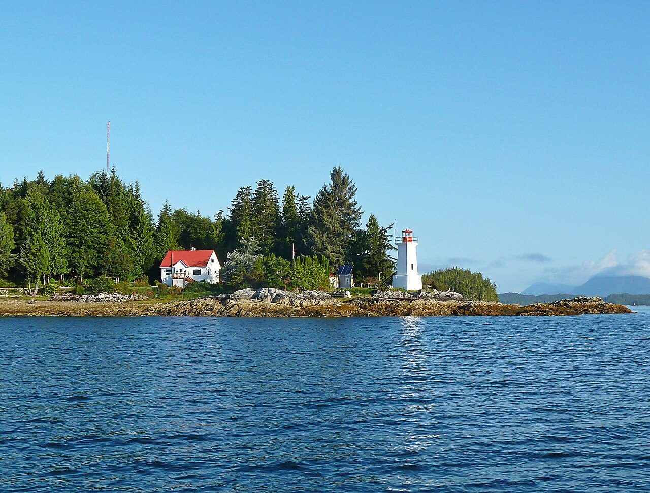
Dryad Point Lighthouse
In French: Phare de Dryad Point
Also known as Turn Point Lighthouse
About Dryad Point Lighthouse
In Bella Bella 1, Dryad Point Lighthouse is the designated heritage lighthouse. By its record, Dryad Point Lighthouse was built in 1919.
The Dryad Point Lighthouse is a square-tapered, reinforced concrete tower that measures 7.3 metres (24 feet) in height. Built in 1919, it replaced the original combined lighthouse and dwelling. The lighthouse is located on Dryad Point on the northeast end of Campbell Island, three kilometres from the village of Bella Bella. There are 10 related buildings on the site that contribute to the heritage character of the lighthouse: (1) the 1962 Four Bedroom Senior Dwelling; (2) the 1981 Three Bedroom Junior Dwelling; (3) the 1978 Storage Building #1; (4) the 1975 Engine Building; (5) the 2004 Bulk Fuel Storage System; (6) the Satellite Equipment Shed; (7) the Solar Equipment Shed; (8) the Seismic Monitoring Shed; (9) the Principal Keeper’s Greenhouse; and, (10) the Assistant Keeper’s Greenhouse.
From the Canadian Register of Historic Places, Dryad Point Lighthouse · Open Government Licence – Canada · quoted as the register has it
The Heritage Lighthouse Protection Act designates lighthouses of heritage value.
Finding Dryad Point Lighthouse
Bella Bella 1


No other historic place stands within a short walk; the town’s others are farther afield.
Questions about Dryad Point Lighthouse
Can you visit Dryad Point Lighthouse?
Yes from the outside; whether it opens its doors is for its owner to say.
When was Dryad Point Lighthouse built?
Dryad Point Lighthouse went up in 1919, by its record.
Is Dryad Point Lighthouse protected?
Its designation under the federal lighthouse act protects it.
What is Dryad Point Lighthouse?
Dryad Point Lighthouse is a Heritage Lighthouse of Canada, designated in 2015.
Contains information licensed under the Open Government Licence – Canada (Parks Canada).
Sources: Parks Canada, Directory of Federal Heritage Designations · Canadian Register of Historic Places (federal extract) · Photos: Wikimedia Commons, each credited with its licence and copied to our own server · Wikidata (CC0) for map points, other names and articles.
Adapted from Statistics Canada (Census of Population 2021, population estimates 2025, 2021 census boundaries) under the Statistics Canada Open Licence; this does not constitute an endorsement by Statistics Canada. Neighbourhood names in some cities © OpenStreetMap contributors (ODbL).