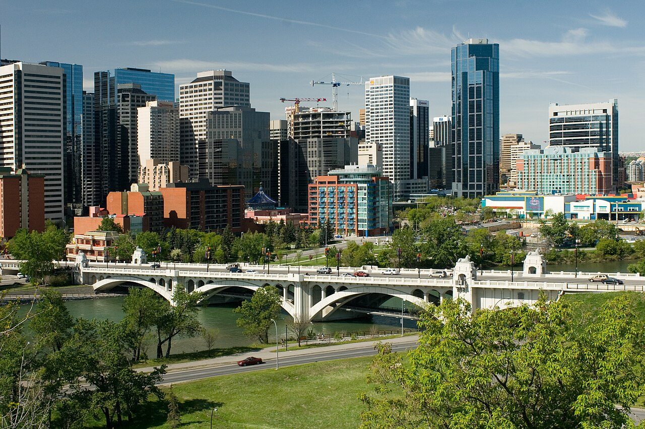
 Centre Street Bridge · Photo: Cszmurlo · CC BY 2.5
Sunnyside’s past, on the record: 1 historic place
Per resident Sunnyside outdoes 91% of Canadian towns, with 3.4 for every 10,000 people. Wikidata knows one more provincial or municipal listing here that gets no page, lacking an open statement or an encyclopedia article.
Where Sunnyside’s history is
Every place on the registers inside the town, by its designation.
Hover a dot for its name; tap one to open its page.
The federal directory kept by Parks Canada supplies most of these places; provincial and municipal lists outside Québec aren’t open data, so only the ones Wikidata documents with an article appear.
Points from Wikidata (Parks Canada’s files carry none) and from Québec’s register, as mapped there.
On a provincial or local list in Sunnyside: one place
Provincial and municipal listings that Wikidata records and an encyclopedia describes. Each one opens its own page.
 Local
Around Sunnyside, within 5 km, the dated heritage reaches back to 1875
The historic places within 5 km of Sunnyside, not in it, by the first construction date on each record.
The chart rests on 11 dated places within 5 km. First by date comes Fort Calgary in Downtown East Village, from 1875.
The closest heritage to Sunnyside is Knox United Church, 1.1 km off
Of 8 top designations nearby, Heritage Hall - Southern Alberta Institute of Technology is the closest, at 1.1 km. They are spread over 5 towns, including Downtown Commercial Core, Beltline and Downtown East Village. The record reaches back to 1875 with Fort Calgary, 2.6 km away.
The 12 nearest, within 5 km
| Knox United ChurchMunicipal historic resource · 1.1 km away, in Downtown Commercial Core |
| Heritage Hall - Southern Alberta Institute of TechnologyNational Historic Site · 1921–1923 · 1.1 km away, in Hillhurst |
| Mewata Drill Hall / Calgary Drill HallNational Historic Site · 1917–1919 · 1.5 km away, in Beltline |
| Palace TheatreNational Historic Site · 1921–1922 · 1.5 km away, in Downtown Commercial Core |
| Bank of Nova ScotiaProvincial historic resource · 1.6 km away, in Downtown Commercial Core |
| Stephen AvenueNational Historic Site · 1880–1931 · 1.6 km away, in Downtown Commercial Core |
| Cathedral Church of the RedeemerMunicipal historic resource · 1905 · 1.7 km away, in Downtown Commercial Core |
| BeaulieuNational Historic Site · 1891–1892 · 1.8 km away, in Beltline |
| Central Memorial Library and ParkNational Historic Site · 1908–1913 · 1.8 km away, in Beltline |
| Burns BuildingProvincial historic resource · 1912 · 1.9 km away, in Downtown Commercial Core |
| Calgary City HallNational Historic Site · 1907–1912 · 1.9 km away, in Downtown East Village |
| St. Mary's Parish HallMunicipal historic resource · 1905 · 2.4 km away, in Mission |
A town of older homes: 24% of Sunnyside’s were built before 1961 (18% is typical)
More of Sunnyside’s homes were built from 1961 to 1980 than in any other period: 39%. Sunnyside built little from 2001 to 2015: 11% of its homes, where most towns have 15%. From 2016 on, Sunnyside built 4.8% of its homes, near the typical 4.1%.
2021 Census, private dwellings by period of construction (Statistics Canada); the typical town is the middle Canadian town of 2,500 or more.
Sunnyside has the 2nd most of 16 towns its size
Towns of 3,000 to 3,000 residents, by places on the registers.
Only Saint-Marc-des-Carrières has more. Their median is 0. 14 of them have none.
Sunnyside and its neighbours
| Town | People | Places | Highest | Oldest |
|---|---|---|---|---|
| Sunnyside | 2,976 | 1 | 0 | — |
| Rosedale | 2,507 | 0 | 0 | — |
| Eau Claire | 3,733 | 0 | 0 | — |
| Downtown Commercial Core | 9,286 | 6 | 2 | 1880 |
| Downtown West End | 2,796 | 0 | 0 | — |
| Hillhurst | 8,435 | 1 | 1 | 1921 |
| Crescent Heights | 6,411 | 0 | 0 | — |
Sunnyside in brief
Of the homes standing in Sunnyside, 24% went up before 1961, against 18% in the typical town. The lists come to 1 historic place. Of the 16 towns closest in size, just one has more historic places. Beyond that, its past has lives on the record such as Ethel Sylvia Wilson (1902) and Roy Charles Taylor (1889).
What this data can and can’t tell you
- Map points. Pins for federal places come from Wikidata rather than Parks Canada, which gives no points.
- The federal register. Federal places come from Parks Canada’s directory, which counts National Historic Sites, federal heritage buildings, stations and lighthouses; their statements are the register’s own.
- People and events. Persons of national historic significance come with no location; a town gets one only by birthplace (name and both life years agreeing) or by one of its own places that bears the name and whose record tells the story. Events, which can’t be tied, are left out.
- The grade. History is described, not graded, for every Canadian town.
- Provincial and municipal lists. Only Wikidata gives open access to listings on provincial and municipal registers outside Québec; without an article such a place is counted but not paged.
- The tiers. Three tiers: the top for National Historic Sites, classified federal buildings and Québec’s classements, a second for the other federal designations, a third for provincial and municipal listings.
- Protection. Federal recognition isn’t a planning control: buildings the federal government owns follow its heritage policy, while others are protected only by a provincial or municipal designation.
Questions about Sunnyside’s history
How many historic places does Sunnyside have on the registers?
Inside Sunnyside: 1 historic place.
How old are the homes in Sunnyside?
24% of its homes were built before 1961, against 18% in the typical Canadian town.
Why might a heritage building in Sunnyside be missing here?
Provincial and municipal registers outside Québec aren’t open data. Wikidata knows one more listing in Sunnyside, but without an open description or an encyclopedia article it gets no page.
Contains information licensed under the Open Government Licence – Canada (Parks Canada).
Sources: Parks Canada, Directory of Federal Heritage Designations · Canadian Register of Historic Places (federal extract) · Wikidata (CC0) for map points, other names and articles · Statistics Canada, 2021 Census (homes by period of construction). Under the Statistics Canada Open Licence.
Adapted from Statistics Canada (Census of Population 2021, population estimates 2025, 2021 census boundaries) under the Statistics Canada Open Licence; this does not constitute an endorsement by Statistics Canada. Neighbourhood names in some cities © OpenStreetMap contributors (ODbL).