169 years in pictures
The archive holds 4 old photos and papers going back to 1934.
- 1857Tuttletown is settled
Each edition grades its towns against each other only.
A town of 440, settled in 1857.
33% of residents live below the poverty line in Tuttletown, where California’s towns sit at 10% and U.S. towns at 9.6%. Only 5 of the 848 California towns we compare have a lower share of working residents who work in town than Tuttletown. Tuttletown has fewer than 1,000 residents, too few for fair grades; the figures below are still real.
In a town this size, neighbors are the best guide. Ask them anything.

The archive holds 4 old photos and papers going back to 1934.
Tuttletown is unincorporated, so Tuolumne County and regional agencies provide most services.
EPA SDWIS (Oct 9, 2026) · HIFLD + EIA-861 2025 · Census 2020 ZCTAs · NCES 2024–25 · registration: vote.gov, updated Nov 18, 2024.
Ordered by what stands out in Tuttletown.
Expected storm and flood damage is higher than in 85% of U.S. communities.
FEMA National Risk Index · OpenFEMA
Tuttletown’s average trip to work is 37 minutes, against 28 minutes in California’s towns and 25 minutes across U.S. towns. The median household income in Tuttletown is $117,000. The top destinations are Sonora (10%), East Sonora (4%) and Modesto (4%).
| Tuttletown | California towns | U.S. towns | |
|---|---|---|---|
| Average trip to work | 37 minutes | 28 minutes | 25 minutes |
| Median household income | $117,000 | $95,000 | $80,000 |
Census LEHD 2023 · ACS
Tuttletown has mild winters and hot summers. Tuttletown’s July high is 93°F.
NOAA U.S. Climate Normals, 1991–2020
41% of Tuttletown adults have high blood pressure. Tuttletown beats the California average on 8 of 32 CDC measures and trails it on 13. 15% of Tuttletown adults have diabetes.
| Tuttletown | California towns | U.S. towns | |
|---|---|---|---|
| Frequent physical distress (CDC PLACES) | 18% | 14% | 14% |
| High blood pressure (CDC PLACES) | 41% | 31% | 35% |
| Diabetes (CDC PLACES) | 15% | 12% | 12% |
| Feel lonely (CDC PLACES) | 32% | 36% | 33% |
| What stands out | Tuttletown | CA |
|---|---|---|
| Fewer uninsured adults | 6.9% | 10.6% |
| Fewer adults facing housing insecurity | 12.2% | 14.9% |
| More adults with COPD | 9.9% | 5.1% |
CDC PLACES 2025 · modeled estimates for adults · CMS · HRSA
91% of households own their home in Tuttletown.
Census ACS, 2020–24 · Zillow Home Value Index · Redfin Data Center
Museums, parks, gardens and other places to visit around Tuttletown. Close and well known come first.
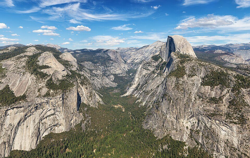
Big draw30 mi National ParkYosemite National Park4.3M visitors a year
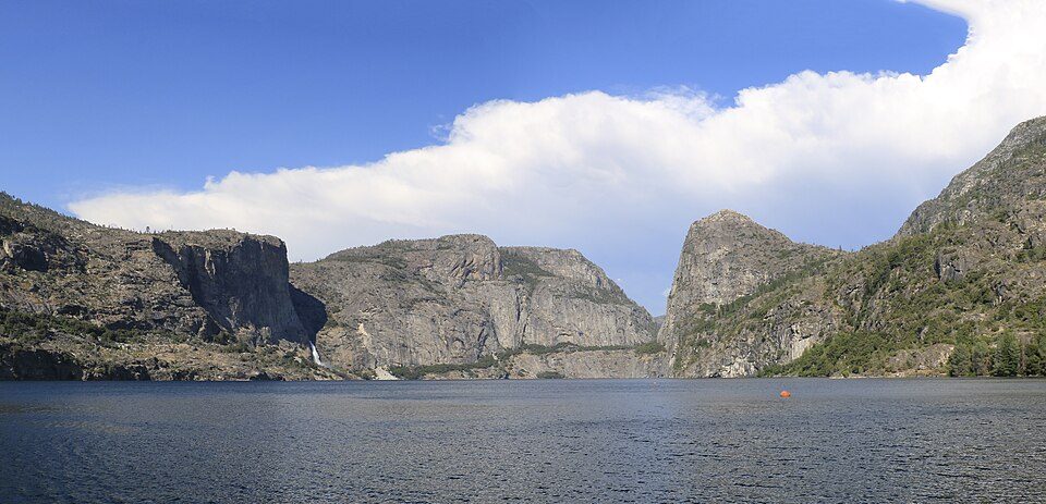
36 mi LakeHetch Hetchy
4 mi MuseumRailtown 1897 State Historic Park
20 mi State parkCalaveras Big Trees State Park
29 mi National forestStanislaus National Forest
30 mi Ski areaDodge Ridge Ski Area61 runs · 1,576 ft verticalYosemite National Park: Thomas Wolf, www.foto-tw.de, CC BY-SA 3.0 · Hetch Hetchy: Vulpinus2, CC BY-SA 4.0 · Railtown 1897 State Historic Park: Ed Bierman, CC BY 2.0 · Calaveras Big Trees State Park: John J. O'Brien (talk · contribs), Public domain · Stanislaus National Forest: U.S. National Park Service, Public domain · Dodge Ridge Ski Area: IanGad, CC BY-SA 3.0
1 within 15 miles of the center of Tuttletown
About 0 of every 100 Tuttletown residents are enrolled in college, against 8 across California.
Where Tuttletown’s working residents go each day. Line width shows the share.
Census LEHD 2023
Census designated place in California
Tuttletown (formerly Mormon Gulch and Tuttleville) is a census-designated place (CDP) in Tuolumne County, California, United States. It is located on State Route 49 near the gold rush community of Columbia. Tuttletown sits at an elevation of 1,047 feet (319 m). The 2020 United States census reported Tuttletown's population was 787.
From Wikipedia, licensed CC BY-SA 4.0 · facts via Wikidata (CC0)
Short answers, built from the data on this page.
Tuttletown has fewer than 1,000 residents, too few for fair grades; the figures below are still real.