Truckee’s post office opened in 1868, and 5 of its places are on the National Register
More historic than 44% of U.S. towns · #185 of 847 in California. What drives it
Most of Truckee was built recently: 1% of its homes predate 1940 and the median home dates from 1989. 5 places in town are on the National Register, among them the Donner Camp, a National Historic Landmark, and a historic district with 32 buildings. Below: 4 old photos and papers, maps from 1885 on, and the census since 1880.
The Truckee post office opened in 1868, the earliest record of the town by name. Two smaller post offices, Polaris (1901) and Gelatt (1923), opened inside today’s town and later closed.
First census: 1,147 in 18802020 census: 16,729158 years
How did Truckee get its name?
It was renamed Truckee after a Paiute chief, whose assumed Paiute name was Tru-ki-zo.
How historic is Truckee?
C+
More historic than 44% of U.S. towns, on its age, its old homes and the National Register.
On its age, its old homes and the National Register, Truckee is more historic than 44% of U.S. towns, #185 of 847 in California. Its National Register listings hold the grade up; its share of homes from before 1940 pulls it down.
C+
HistoryA character grade: shown, never part of Truckee’s overall grade.
Few California towns list much on the Register (a typical California town has 0.0 per 10,000 residents, the U.S. 2.4), so Truckee’s 20.5 sits above most of its state (95% of California towns have fewer) while its 35 historic buildings outnumber those of 83% of U.S. towns.
How sure. Graded on any two of the three inputs instead, the letter would range from D to B+. The pre-1940 share (±0.8 points) is firm at this size. The founding year is the first post office, not a stated founding date.
Founding year: the first post office (other dates in Quick answers). Homes: Census ACS 2020–24. National Register: National Park Service, May 2026 list; each listing counted once (boundary changes and added documentation belong to their listing), and a historic district counts its contributing buildings. How TownRatings grades history →
What stands out about Truckee’s past
Read from the archive, the National Register and the record. The page puts what stands out first.
Truckee's existence began in 1863 as Gray's Station, named for Joseph Gray's Roadhouse on the trans-Sierra wagon road. A blacksmith named Samuel S. Coburn was there almost from the beginning, and by 1866 the area was known as Coburn's Station. The Central Pacific Railroad selected Truckee as the name of its railroad station by August 1867, even though the tracks would not reach the station until a year later in 1868. It was renamed Truckee after a Paiute chief, whose assumed Paiute name was Tru-ki-zo. He was the father of Chief Winnemucca and grandfather of Sarah Winnemucca. The first Europeans who came to cross the Sierra Nevada encountered his tribe. The friendly chief rode toward them yelling, "Tro-kay!", which is Paiute for 'Everything is all right'. The unaware travelers assumed he was yelling his name. Chief Truckee later served as a guide for John C. Frémont.
The Truckee basin as a lumber region is distinct from the balance of the county. Tributary to Truckee and the stations alonsr the railroad are about 230,000 acres of timber land, that for thirteen years have witnessed the toil of the lumberman and furnished material for the tireless saw. When the railroad began to approach the summit, the saw mills went in advance of it, and were kept busy in furnishing timbers and wood for its construction. In 18G8 there were fourteen mills
Text read by machine from the scan; it may contain errors.
Upon a petition being presented to the Board of Supervisors, signed by 160 legal voters of the town, that body incorporated the town as " The Inhabitants of the town of Truckee," under the provisions of the Act approved April 19, 1856. The town as incorporated contained the south half of the southwest quarter and the south half of the southeast quarter of section 10, the south half of the southwest quarter and the southwest quarter of the southeast quarter of section 11, the northwest
Text read by machine from the scan; it may contain errors.
Scans and text from the Internet Archive. Books published in 1930 or earlier, which are in the public domain.
Timeline
Truckee, 1868 to 1992
Woven from the archive, old maps, post office records, the National Register and the people born here.
Nothing in the archives for these yearsWeddings on Main Street, storms, parades, school pictures, the old store. If it’s in your family album, it belongs here.
Every edition of the U.S. Geological Survey’s map of Truckee. Tap a year, or press play to watch the town change.
1955Truckee sheet · 1:24,000
U.S. Geological Survey historical topographic maps (public domain), via Esri’s collection of the scans. The red ring marks the center of Truckee.
Every building
Truckee, building by building, 1885–1907
Fire insurance maps drew every building, what it was made of and what it was used for, so insurers could price the risk of fire. Pick a year, then a sheet.
The Truckee post office opened in 1868, the earliest record of the town by name (U.S. post office records).
How does Truckee rank for history?
Truckee is more historic than 44% of U.S. towns, #185 of 847 in California. The History grade combines the town’s founding era, the share of homes built before 1940 and its National Register listings. It’s a character grade, so it isn’t part of the overall grade. How it works.
What is on the National Register in Truckee?
5 listings: 2 buildings, 1 historic district, the Commercial Row-Brickelltown Historic District, with 32 contributing buildings, 1 site, and 1 structure. 35 historic buildings in all.
How old are the homes in Truckee?
1% of Truckee’s homes were built before 1940 (Census estimate), against a typical 3.4% for a California town; the median home was built in 1989.
Founding dates: Wikidata, Wikipedia, the U.S. post office records of Blevins & Helbock (CC0) and the Census. Homes by year built: Census ACS 2020–24. National Register of Historic Places: National Park Service (list of May 22, 2026). Old photos, postcards and papers: Wikimedia Commons, the Library of Congress and other public archives, credited on each item’s page. Maps: U.S. Geological Survey historical topographic maps (via Esri) and Sanborn fire-insurance maps (Library of Congress). History text and census tables: Wikipedia (CC BY-SA 4.0). Places that used to be: USGS Geographic Names Information System (2021).
From Wikimedia Commons (1), the Library of Congress (8), the National Register of Historic Places (5), Wikipedia, Wikidata and Wikipedia for famous people, U.S. Geological Survey historical maps, U.S. Census counts (via Wikipedia), the US Post Offices dataset (Blevins & Helbock), the USGS Geographic Names Information System, Sanborn fire insurance maps (Library of Congress) and old county and town histories (Internet Archive). Archive images are copied here with their credits and licenses, shown on each photo’s page. Refreshed monthly.

 ★ Landmark

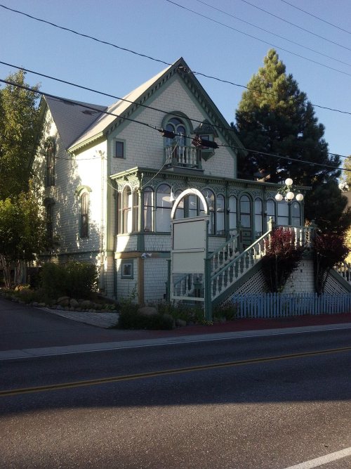


 1909
 1909
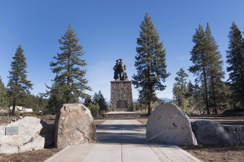 2012
 2012
 2012
 2012
 2010


