Trinidad’s post office opened in 1851, and 14% of its homes were built before 1940
2 places in town are on the National Register, among them a historic district with 1 buildings. Below: 5 old photos and papers, maps from 1945 on, and the census since 1880.
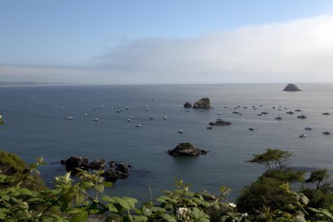
The Yurok people established the village of Tsurai on bluffs overlooking Trinidad Bay in prehistoric times. They occupied the village for thousands of years before vacating it in 1916.
In the year 1802 there resided in the town of Galway a physician named Lynch, whose brother-in-law, Mr. Nicholas Lynch, had some time previously settled in Trinidad. In 1801 Nicholas Lynch paid a visit to his relations in Ireland and described to his brother-in-law, in very glowing terms, the advantages he would reap if he abandoned the scanty emoluments of a country Doctor in the West of Ireland, and establish himself in Trinidad, where, at that time, duly qualified medical men were very rarely met with.
Text read by machine from the scan; it may contain errors.
The Island of Trinidad, at that period, formed part of the Diocese of Guayana, which was created by Pope Pius VI. in May, 1790, and which included, besides Trinidad, the Island of Margarita and the Provinces of Guayana and Cumana. When the Island was captured by the British, the See was occupied by the Right Reverend Doctor Francisco de Ibarra, who was succeeded, in 1801, by the Right Reverend Jose Antonio Mohedano, by whom the following letter was addressed to the Governor of Trinidad : —
Text read by machine from the scan; it may contain errors.
Scans and text from the Internet Archive. Books published in 1930 or earlier, which are in the public domain.
Timeline
Trinidad, 1851 to 1980
Woven from the archive, old maps, post office records, the National Register and the people born here.
Nothing in the archives for these yearsWeddings on Main Street, storms, parades, school pictures, the old store. If it’s in your family album, it belongs here.
Nothing in the archives for these yearsWeddings on Main Street, storms, parades, school pictures, the old store. If it’s in your family album, it belongs here.
Founding dates: Wikidata, Wikipedia, the U.S. post office records of Blevins & Helbock (CC0) and the Census. Homes by year built: Census ACS 2020–24. National Register of Historic Places: National Park Service (list of May 22, 2026). Old photos, postcards and papers: Wikimedia Commons, the Library of Congress and other public archives, credited on each item’s page. Maps: U.S. Geological Survey historical topographic maps (via Esri) and Sanborn fire-insurance maps (Library of Congress). History text and census tables: Wikipedia (CC BY-SA 4.0). Places that used to be: USGS Geographic Names Information System (2021). How TownRatings grades history →
From Wikimedia Commons (7), the Library of Congress (17), the National Register of Historic Places (2), Wikipedia, U.S. Geological Survey historical maps, U.S. Census counts (via Wikipedia), the US Post Offices dataset (Blevins & Helbock), the USGS Geographic Names Information System and old county and town histories (Internet Archive). Archive images are copied here with their credits and licenses, shown on each photo’s page. Refreshed monthly.


 1926
 1926
 2012
 2012
 2012
 2012
 2012
 2012
 2012
 2012
 2012
 2012
 2012
 2012
 2012
 2012
 2011
 2011
 2008
 2008
 2006


