
Topanga Summit 1922, 1922
Topanga’s story
118 years in pictures
The archive holds 6 old photos and papers going back to 1922 and 8 maps from 1903 on.
- 1908Topanga is settled
Each edition grades its towns against each other only.

A town of 8,885, settled in 1908.
Topanga's standout: it has 52 miles of trail and 44% conserved land. Overall it grades C+, 275th of 841 graded towns in California. Residents are healthier than 95% of U.S. towns on CDC estimates and the median household earns $157K. Its weakest subject is cost of living: the typical home is worth about $1.4 million, 14.5 years of the Los Angeles metro’s $96K median household income. 64% of adults 25 and older hold a bachelor’s degree or more in Topanga, above both California’s towns (29%) and U.S. towns (29%). On hazard risk, just 48 of California’s 1,064 towns do worse. The biggest place to walk is Santa Monica Mountains National Recreation Area, 12,039 acres with 14 miles of trail.
Where Topanga beats most towns, and one thing worth knowing.
44.1% of the town is conserved land, across 22 parks and preserves.
Each subject compared with towns across the country (schools within California), ordered by how far Topanga is from typical.
How TownRatings grades towns →
The archive holds 6 old photos and papers going back to 1922 and 8 maps from 1903 on.
Museums, parks, gardens and other places to visit around Topanga. Close and well known come first.
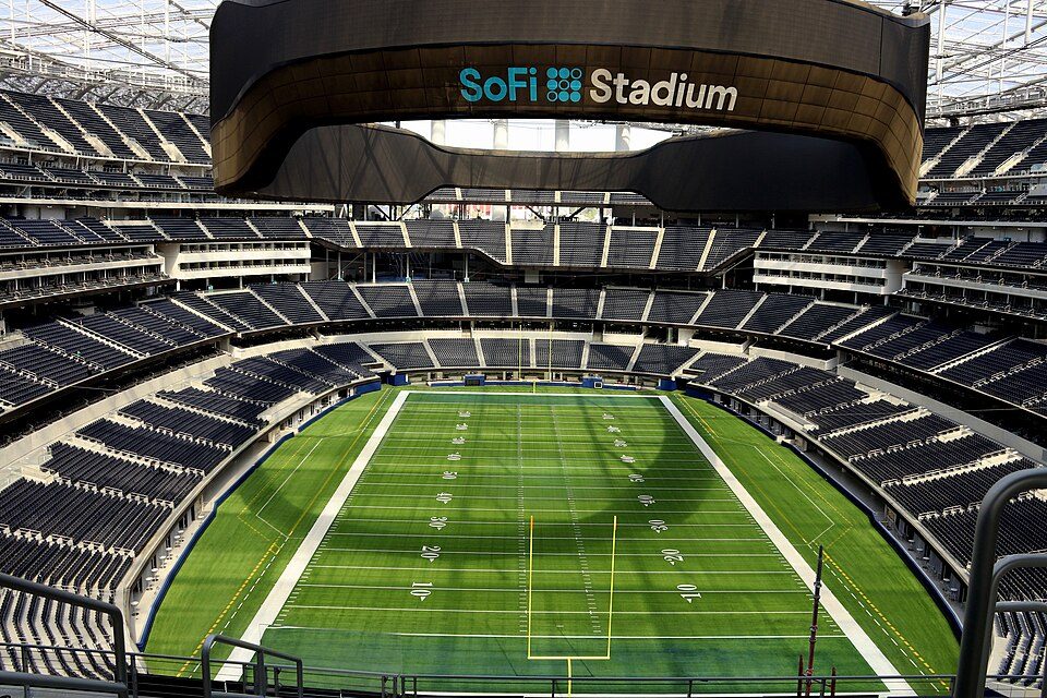 Big draw18 mi Stadium & arenaSoFi Stadium
 Big draw15 mi LandmarkHollywood Walk of Fame10.0M visitors a year
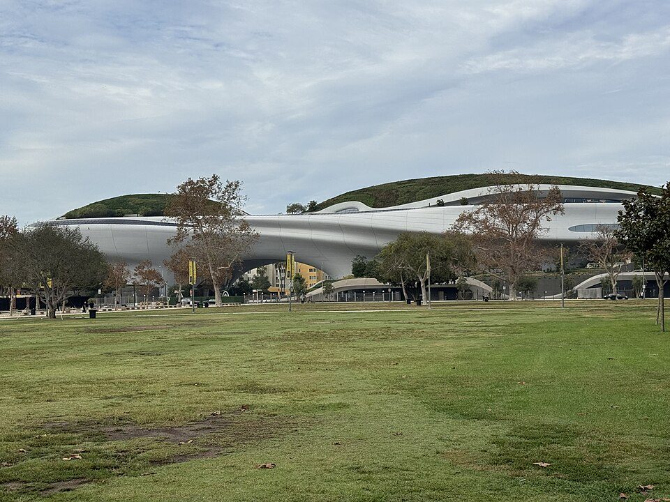 Big draw19 mi MuseumLucas Museum of Narrative Art
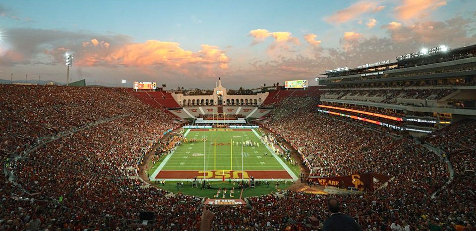 Big draw19 mi Stadium & arenaLos Angeles Memorial Coliseum
 Big draw15 mi MuseumLa Brea Tar Pits
 Big draw17 mi LandmarkHollywood Sign
SoFi Stadium: Thank You (21 Millions+) views, CC BY 2.0 · Hollywood Walk of Fame: BenSherman, Public domain · Lucas Museum of Narrative Art: Kriddl, CC0 · Los Angeles Memorial Coliseum: CanonStarGal, CC BY-SA 4.0 · La Brea Tar Pits: Daniel Schwen, CC BY-SA 2.5 · Hollywood Sign: Thomas Wolf, www.foto-tw.de, CC BY-SA 3.0
Topanga is unincorporated, so Los Angeles County and regional agencies provide most services.
EPA SDWIS (Oct 9, 2026) · HIFLD + EIA-861 2025 · Census 2020 ZCTAs · NCES 2024–25 · registration: vote.gov, updated Nov 18, 2024.
Ordered by what stands out in Topanga.
Topanga has less no health insurance than most of California, keeps more of its land conserved than most of California and has milder winter nights than nearly all U.S. towns.
At 14.5 years of the Los Angeles metro’s $96K median household income, the typical home (about $1.39M) costs more against local pay than in 91% of California towns; that ratio is one input to its D− for cost of living. The typical value, about $1.39M, is 9% below its December 2023 peak.
Topanga’s median rent is $3,501 a month. The typical Topanga home is worth about $1,390,000, down 3.4% in a year, 82% above the California typical home.
| Topanga | California towns | U.S. towns | |
|---|---|---|---|
| Median rent | $3,501 a month | $1,895 a month | $1,185 a month |
| Households that own their home | 82% | 64% | 73% |
Census ACS, 2020–24 · Zillow Home Value Index · Redfin Data Center
Its public schools are run by the Las Virgenes Unified school district. Two of its 3 schools are below, each with why it’s listed.
| School | Level | Students | Letter |
|---|---|---|---|
| Alice C. Stelle MiddleLargest public middle schoolGrades 6–8 | Grades 6–8 | 760 | A− |
| Manzanita School and Institute PrivateLargest high schoolGrades K–12 | Grades K–12 | 139 | – |
NCES · EDFacts · graded within CA on state tests and graduation
Its 5,384 conserved acres are a larger share of the town than in 97% of California towns. Its A+ for the outdoors ranks #3 of 847 in California.
52 miles of trail in 22 parks and preserves. The trail density in Topanga is 2.7 miles per square mile.
| Biggest places to walk | Trails | Acres |
|---|---|---|
| 1. Santa Monica Mountains National Recreation Area | 14 mi | 12,039 |
| 2. Topanga State Park | 13.2 mi | 2,527 |
| 3. Summit Valley Edmund D. Edelman Park | 8.6 mi | 660 |
Trails & parks © OpenStreetMap contributors · Conserved land: USGS PAD-US
Its widest gap with California is no health insurance: 3.3% of those 18–64 have no health insurance, against 10.6% statewide. Against the 2,344 U.S. towns with household incomes like Topanga’s, it is healthier than 71%, a smaller edge than it has nationally: part of it comes with its incomes.
23% of Topanga adults have obesity. Topanga beats the California average on 21 of 32 CDC measures and trails it on 3. 15% of Topanga adults get no exercise outside work.
| Topanga | California towns | U.S. towns | |
|---|---|---|---|
| Obesity (CDC PLACES) | 23% | 29% | 35% |
| Get no exercise (CDC PLACES) | 15% | 24% | 25% |
| Sleep under 7 hours (CDC PLACES) | 30% | 35% | 36% |
| Frequent mental distress (CDC PLACES) | 14% | 17% | 17% |
| What stands out | Topanga | CA |
|---|---|---|
| Fewer uninsured adults | 3.3% | 10.6% |
| Fewer adults facing food insecurity | 7.2% | 17.9% |
| More adults who have had cancer | 9.9% | 6.4% |
CDC PLACES 2025 · modeled estimates for adults · CMS · HRSA
Expected storm and flood damage is higher than in 99% of U.S. communities. One flood insurance claim has been paid in Topanga since 2024.
FEMA flood insurance claims · FEMA National Risk Index · OpenFEMA
40.7% of workers work from home, against 17.2% across California.
41% of workers work from home in Topanga. Jobs based in Topanga grew to 1,200 in 2023, 214 more than in 2013. 6% of residents live below the poverty line in Topanga.
| Topanga | California towns | U.S. towns | |
|---|---|---|---|
| Work from home | 41% | 14% | 11% |
| Median household income | $157,000 | $95,000 | $80,000 |
| Below the poverty line | 6% | 10% | 9.6% |
| Average trip to work | 29 minutes | 28 minutes | 25 minutes |
Census LEHD 2023 · ACS
January nights average 47.8°, milder than in 98% of U.S. towns; July afternoons average 84.1°.
Topanga has warm winters and warm summers, with very little rain. Snow is almost unheard of.
| Topanga | California towns | U.S. towns | |
|---|---|---|---|
| January low | 48°F | 40°F | 22°F |
| July high | 84°F | 89°F | 85°F |
NOAA U.S. Climate Normals, 1991–2020
23 within 15 miles of the center of Topanga
About 6 of every 100 Topanga residents are enrolled in college, against 8 across California.
Where Topanga’s working residents go each day. Line width shows the share.
Census LEHD 2023
Census-designated place in Los Angeles County, California, US
Topanga (Tongva: Topaa'nga) is an unincorporated community in western Los Angeles County, California, United States. Located in the Santa Monica Mountains, the community exists in Topanga Canyon and the surrounding hills. The narrow southern portion of Topanga at the coast is between the city of Malibu and the Los Angeles neighborhood of Pacific Palisades. For statistical purposes, the United States Census Bureau has defined Topanga as a census-designated place (CDP). As of the 2020 census the population of the Topanga CDP was 8,560. The ZIP Code is 90290 and the area code is primarily 310, with 818 only at the north end of the canyon. It is in the 3rd County Supervisorial district. Topanga…
From Wikipedia, licensed CC BY-SA 4.0 · facts via Wikidata (CC0)
3 towns share a border with Topanga.
| Town | CA rank | Overall | Cost | Safety | Schools | Health |
|---|---|---|---|---|---|---|
| Topanga | #275 | C+ | D− | — | B− | A |
| Calabasas | #145 | B | D− | B− | A | A+ |
| Los Angeles | #613 | D | D− | D | B− | B− |
| Malibu | #318 | C+ | D− | D | A | A |
Topanga reports no FBI crime data of its own. Compare Topanga with a neighbor →
Short answers, built from the data on this page.
Topanga grades C+ overall, better than 41% of U.S. towns and #275 of 841 in California. It grades A for health and B− for schools. Cost of living is its weak spot, with a D−.
Yes. Cost of living, which also weighs rents, property taxes and how many households pay 30% or more of their income for housing, grades D−.


