More historic than 21% of U.S. towns · #444 of 847 in California. What drives it
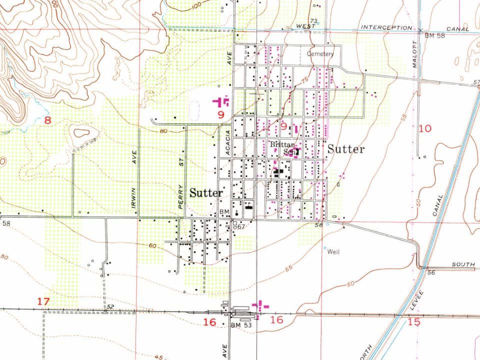
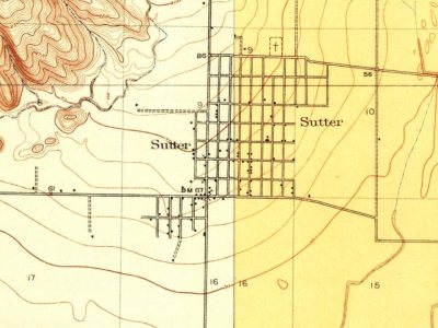
Most of Sutter was built recently: 4% of its homes predate 1940 and the median home dates from 1975. Below: maps from 1912 on and the census since 1960.
Founding year: Wikidata. First post office: 1871.The full story ↓
History grade
What drives Sutter’s History grade
On its age, its old homes and the National Register, Sutter is more historic than 21% of U.S. towns, #444 of 847 in California. Its age holds the grade up; its share of homes from before 1940 pulls it down.
C−
HistoryA character grade: shown, never part of Sutter’s overall grade.
Few California towns list much on the Register (a typical California town has 0.0 per 10,000 residents, the U.S. 2.4), so Sutter’s 0.0 sits below most of its state (31% of California towns have fewer) while its 0 listings outnumber those of 23% of U.S. towns.
How sure. Graded on any two of the three inputs instead, the letter would still be C−. The pre-1940 share (±2.6 points) is firm at this size. Two sources give 1871.
Founding year: Wikidata (other dates in Quick answers). Homes: Census ACS 2020–24. National Register: National Park Service, May 2026 list; each listing counted once (boundary changes and added documentation belong to their listing), and a historic district counts its contributing buildings. How TownRatings grades history →
What stands out about Sutter’s past
Read from the archive, the National Register and the record. The page puts what stands out first.
Originally a settlement called South Butte, established in the vicinity of the stage station at Butte House east of the current town. It had a post office from August 7, 1871, until December 17, 1878, and from February 18, 1879, to January 20, 1888, when it was moved to the new Sutter City Post Office nearby. The Sutter Cemetery (originally South Butte Cemetery) lay to the west on the stage road (in former times used mostly by stagecoaches), and beside it was the school house, that had its classes dismissed when there was a funeral.
Later, they were called "Sutter's Buttes" and " Marysville Buttes," but are now generally spoken of as the " Butte Mountains," or "Sutter County Buttes." The county of Butte, which adjoins Sutter on the north, received its name from these noted peaks, although at that time they were in Sutter county. In 1852, the boundary between these two counties was changed so as to include the Buttes in Butte county; but two years later they were restored and have ever since been a part of Sutter coimty. They are undoubt-
Text read by machine from the scan; it may contain errors.
History of Yuba and Sutter Counties, California1924 · page 224Read the page →
Read the text
The Buttes that form such a prominent feature in the landscape of Sutter have been known by various names since they came to the knowledge of white men. They were spoken of by Fremont in 1843 as "The Three Buttes." In the grants made to Captain Sutter, they are called "los tres picos." Later they were called "Sutter's Buttes" and "Marysville Buttes," but are now generally spoken of as the "Sutter County Buttes."
Text read by machine from the scan; it may contain errors.
History of Yuba and Sutter Counties, California1924 · page 247Read the page →
Read the text
County Horticultural Commissioner H. P. Stabler, in 1922, on the occasion of the first annual Peach Day Celebration, thus wrote of Sutter County's claim to the title of "Home of the Cling Peach" : "Gen. John A. Sutter, soon after the discovery of gold, left Sutter's Fort at Sacramento and built a home on Hock Farm on the Feather River, nine miles south of Yuba City. Here he planted a peach orchard, the first peach orchard in Sutter County. In 1860 John Briggs, P. L. Bunce, Dr. A. L. Chandler, and Dr. Eli Teegarden planted peach orchards in Sutter
Text read by machine from the scan; it may contain errors.
Scans and text from the Internet Archive. Books published in 1930 or earlier, which are in the public domain.
Timeline
Sutter, 1871 to 1997
Woven from the archive, old maps, post office records, the National Register and the people born here.
Sanborn Map Company, via the Library of Congress. Editions published in 1930 or earlier, which are in the public domain.
People over time
Sutter, census by census
Grew from 1,219 people in 1960 to 2,997 in 2020.
7 censuses, 1960–2020.
U.S. Census Bureau decennial counts, from the census table on Sutter’s Wikipedia page.
Questions about Sutter’s history
What year was Sutter founded?
In 1871, according to Wikidata. Sutter’s post office opened in 1871, and the census of 1960 counted 1,219 people here.
How does Sutter rank for history?
Sutter is more historic than 21% of U.S. towns, #444 of 847 in California. The History grade combines the town’s founding era, the share of homes built before 1940 and its National Register listings. It’s a character grade, so it isn’t part of the overall grade. How it works.
How old are the homes in Sutter?
4% of Sutter’s homes were built before 1940 (Census estimate, ±2.6 points), against a typical 3.4% for a California town; the median home was built in 1975.
Founding dates: Wikidata, Wikipedia, the U.S. post office records of Blevins & Helbock (CC0) and the Census. Homes by year built: Census ACS 2020–24. National Register of Historic Places: National Park Service (list of May 22, 2026). Old photos, postcards and papers: Wikimedia Commons, the Library of Congress and other public archives, credited on each item’s page. Maps: U.S. Geological Survey historical topographic maps (via Esri) and Sanborn fire-insurance maps (Library of Congress). History text and census tables: Wikipedia (CC BY-SA 4.0). Places that used to be: USGS Geographic Names Information System (2021).
From Wikipedia, Wikidata and Wikipedia for famous people, U.S. Geological Survey historical maps, U.S. Census counts (via Wikipedia), the US Post Offices dataset (Blevins & Helbock), the USGS Geographic Names Information System, Sanborn fire insurance maps (Library of Congress) and old county and town histories (Internet Archive). Archive images are copied here with their credits and licenses, shown on each photo’s page. Refreshed monthly.