
Mojave, 2006
Rosamond’s story
149 years in pictures
Census counts: 2,281 in 1970, 20,961 in 2020. The archive holds 2 old photos and papers going back to 2006 and 3 maps from 1947 on.
- 1877Rosamond is established
Each edition grades its towns against each other only.

A town of 21,473, established in 1877.
Rosamond grades D− overall, 827th among California's 841 graded towns, mostly because of incomes. The median household income is $79K, and 17% of residents live below the poverty line. Rosamond’s peak summer temperature is 98°F, above both the California town median (89°F) and the median of U.S. towns (85°F). Homes are expensive, about $405K for a typical one and 5.8 times the Bakersfield metro’s $70K median household income.
18,150 counted in 2010 and 20,961 in 2020.
U.S. Census 2010 & 2020 counts
Each subject compared with towns across the country (schools within California), ordered by how far Rosamond is from typical.
How TownRatings grades towns →
Census counts: 2,281 in 1970, 20,961 in 2020. The archive holds 2 old photos and papers going back to 2006 and 3 maps from 1947 on.
Rosamond is unincorporated, so Kern County and regional agencies provide most services.
EPA SDWIS (Oct 9, 2026) · HIFLD + EIA-861 2025 · Census 2020 ZCTAs · NCES 2024–25 · registration: vote.gov, updated Nov 18, 2024.
Ordered by what stands out in Rosamond.
Across 3 parks and preserves: 198 miles of trail. Rosamond’s trail density comes in at 3.8 miles per square mile. Parks and preserves in the town: 3, covering 23 acres.
| Rosamond | California towns | U.S. towns | |
|---|---|---|---|
| Miles of trail per square mile | 3.8 miles per square mile | 1.0 | 0.4 |
| Conserved land | 0.8% | 4.3% | 4.3% |
| Biggest places to walk | Trails | Acres |
|---|---|---|
| 1. Jim Williford Community Park | 0.5 mi | 5 |
| 2. United Street Park | 0.1 mi | 10 |
| 3. Rosamond Park | — | 8 |
Trails & parks © OpenStreetMap contributors · Conserved land: USGS PAD-US
The largest public high school is Rosamond High Early College Campus, with 927 students. Two of the 6 schools are below, and why each made the list. Its public schools are run by the Southern Kern Unified school district.
| School | Level | Students | Letter |
|---|---|---|---|
| Westpark ElementaryLargest public elementary schoolGrades K–5 | Grades K–5 | 952 | – |
| Rosamond High Early College CampusLargest public high schoolGrades 9–12 | Grades 9–12 | 927 | – |
NCES · EDFacts · graded within CA on state tests and graduation
77% of Rosamond households live in a home they own. Zillow values the typical Rosamond home at about $405,000, about the same as a year ago, 47% below the California typical home. Also worth knowing: its typical rent is $1,498 a month.
| Rosamond | California towns | U.S. towns | |
|---|---|---|---|
| Households that own their home | 77% | 64% | 73% |
| Median rent | $1,498 a month | $1,898 a month | $1,185 a month |
Census ACS, 2020–24 · Zillow Home Value Index · Redfin Data Center
The national flood insurance program has paid one claim in Rosamond since 2023. Compared with 87% of U.S. communities, expected storm and flood damage in the town is higher. Of the losses FEMA expects in the town, 64% come from inland flooding and 30% from earthquakes. Federal disaster aid has reached households in Rosamond after 2 declared disasters, most recently in 2023.
FEMA flood insurance claims · FEMA disaster declarations and aid · FEMA National Risk Index · OpenFEMA
The average trip to work for Rosamond comes to 31 minutes. Commuting out is the norm in the town: nearly a tenth of working residents work locally. Employers in Rosamond added 191 jobs between 2013 and 2023, to 1,470. Half the trips to work are shorter than 23 miles.
| Rosamond | California towns | U.S. towns | |
|---|---|---|---|
| Average trip to work | 31 minutes | 28 minutes | 25 minutes |
| Work from home | 7.8% | 14% | 11% |
| Median household income | $79,000 | $95,000 | $80,000 |
| Working residents who work in town | 8.9% | 6.6% | 8% |
Census LEHD 2023 · ACS
For adults in Rosamond, the share who binge drink is 18%. Against the California average, Rosamond comes out ahead on 1 CDC measures out of 32, and behind on 19. Nearly a quarter of adults in Rosamond worry about having enough food; 71% had a checkup this year.
| Rosamond | California towns | U.S. towns | |
|---|---|---|---|
| Frequent mental distress (CDC PLACES) | 21% | 17% | 17% |
| Food insecurity (CDC PLACES) | 24% | 16% | 14% |
| Yearly checkup (CDC PLACES) | 71% | 72% | 79% |
| Fair or poor health (CDC PLACES) | 26% | 22% | 19% |
| What stands out | Rosamond | CA |
|---|---|---|
| Fewer adults who have had cancer | 5.7% | 6.4% |
| More adults facing a utility shut-off | 11.1% | 7.3% |
CDC PLACES 2025 · modeled estimates for adults · CMS · HRSA
The Mojave weather station, 13 miles away, records that about 110 days a year reach 90°, more than in 96% of U.S. towns. July afternoons average 97.8°, hotter than in 99% of U.S. towns; January nights average 33°.
Its January low comes in at 33°F. About 1 inches of snow falls in a winter.
NOAA U.S. Climate Normals, 1991–2020
Museums, parks, gardens and other places to visit around Rosamond. Close and well known come first.
 Big draw38 mi Theme parkSix Flags Magic Mountain3.3M visitors a year
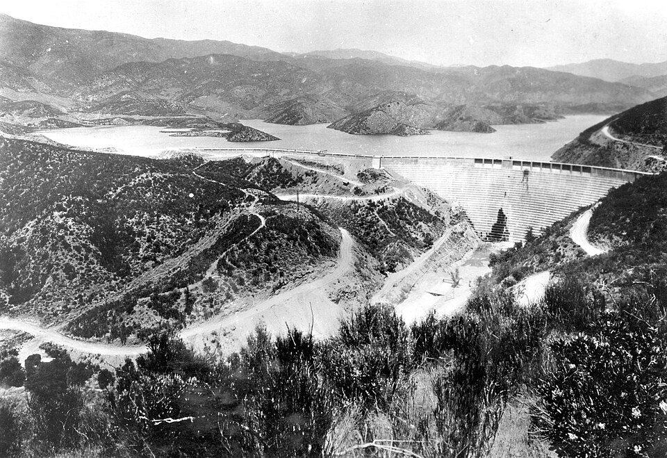 Big draw28 mi DamSt. Francis Dam
 27 mi Park & preserveVasquez Rocks
 21 mi LandmarkBalls 8
 37 mi National forestAngeles National Forest
 14 mi State parkAntelope Valley California Poppy Reserve
Six Flags Magic Mountain: Alton, CC BY 3.0 · St. Francis Dam: Stearns, H.T. USGS, Public domain · Vasquez Rocks: Thomas from USA, CC BY 2.0 · Balls 8: NASA/Tony Landis, Public domain · Angeles National Forest: Geographer at en.wikipedia, CC BY 1.0 · Antelope Valley California Poppy Reserve: Thomas, CC BY 2.0
1 within 15 miles of the center of Rosamond
About 6 of every 100 Rosamond residents are enrolled in college, against 8 across California.
0.8% of the town is conserved land, across 3 parks and preserves.
Unincorporated community in Kern County, California
Rosamond is an unincorporated community in Kern County, California, US, near the Los Angeles county line. Rosamond is part of Greater Los Angeles and is located in the Mojave Desert just north of Lancaster and Palmdale, the two largest cities in the Antelope Valley. As of the 2020 Census, Rosamond's population was 20,961. For statistical purposes, the United States Census Bureau has defined Rosamond as a census-designated place (CDP). Rosamond is a suburban bedroom community with many residents employed by nearby Edwards Air Force Base or commuting to Los Angeles, Lancaster, and Palmdale for work. The town is about 15 minutes north of the Lancaster Metrolink station providing direct access …
From Wikipedia, licensed CC BY-SA 4.0 · facts via Wikidata (CC0)
Short answers, built from the data on this page.
Rosamond grades D− overall, in the bottom 2% of U.S. towns and #827 of 841 in California. It grades C for health and C for schools. Cost of living is its weak spot, with a D.
Yes. Cost of living, which also weighs rents, property taxes and how many households pay 30% or more of their income for housing, grades D.


