More historic than 19% of U.S. towns · #486 of 847 in California. What drives it
Most of Ripon was built recently: 3% of its homes predate 1940 and the median home dates from 1995. Below: maps from 1914 on and the census since 1950.
Founding year: the first Ripon post office (Blevins & Helbock, CC0). Wikidata: 1945.The full story ↓
History grade
What drives Ripon’s History grade
On its age, its old homes and the National Register, Ripon is more historic than 19% of U.S. towns, #486 of 847 in California. Its age holds the grade up; its share of homes from before 1940 pulls it down.
C−
HistoryA character grade: shown, never part of Ripon’s overall grade.
Few California towns list much on the Register (a typical California town has 0.0 per 10,000 residents, the U.S. 2.4), so Ripon’s 0.0 sits below most of its state (31% of California towns have fewer) while its 0 listings outnumber those of 23% of U.S. towns.
How sure. Graded on any two of the three inputs instead, the letter would still be C−. The pre-1940 share (±2.1 points) is firm at this size. The founding year is the first post office, not a stated founding date; Wikidata gives 1945.
Founding year: the first post office (other dates in Quick answers). Homes: Census ACS 2020–24. National Register: National Park Service, May 2026 list; each listing counted once (boundary changes and added documentation belong to their listing), and a historic district counts its contributing buildings. How TownRatings grades history →
What stands out about Ripon’s past
Read from the archive, the National Register and the record. The page puts what stands out first.
Ripon, on the site previously known as Murphy's Ferry, Stanislaus City, and Stanislaus Station, was renamed for Ripon, Wisconsin, which was named for a city in North Yorkshire, England. Ripon's economy is largely agriculture based, known especially for its high production of almonds. In 1998, great expansion began for the city. Areas north of the Golden State (99) Freeway were slated for housing divisions, and huge swaths of agricultural land were slated for development. In 2003, the Jack Tone Road intersection was rebuilt, thus beginning a gigantic commercial development for two truck stops—Loves and the Flying J—that year. The next couple of years saw the addition of numerous restaurants and a shopping center.
Passages that mention Ripon, cut from the printed page as they were published.
Ripon millenary, a record of the festival. Also a history of the city, arranged under its wakemen and mayors from the year 14001892 · page 231Read the page →
Read the text
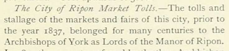
The City of Ripon Market Tolls.— The tolls and stallage of the markets and fairs of this city, prior to the year 1837, belonged for many centuries to the .Archbishops of York as Lords of the Manor of Ripon.
Text read by machine from the scan; it may contain errors.
Ripon millenary, a record of the festival. Also a history of the city, arranged under its wakemen and mayors from the year 14001892 · page 295Read the page →
Read the text
Richardson, Esq., M.D., by a codicil to his will, dated July 29th, 1782, as an encouragement to establish a woollen or linen manufactor\' in the town of Ripon, and the neighbourhood thereof, bequeathed the 300/. advanced by him on the credit of the Ripon Navigation to the mayor, etc., of-Ripon, for the purpose of giving two premiums — one of 5/. 5s. od. for the best piece of woollen orlinen goods manufactured
Text read by machine from the scan; it may contain errors.
Scans and text from the Internet Archive. Books published in 1930 or earlier, which are in the public domain.
Timeline
Ripon, 1874 to 1989
Woven from the archive, old maps, post office records, the National Register and the people born here.
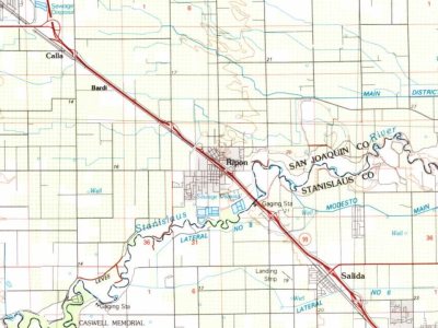
U.S. Geological Survey historical topographic maps (public domain), via Esri’s collection of the scans. The red ring marks the center of Ripon.
Every building
Ripon, building by building, 1914–1920
Fire insurance maps drew every building, what it was made of and what it was used for, so insurers could price the risk of fire. Pick a year, then a sheet.
1914Sheet 1 of 1
Edition
Sheets
BrickWoodStone
Sanborn Map Company, via the Library of Congress. Editions published in 1930 or earlier, which are in the public domain.
People over time
Ripon, census by census
Grew from 1,550 people in 1950 to 16,013 in 2020, more than tenfold.
8 censuses, 1950–2020.
U.S. Census Bureau decennial counts, from the census table on Ripon’s Wikipedia page.
Famous people
2 famous people were born in Ripon
Writers, athletes, leaders and more, ranked by how widely they’re known.
The Ripon post office opened in 1874, the earliest record of the town by name (U.S. post office records). Wikidata gives 1945.
How does Ripon rank for history?
Ripon is more historic than 19% of U.S. towns, #486 of 847 in California. The History grade combines the town’s founding era, the share of homes built before 1940 and its National Register listings. It’s a character grade, so it isn’t part of the overall grade. How it works.
How old are the homes in Ripon?
3% of Ripon’s homes were built before 1940 (Census estimate, ±2.1 points), against a typical 3.4% for a California town; the median home was built in 1995.
Founding dates: Wikidata, Wikipedia, the U.S. post office records of Blevins & Helbock (CC0) and the Census. Homes by year built: Census ACS 2020–24. National Register of Historic Places: National Park Service (list of May 22, 2026). Old photos, postcards and papers: Wikimedia Commons, the Library of Congress and other public archives, credited on each item’s page. Maps: U.S. Geological Survey historical topographic maps (via Esri) and Sanborn fire-insurance maps (Library of Congress). History text and census tables: Wikipedia (CC BY-SA 4.0). Places that used to be: USGS Geographic Names Information System (2021).
From Wikimedia Commons (5), Wikipedia, Wikidata and Wikipedia for famous people, U.S. Geological Survey historical maps, U.S. Census counts (via Wikipedia), the US Post Offices dataset (Blevins & Helbock), the USGS Geographic Names Information System, Sanborn fire insurance maps (Library of Congress) and old county and town histories (Internet Archive). Archive images are copied here with their credits and licenses, shown on each photo’s page. Refreshed monthly.


 2023
 2021
 2020
 2020
 2016

