139 years in pictures
Census counts: 1,284 in 1980, 2,587 in 2020. The archive holds 9 old photos and papers going back to 1900 and 8 maps from 1900 on.
- 1887Piru is settled
Each edition grades its towns against each other only.

A town of 2,185, settled in 1887.
The best of Piru’s subject grades is a B for the outdoors; the weakest is a D− for hazard risk. Piru’s trail network density is 2.3 miles per square mile, above both the California town median (1.0) and the median of U.S. towns (0.4). Piru has fewer than 2,500 residents, so it gets subject grades but no overall grade.
2,063 counted in 2010 and 2,587 in 2020.
U.S. Census 2010 & 2020 counts
Each subject compared with towns across the country (schools within California), ordered by how far Piru is from typical.
How TownRatings grades towns →

Census counts: 1,284 in 1980, 2,587 in 2020. The archive holds 9 old photos and papers going back to 1900 and 8 maps from 1900 on.
Museums, parks, gardens and other places to visit around Piru. Close and well known come first.
Big draw34 mi LandmarkHollywood Walk of Fame10.0M visitors a year
Big draw12 mi Theme parkSix Flags Magic Mountain3.3M visitors a year
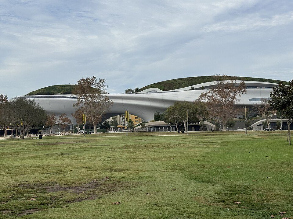
Big draw40 mi MuseumLucas Museum of Narrative Art
Big draw33 mi LandmarkHollywood Sign
Big draw35 mi MuseumLa Brea Tar Pits
Big draw32 mi Theme parkUniversal Studios Hollywood8.7M visitors a yearHollywood Walk of Fame: BenSherman, Public domain · Six Flags Magic Mountain: Alton, CC BY 3.0 · Lucas Museum of Narrative Art: Kriddl, CC0 · Hollywood Sign: Thomas Wolf, www.foto-tw.de, CC BY-SA 3.0 · La Brea Tar Pits: Daniel Schwen, CC BY-SA 2.5 · Universal Studios Hollywood: 林振宇, CC BY-SA 4.0
Piru is unincorporated, so Ventura County and regional agencies provide most services.
EPA SDWIS (Oct 9, 2026) · HIFLD + EIA-861 2025 · Census 2020 ZCTAs · NCES 2024–25 · registration: vote.gov, updated Nov 18, 2024.
Ordered by what stands out in Piru.
Piru’s FEMA hazard score stands at 99 of 100, against 88 of 100 in California’s towns and 44 of 100 across U.S. towns. Of the losses FEMA expects locally, 34% come from inland flooding and 31% from wildfires. Households here have drawn federal disaster aid in 4 declared disasters, most recently in 2022.
FEMA disaster declarations and aid · FEMA National Risk Index · OpenFEMA
Its public schools are run by the Fillmore Unified school district. Enrollment at Piru’s public school: 272 students.
| School | Level | Students | Letter |
|---|---|---|---|
| Piru ElementaryLargest public elementary schoolGrades K–5 | Grades K–5 | 272 | – |
NCES · EDFacts · graded within CA on state tests and graduation
The top destinations are Los Angeles (15%), San Buenaventura (Ventura) (5%) and Oxnard (4%). Employers in Piru added 365 jobs between 2013 and 2023, to 626. Also worth knowing: the town’s typical journey to work comes in at 34 minutes. The median commute is under 29 miles.
| Piru | California towns | U.S. towns | |
|---|---|---|---|
| Average trip to work | 34 minutes | 28 minutes | 25 minutes |
| Below the poverty line | 16% | 10% | 9.6% |
| Working residents who work in town | 3.8% | 6.6% | 8% |
| Median household income | $89,000 | $95,000 | $80,000 |
Census LEHD 2023 · ACS
In Piru, the going rate for rent is $1,490 a month. Values rose 1.7% in the 12 months to September 2026. 53% of Piru households own their home.
| Piru | California towns | U.S. towns | |
|---|---|---|---|
| Households that own their home | 53% | 64% | 73% |
| Median rent | $1,490 a month | $1,896 a month | $1,185 a month |
Census ACS, 2020–24 · Zillow Home Value Index · Redfin Data Center
NOAA U.S. Climate Normals, 1991–2020
For adults in Piru, the share who binge drink is 17%. The town does better than the California average on 6 of 32 CDC measures and worse on 7. 27% of adults in Piru say their health is fair or poor; 27% have high blood pressure.
| Piru | California towns | U.S. towns | |
|---|---|---|---|
| No health insurance, 18–64 (CDC PLACES) | 18% | 9% | 8.1% |
| Yearly checkup (CDC PLACES) | 70% | 72% | 79% |
| Fair or poor health (CDC PLACES) | 27% | 22% | 19% |
| High blood pressure (CDC PLACES) | 27% | 31% | 35% |
| What stands out | Piru | CA |
|---|---|---|
| Fewer adults who have had cancer | 4.4% | 6.4% |
| Fewer adults with COPD | 3.7% | 5.1% |
| More uninsured adults | 18.4% | 10.6% |
CDC PLACES 2025 · modeled estimates for adults · CMS · HRSA
7.4 miles of trail wind through 1 park or preserve. Piru has one park or preserve, 4 acres in all.
| Biggest places to walk | Trails | Acres |
|---|---|---|
| 1. Warring Park | — | 4 |
Trails & parks © OpenStreetMap contributors · Conserved land: USGS PAD-US
4 within 15 miles of the center of Piru
About 7 of every 100 Piru residents are enrolled in college, about the same as California.
Where Piru’s working residents go each day. Line width shows the share.
Census LEHD 2023
Unincorporated community in Ventura County, California
Piru ( ) is a small unincorporated historic town located in eastern Ventura County, California, in the Santa Clara River Valley near the Santa Clara River and Highway 126, about seven miles (11 km) east of Fillmore and about 13 miles (21 km) west of Interstate 5. Lake Piru, in the Los Padres National Forest, is the main recreational attraction. The population was 2,587 at the 2020 census, up from 2,063 at the 2010 census. For statistical purposes, the United States Census Bureau has defined Piru as a census-designated place (CDP), which does not precisely correspond to the historical community.
From Wikipedia, licensed CC BY-SA 4.0 · facts via Wikidata (CC0)
Short answers, built from the data on this page.
Yes. That is 4.7 years of the area's median household income ($109,797 across the Oxnard-Thousand Oaks-Ventura, CA metro area). Cost of living, which also weighs rents, property taxes and how many households pay 30% or more of their income for housing, grades C−.