Martinez dates to 1849, and 9 of its places are on the National Register
More historic than 78% of U.S. towns · #35 of 847 in California. What drives it
9 places in town are on the National Register, among them the John Muir National Historic Site, a National Historic Landmark, and two historic districts with 2 buildings between them. Most of Martinez was built recently: 9% of its homes predate 1940 and the median home dates from 1977. Below: maps from 1884 on and the census since 1870.
Founding year: Wikidata; Wikipedia’s history section gives the same year. First post office: 1851.The full story ↓
History grade
What drives Martinez’s History grade
On its age, its old homes and the National Register, Martinez is more historic than 78% of U.S. towns, #35 of 847 in California. Its National Register listings hold the grade up; its share of homes from before 1940 pulls it down.
A−
HistoryA character grade: shown, never part of Martinez’s overall grade.
Few California towns list much on the Register (a typical California town has 0.0 per 10,000 residents, the U.S. 2.4), so Martinez’s 3.0 sits above most of its state (84% of California towns have fewer) while its 11 historic buildings outnumber those of 76% of U.S. towns.
How sure. Graded on any two of the three inputs instead, the letter would range from B to A−. The pre-1940 share (±1.5 points) is firm at this size. Two sources give 1849.
Founding year: Wikidata (other dates in Quick answers). Homes: Census ACS 2020–24. National Register: National Park Service, May 2026 list; each listing counted once (boundary changes and added documentation belong to their listing), and a historic district counts its contributing buildings. How TownRatings grades history →
What stands out about Martinez’s past
Read from the archive, the National Register and the record. The page puts what stands out first.
The country’s official list of buildings and places worth saving. One is a National Historic Landmark, the highest tier. Boundary changes and added documentation are counted with their listing.
The lush Alhambra Valley is believed to have been a seasonal “pantry” used for foraging by the local population of the Karkines Indians. The Karkines are a part of the Ohlone (Costanoan) Indian group.
In 1824, the western side of Martinez, Alhambra Valley was included in the Rancho El Pinole Mexican land grant to Ygnacio Martínez. East of these lands was the Rancho Las Juntas, a grant made to Irish born William Welch in 1844; his land lay between the lands of Martinez and Pacheco.
Passages that mention Martinez, cut from the printed page as they were published.
The history of Contra Costa County, California1917 · page 311Read the page →
Read the text
On January 25, 185 1, a petition signed by the citizens of Martinez was presented to the Court of Sessions, through District Attorney J. F. Williams, praying for the incorporation of the town of Martinez. The petition reads as follows : *To the Honorable F. M. Warmcastle, County Judge : Your petitioners, citizens of Martinez, pray your honor to incorporate the following metes and bounds to be known as the town of Martinez and to establish therein a police for their local government and regulation of any
Text read by machine from the scan; it may contain errors.
History of Contra Costa County, California1926Read the page →
Read the text
CHAPTER V MARTINEZ The town of Martinez had its beginning in 1849, when Col. William M. Smith, then acting as agent for the Martinez heirs, decided to lay out a townsite. As early as 1823, Ignacio Martinez and Francisco Castro applied for and were granted the Pinole and San Pablo Ranchos, comprising many leagues of land. They erected adobe houses and barns, began planting trees and vines, and became the first fruit and grape growers
Text read by machine from the scan; it may contain errors.
The history of Contra Costa County, California1917 · page 309Read the page →
Read the text
The first settlement of the region contingent to the city of Martinez, the county seat of Contra Costa County, was made nearly a century ago. In the year 1823, over twenty years before gold was discovered in California, and before the eyes of the East, and in fact the entire world, turned toward the Golden West, Ignacio Martinez and Francisco Castro applied for and received grants to vast tracts of land, the latter receiving what was known as the San Pablo Rancho, and Martinez receiving the Pinole grant. Their nearest neighbors were the Peraltas
Text read by machine from the scan; it may contain errors.
Scans and text from the Internet Archive. Books published in 1930 or earlier, which are in the public domain.
Timeline
Martinez, 1849 to 1992
Woven from the archive, old maps, post office records, the National Register and the people born here.
Fire insurance maps drew every building, what it was made of and what it was used for, so insurers could price the risk of fire. Pick a year, then a sheet.
In 1849, according to Wikidata and Wikipedia’s history of the town. Martinez’s post office opened in 1851, and the census of 1870 counted 560 people here.
How does Martinez rank for history?
Martinez is more historic than 78% of U.S. towns, #35 of 847 in California. The History grade combines the town’s founding era, the share of homes built before 1940 and its National Register listings. It’s a character grade, so it isn’t part of the overall grade. How it works.
What is on the National Register in Martinez?
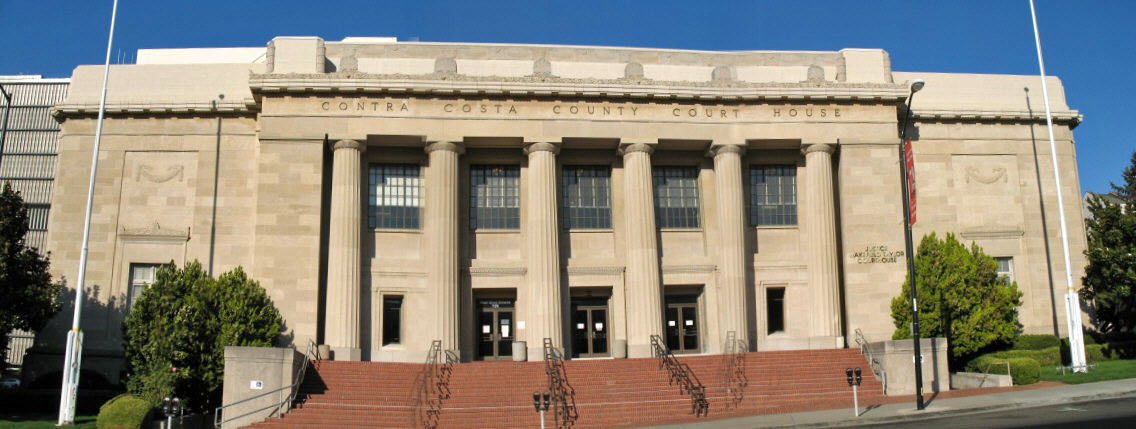
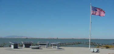
9 listings: 7 buildings, among them the John Muir National Historic Site (a National Historic Landmark since 1962), and 2 historic districts, the Port Chicago Naval Magazine National Memorial and the Contra Costa County Courthouse Block, with 2 contributing buildings. 11 historic buildings in all.
How old are the homes in Martinez?
9% of Martinez’s homes were built before 1940 (Census estimate, ±1.5 points), against a typical 3.4% for a California town; the median home was built in 1977.
Founding dates: Wikidata, Wikipedia, the U.S. post office records of Blevins & Helbock (CC0) and the Census. Homes by year built: Census ACS 2020–24. National Register of Historic Places: National Park Service (list of May 22, 2026). Old photos, postcards and papers: Wikimedia Commons, the Library of Congress and other public archives, credited on each item’s page. Maps: U.S. Geological Survey historical topographic maps (via Esri) and Sanborn fire-insurance maps (Library of Congress). History text and census tables: Wikipedia (CC BY-SA 4.0). Places that used to be: USGS Geographic Names Information System (2021).
From Wikimedia Commons (17), Wikidata (1), the National Register of Historic Places (9), Wikipedia, Wikidata and Wikipedia for famous people, U.S. Geological Survey historical maps, U.S. Census counts (via Wikipedia), the US Post Offices dataset (Blevins & Helbock), the USGS Geographic Names Information System, Sanborn fire insurance maps (Library of Congress) and old county and town histories (Internet Archive). Archive images are copied here with their credits and licenses, shown on each photo’s page. Refreshed monthly.


 ★ Landmark




 2021
 2019
 2019
 2018
 2018
 2017
 2015
 2015
 2015
 2015
 2014
 2014
 2013
 2011
 2010
 2010
 2008


