
Lytle CreekCA
A town of 672, settled in 1953.
Is Lytle Creek a good place to live?
Lytle Creek’s average trip to work is 44 minutes, where California’s towns sit at 28 minutes and U.S. towns at 25 minutes. Only 5 of the 848 California towns we compare have a higher share of households owning their home than Lytle Creek. 84% of the land in Lytle Creek is conserved, where California’s towns sit at 4.3% and U.S. towns at 4.3%. San Bernardino National Forest, at 3,836 acres with 7 miles of trail, is the biggest park or preserve. Lytle Creek has fewer than 1,000 residents, too few for fair grades; the figures below are still real.
672 people, and everyone knows the way
In a town this size, neighbors are the best guide. Ask them anything.
Disneyland and 74 more within 40 miles
Museums, parks, gardens and other places to visit around Lytle Creek. Close and well known come first.
 Big draw39 mi Theme parkDisneyland17.3M visitors a year
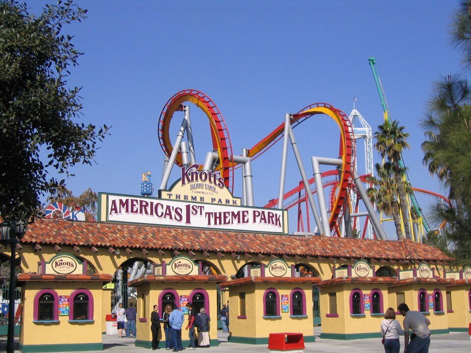 Big draw40 mi Theme parkKnott's Berry Farm4.5M visitors a year
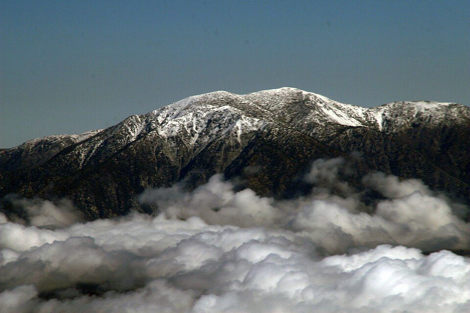 9 mi MountainMount San Antonio
 Big draw39 mi Theme parkDisney California Adventure10.1M visitors a year
 Big draw38 mi Stadium & arenaAngel Stadium of Anaheim
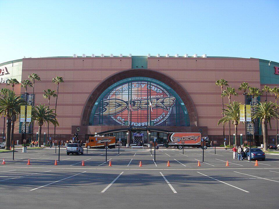 37 mi Stadium & arenaHonda Center
Photo credits
Disneyland: HarshLight from San Jose, CA, USA, CC BY 2.0 · Knott's Berry Farm: Phydend at English Wikipedia, Public domain · Mount San Antonio: The original uploader was Tillman at English Wikipedia., CC BY-SA 2.0 · Disney California Adventure: CrispyCream27, CC BY-SA 4.0 · Angel Stadium of Anaheim: Staff Sgt. Chad McMeen, Public domain · Honda Center: Arnold C (Buchanan-Hermit), Attribution


Moving to Lytle Creek: who provides what
Lytle Creek is unincorporated, so San Bernardino County and regional agencies provide most services.
EPA SDWIS (Oct 9, 2026) · HIFLD + EIA-861 2025 · Census 2020 ZCTAs · NCES 2024–25 · registration: vote.gov, updated Nov 18, 2024.
The data
Ordered by what stands out in Lytle Creek.
Nearly a third of Lytle Creek is conserved land
Lytle Creek’s trail density is 1.2 miles per square mile.
| Biggest places to walk | Trails | Acres |
|---|---|---|
| 1. San Bernardino National Forest | 7 mi | 3,836 |
Trails & parks © OpenStreetMap contributors · Conserved land: USGS PAD-US
Lytle Creek stands out in California and nationally: the FEMA risk score there is higher
The FEMA risk score in Lytle Creek is 100 of 100.
FEMA National Risk Index · OpenFEMA
The typical home in Lytle Creek is valued at about $388K
The typical Lytle Creek home is worth about $388,000, up 2.3% in a year, 49% below the California typical home.
Typical home value
Zillow Home Value Index · Redfin Data Center
With 0.1 jobs for every working resident, most of Lytle Creek’s workers commute out
Most working residents leave Lytle Creek for work: only 0% work in town. The top destinations are Ontario (8%), San Bernardino (8%) and Fontana (7%). Half commute less than 18 miles.
| Lytle Creek | California towns | U.S. towns | |
|---|---|---|---|
| Median household income | $86,000 | $95,000 | $80,000 |
| Below the poverty line | 8.8% | 10% | 9.6% |
Where working residents work
Census LEHD 2023 · ACS
Four seasons and pleasant summers in Lytle Creek
Lytle Creek has mild winters and warm summers. July afternoons reach 85° and January nights drop to 35°.
Typical low → high °F
NOAA U.S. Climate Normals, 1991–2020
How healthy Lytle Creek is
Lytle Creek beats the California average on 6 of 32 CDC measures and trails it on 7. 37% of Lytle Creek adults have high blood pressure.
| Lytle Creek | California towns | U.S. towns | |
|---|---|---|---|
| High blood pressure (CDC PLACES) | 37% | 31% | 35% |
| Yearly checkup (CDC PLACES) | 74% | 72% | 79% |
| Get no exercise (CDC PLACES) | 21% | 24% | 25% |
| Obesity (CDC PLACES) | 32% | 29% | 35% |
| What stands out | Lytle Creek | CA |
|---|---|---|
| Fewer uninsured adults | 7.5% | 10.6% |
| Fewer adults facing food insecurity | 13.4% | 17.9% |
| More adults who have had cancer | 9.3% | 6.4% |
CDC PLACES 2025 · modeled estimates for adults · CMS · HRSA
Everything we know about Lytle Creek
Colleges nearby
9 within 15 miles of the center of Lytle Creek
About 5 of every 100 Lytle Creek residents are enrolled in college, against 8 across California.
100% of working residents leave Lytle Creek for work
Where Lytle Creek’s working residents go each day. Line width shows the share.
Census LEHD 2023
About Lytle Creek
Community in San Bernardino County, California
Lytle Creek is a census-designated place in the San Gabriel Mountains, within the Inland Empire region of San Bernardino County. It is about 16 miles (26 km) northwest of downtown San Bernardino and 10 miles (16 km) from the cities of Fontana and Rialto. This small remote community is located in a large southeast-trending canyon on the eastern portion of the San Gabriel Mountains completely within the boundaries of the San Bernardino National Forest. The population was 725 at the 2020 census. The ZIP Code for Lytle Creek is 92358 and the community is inside area code 909.
From Wikipedia, licensed CC BY-SA 4.0 · facts via Wikidata (CC0)
- Area
- 6.0 sq mi
- Elevation
- 3,419 ft
- ZIP code
- 92358
- Area code
- 909
Questions about Lytle Creek
Short answers, built from the data on this page.
Is Lytle Creek, CA a good place to live?
Lytle Creek has fewer than 1,000 residents, too few for fair grades; the figures below are still real.