Lancaster’s post office opened in 1884, and 1 of its places is on the National Register
More historic than 34% of U.S. towns · #289 of 847 in California. What drives it
Most of Lancaster was built recently: 2% of its homes predate 1940 and the median home dates from 1986. 1 place in town is on the National Register, among them a historic district with 4 buildings. Below: 17 old photos and papers, maps from 1910 on, and the census since 1960.
Founding year: the first Lancaster post office (Blevins & Helbock, CC0). Wikidata: 1977.The full story ↓
History grade
What drives Lancaster’s History grade
On its age, its old homes and the National Register, Lancaster is more historic than 34% of U.S. towns, #289 of 847 in California. Its National Register listings hold the grade up; its share of homes from before 1940 pulls it down.
C
HistoryA character grade: shown, never part of Lancaster’s overall grade.
Among the 400 U.S. cities of 100,000 or more, Lancaster ranks #290 on History.
Few California towns list much on the Register (a typical California town has 0.0 per 10,000 residents, the U.S. 2.4), so Lancaster’s 0.2 sits above most of its state (66% of California towns have fewer) while its 4 historic buildings outnumber those of 68% of U.S. towns.
Newer cities are common at Lancaster’s size: in the typical U.S. city of 100,000 or more, 5% of homes predate 1940.
How sure. Graded on any two of the three inputs instead, the letter would range from C− to B−. The pre-1940 share (±0.6 points) is firm at this size. The founding year is the first post office, not a stated founding date; Wikidata gives 1977.
Founding year: the first post office (other dates in Quick answers). Homes: Census ACS 2020–24. National Register: National Park Service, May 2026 list; each listing counted once (boundary changes and added documentation belong to their listing), and a historic district counts its contributing buildings. How TownRatings grades history →
What stands out about Lancaster’s past
Read from the archive, the National Register and the record. The page puts what stands out first.
Fire insurance maps drew every building, what it was made of and what it was used for, so insurers could price the risk of fire. Pick a year, then a sheet.
Antelope Valley, the area where Lancaster is now located, was home to the Paiute tribe at the time of first contact with Europeans. The Antelope Valley's central geography then served as the hub of a trade route for tribes trading between the California coast, the Central Valley, the Great Basin, and the pueblos of Arizona.
Passages that mention Lancaster, cut from the printed page as they were published.
An history of the original parish of Whalley, and honor of Clitheroe1818Read the page →
Read the text
Chapelry of Colne East, to the Hyndeburn West, fifteen miles. That portion of it which lies South of Ribble has been ascertained to consist of l6l square miles. Little Rowland may be estimated at ten miles, and the scattered and insulated portions of it which lie intermixed with the parish of Sladeburn, in Yorkshire, at as much more. The county of Lancaster, South of Ribble, measures 1003 square miles ; that on the North 6\6 ; in all 1619 miles : estimating, therefore, the present parish of Whalley at 180 miles, it is nearly equal to one ninth part of the county of Lancaster, or to 115,200 acres. Though a mere village, the parish which it denominates contains within its limits four market-towns, of which one is a borough ; and the
Text read by machine from the scan; it may contain errors.
An history of the original parish of Whalley, and honor of Clitheroe1818Read the page →
Read the text
Of the adjoining hermitage, founded by Henry Duke of Lancaster, nothing has occurred since the foundation ; but, in the time of abbot Eccles, an instance of misconduct, in a votaress on this establishment, afforded a pretext, which may seem to have been willingly embraced, for petitioning the King, who was now become patron, as Duke of Lancaster, to dissolve an institution, which did no credit either to itself or the monastery on which it depended.
Text read by machine from the scan; it may contain errors.
History of the county palatine and duchy of Lancaster1836 · page 22Read the page →
Read the text
Lancaster In the mean time, captain Birch proceeded from Preston to Lancaster, which proved an easy conquest; and the castle, in which were Mr. Kirby, one of the knights of the shire, and sir John Girlington, also surrendered, but not till these gentlemen had effected their escape. At the same time, twenty-one pieces of ordnance, taken from a Dunkirk ship in the harbour, were brought to the castle, and served to enhance the value of the victory.
Text read by machine from the scan; it may contain errors.
Scans and text from the Internet Archive. Books published in 1930 or earlier, which are in the public domain.
Timeline
Lancaster, 1884 to 2001
Woven from the archive, old maps, post office records, the National Register and the people born here.
The Lancaster post office opened in 1884, the earliest record of the town by name (U.S. post office records). Wikidata gives 1977.
How does Lancaster rank for history?
Lancaster is more historic than 34% of U.S. towns, #289 of 847 in California. The History grade combines the town’s founding era, the share of homes built before 1940 and its National Register listings. It’s a character grade, so it isn’t part of the overall grade. How it works.
What is on the National Register in Lancaster?
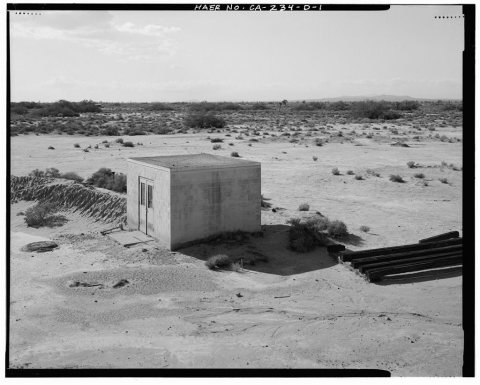
One place: the Cedar Avenue Complex (listed 1993).
How old are the homes in Lancaster?
2% of Lancaster’s homes were built before 1940 (Census estimate), against a typical 3.4% for a California town; the median home was built in 1986.
Founding dates: Wikidata, Wikipedia, the U.S. post office records of Blevins & Helbock (CC0) and the Census. Homes by year built: Census ACS 2020–24. National Register of Historic Places: National Park Service (list of May 22, 2026). Old photos, postcards and papers: Wikimedia Commons, the Library of Congress and other public archives, credited on each item’s page. Maps: U.S. Geological Survey historical topographic maps (via Esri) and Sanborn fire-insurance maps (Library of Congress). History text and census tables: Wikipedia (CC BY-SA 4.0). Places that used to be: USGS Geographic Names Information System (2021).
From the Library of Congress (17), Wikidata (1), the National Register of Historic Places (1), Wikipedia, Wikidata and Wikipedia for famous people, U.S. Geological Survey historical maps, U.S. Census counts (via Wikipedia), the US Post Offices dataset (Blevins & Helbock), the USGS Geographic Names Information System, Sanborn fire insurance maps (Library of Congress) and old county and town histories (Internet Archive). Archive images are copied here with their credits and licenses, shown on each photo’s page. Refreshed monthly.


 Date?
 Date?
 Date?
 Date?
 Date?
 Date?
 Date?
 Date?
 Date?
 Date?
 Date?
 Date?
 Date?
 Date?
 Date?
 Date?
 Date?


