Fresno’s post office opened in 1872, and 32 of its places are on the National Register
More historic than 49% of U.S. towns · #158 of 847 in California. What drives it
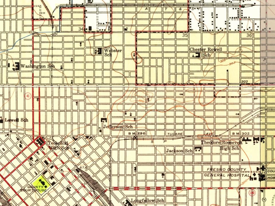
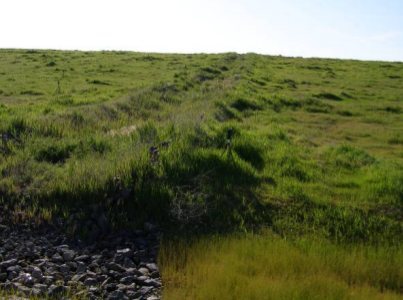
Most of Fresno was built recently: 6% of its homes predate 1940 and the median home dates from 1980. 32 places in town are on the National Register, among them the Fresno Sanitary Landfill, a National Historic Landmark, and two historic districts with 5 buildings between them. Below: 14 old photos and papers, maps from 1885 on, and the census since 1880.
The Fresno post office opened in 1872, the earliest record of the town by name. Seven smaller post offices, Fort Miller (1874), Herndon (1887) and Burrough (1889), opened inside today’s city and later closed.
First census: 1,112 in 18802020 census: 542,107154 years
How historic is Fresno?
B−
More historic than 49% of U.S. towns, on its age, its old homes and the National Register.
Founding year: the first Fresno post office (Blevins & Helbock, CC0).The full story ↓
History grade
What drives Fresno’s History grade
On its age, its old homes and the National Register, Fresno is more historic than 49% of U.S. towns, #158 of 847 in California. Its National Register listings hold the grade up; its share of homes from before 1940 pulls it down.
B−
HistoryA character grade: shown, never part of Fresno’s overall grade.
Among the 400 U.S. cities of 100,000 or more, Fresno ranks #245 on History.
Few California towns list much on the Register (a typical California town has 0.0 per 10,000 residents, the U.S. 2.4), so Fresno’s 0.6 sits above most of its state (72% of California towns have fewer) while its 33 historic buildings outnumber those of 82% of U.S. towns.
How sure. Graded on any two of the three inputs instead, the letter would range from C to B. The pre-1940 share (±0.4 points) is firm at this size. The founding year is the first post office, not a stated founding date.
Founding year: the first post office (other dates in Quick answers). Homes: Census ACS 2020–24. National Register: National Park Service, May 2026 list; each listing counted once (boundary changes and added documentation belong to their listing), and a historic district counts its contributing buildings. How TownRatings grades history →
What stands out about Fresno’s past
Read from the archive, the National Register and the record. The page puts what stands out first.
Ararat ArmenianBelmont Memorial ParkBeth IsraelIndependent Order of OddfellowsLiberty Veteran'sMasis Ararat ArmenianMountain View
US Post Offices dataset (Blevins & Helbock, CC0). Places and cemeteries from the USGS Geographic Names Information System (2021).
Every building
Fresno, building by building, 1885–1919
Fire insurance maps drew every building, what it was made of and what it was used for, so insurers could price the risk of fire. Pick a year, then a sheet.
The original inhabitants of the San Joaquin Valley region were the Yokuts people and Miwok people, who engaged in trading with other Californian tribes of Native Americans including coastal peoples such as the Chumash of the Central California coast, with whom they are thought to have traded plant and animal products.
The first European to enter the San Joaquin Valley was Pedro Fages in 1772. The county of Fresno was formed in 1856 after the California Gold Rush and was named for the abundant ash trees (Spanish: fresno) lining the San Joaquin River.
Passages that mention Fresno, cut from the printed page as they were published.
A memorial and biographical history of the counties of Fresno, Tulare and Kern, California1892 · page 110Read the page →
Read the text
considered at the time a sandy desert. In a short time the railroad was pushing southward and he concluded it was about the right distance from Fresno to locate a town and secure a depot, so in 1880 he laid out the town of Selma. A station was established by the railroad company, and from that time on there has been a scene of activity in building, and the country surround-
Text read by machine from the scan; it may contain errors.
A memorial and biographical history of the counties of Fresno, Tulare and Kern, California1892 · page 56Read the page →
Read the text
There were deposited in the corner-stone the following articles: Copy of the act of the Legislature fixing the county seat at Fresno; copy of the act authorizing issuance of courthouse and jail bonds; copy of said honds; copy of joint report of the county auditor and treasurer of Fresno County; names of Fresno county officers; copy of the great register of Fresno
Text read by machine from the scan; it may contain errors.
Scans and text from the Internet Archive. Books published in 1930 or earlier, which are in the public domain.
Timeline
Fresno, 1872 to 2001
Woven from the archive, old maps, post office records, the National Register and the people born here.
Nothing in the archives for these yearsWeddings on Main Street, storms, parades, school pictures, the old store. If it’s in your family album, it belongs here.
The Fresno post office opened in 1872, the earliest record of the town by name (U.S. post office records).
How does Fresno rank for history?
Fresno is more historic than 49% of U.S. towns, #158 of 847 in California. The History grade combines the town’s founding era, the share of homes built before 1940 and its National Register listings. It’s a character grade, so it isn’t part of the overall grade. How it works.
What is on the National Register in Fresno?
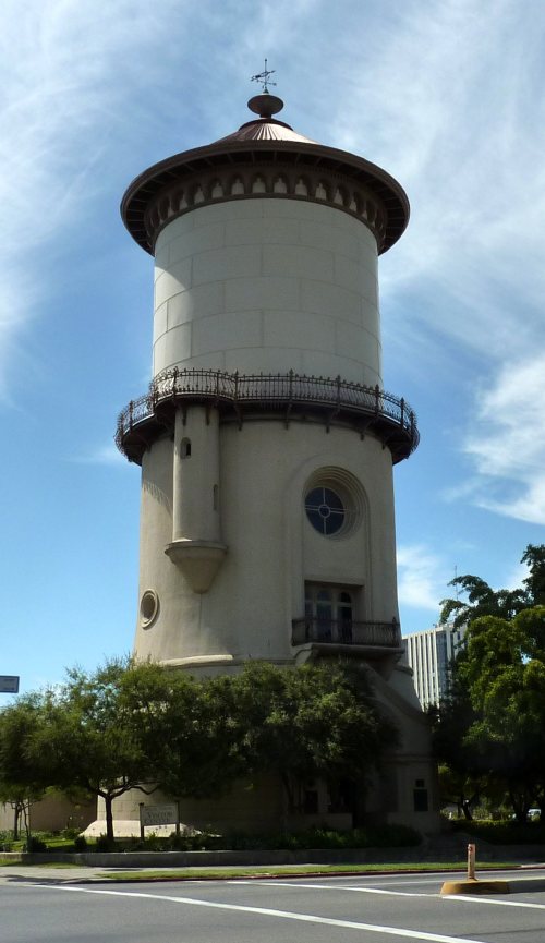
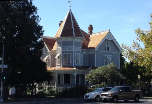
32 listings: 27 buildings, 2 historic districts, the Warehouse Row and the Ben Gefvert Ranch Historic District, with 5 contributing buildings, 2 sites, and 1 structure. 33 historic buildings in all.
How old are the homes in Fresno?
6% of Fresno’s homes were built before 1940 (Census estimate), against a typical 3.4% for a California town; the median home was built in 1980.
Founding dates: Wikidata, Wikipedia, the U.S. post office records of Blevins & Helbock (CC0) and the Census. Homes by year built: Census ACS 2020–24. National Register of Historic Places: National Park Service (list of May 22, 2026). Old photos, postcards and papers: Wikimedia Commons, the Library of Congress and other public archives, credited on each item’s page. Maps: U.S. Geological Survey historical topographic maps (via Esri) and Sanborn fire-insurance maps (Library of Congress). History text and census tables: Wikipedia (CC BY-SA 4.0). Places that used to be: USGS Geographic Names Information System (2021).
From Wikimedia Commons (11), the Library of Congress (3), Wikidata (4), the National Register of Historic Places (32), Wikipedia, Wikidata and Wikipedia for famous people, U.S. Geological Survey historical maps, U.S. Census counts (via Wikipedia), the US Post Offices dataset (Blevins & Helbock), the USGS Geographic Names Information System, Sanborn fire insurance maps (Library of Congress) and old county and town histories (Internet Archive). Archive images are copied here with their credits and licenses, shown on each photo’s page. Refreshed monthly.


 ★ Landmark







 1882
 1892
 1892
 1893
 1893
 1894
 1901
 1907
 1909
 1909
 1909