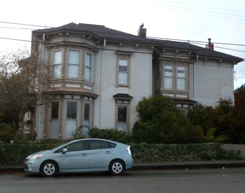
Fortuna’s post office opened in 1888, and 1 of its places is on the National Register
More historic than 46% of U.S. towns · #173 of 847 in California. What drives it
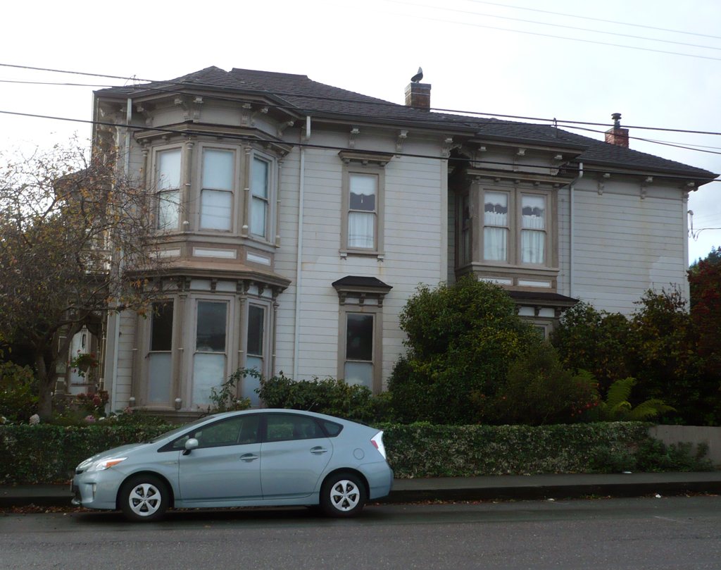
Most of Fortuna was built recently: 9% of its homes predate 1940 and the median home dates from 1978. Its Register listing is the Gushaw-Mudgett House. Below: maps from 1889 on and the census since 1910.
The Fortuna post office opened in 1888, the earliest record of the town by name. Wikidata gives 1906. Three smaller post offices, Eel River (1857), Rohnerville (1874) and Slide (1876), opened inside today’s city and later closed.
First census: 383 in 19102020 census: 12,516138 years
How historic is Fortuna?
B−
More historic than 46% of U.S. towns, on its age, its old homes and the National Register.
Founding year: the first Fortuna post office (Blevins & Helbock, CC0). Wikidata: 1906.The full story ↓
History grade
What drives Fortuna’s History grade
On its age, its old homes and the National Register, Fortuna is more historic than 46% of U.S. towns, #173 of 847 in California. Its National Register listings hold the grade up; its age pulls it down.
B−
HistoryA character grade: shown, never part of Fortuna’s overall grade.
Few California towns list much on the Register (a typical California town has 0.0 per 10,000 residents, the U.S. 2.4), so Fortuna’s 0.8 sits above most of its state (74% of California towns have fewer) while its 1 listings outnumber those of 51% of U.S. towns.
How sure. Graded on any two of the three inputs instead, the letter would range from C to B−. The pre-1940 share (±2.7 points) is firm at this size. The founding year is the first post office, not a stated founding date; Wikidata gives 1906.
Founding year: the first post office (other dates in Quick answers). Homes: Census ACS 2020–24. National Register: National Park Service, May 2026 list; each listing counted once (boundary changes and added documentation belong to their listing), and a historic district counts its contributing buildings. How TownRatings grades history →
What stands out about Fortuna’s past
Read from the archive, the National Register and the record. The page puts what stands out first.
Lost post offices, old corners and burying grounds
Fortuna’s post office has been open since 1888. Three other post offices opened and closed inside today’s town.
Eel River
1857–1874
Rohnerville
1874–1959
Slide
1876–1888
Fortuna
1888–today
18501940today
Hamlets and corners on the map
NewburgRohnerville
2cemeteries and burying grounds inside Fortuna
CatholicSunrise
US Post Offices dataset (Blevins & Helbock, CC0). Places and cemeteries from the USGS Geographic Names Information System (2021).
Every building
Fortuna, building by building, 1889–1911
Fire insurance maps drew every building, what it was made of and what it was used for, so insurers could price the risk of fire. Pick a year, then a sheet.
1889Sheet 1 of 1
Edition
Sheets
BrickWoodStone
Sanborn Map Company, via the Library of Congress. Editions published in 1930 or earlier, which are in the public domain.
The settlement was originally called "Slide," for Slide Hill, in 1874, named for the slide that was a fixture on the northeast side of the Eel River and the southwest portion of Christian Ridge just to the northwest, near the edge of town. In 1875, the name was changed to Springville during the construction of the Springville Mill, a lumber mill for the nearby redwood forests, named so because of the numerous springs in the area. The mill's owners were Henry Rohner (namesake of neighboring Rohnerville), Alexander Masson, M. N. Weber and G. F. Gushaw. Springville was originally a company town belonging to the mill, and the few people that resided there all worked at the mill. By the late 1870s Springville had grown enough to warrant a post office, but a town called Springville, California (now part of Camarillo, in Ventura County) already existed in the state. The post office was named S…
Passages that mention Fortuna, cut from the printed page as they were published.
History of Humboldt County, California1915 · page 942Read the page →
Read the text
cated in the public schools of that place until he was seventeen, when with the family he joined his father in Humboldt county and here continued his studies for two years in a district that later became the thriving city of Fortuna. After his school days were over, he started a shingle mill on his own account, in 1878, building it in Palmer Creek gulch about one mile from what is now Fortuna. It was then called Slide, afterwards Springville and finally Fortuna. He continued as a shingle manufacturer for thirty-five years.
Text read by machine from the scan; it may contain errors.
History of Humboldt County, California1915 · page 1044Read the page →
Read the text
nineteen years old, he apprenticed himself to learn the blacksmith's trade, serving three years in the shop of Fred Leach, but in 1878 he gave this up and, going to Centerville, he there engaged in farming for two years. Then he went to Fortuna and again opened a blacksmith shop for himself and ran it for four years. Selling out the business and all his interests in Fortuna in 1885, he moved to Rio Dell, where again he engaged in his trade and continued in the same until 1908, his shop being the only one in Rio Dell. For twenty-eight years he successfully conducted the business in Rio
Text read by machine from the scan; it may contain errors.
History of Humboldt County, California, with biographical sketches of the leading men and women of the county who have been identified with its growth and development from the early days to the present1915 · page 942Read the page →
Read the text
cated in the public schools of that place until he was seventeen, when with the family he joined his father in Humboldt county and here continued his studies for two years in a district that later became the thriving city of Fortuna. After his school days' were over, he started a shingle mill on his own account, in 1878, building it in Palmer Creek gulch about one mile from what is now Fortuna. It was then called Slide, afterwards Springville and finally Fortuna. He continued as a shingle manufacturer for thirty-five years.
Text read by machine from the scan; it may contain errors.
History of Humboldt County, California, with biographical sketches of the leading men and women of the county who have been identified with its growth and development from the early days to the present1915 · page 136Read the page →
Read the text
Fortuna is located twenty miles south of Eureka on the Northwestern Pacific Railroad, Eel river, the main county road and the projected state highway. It is the fourth largest town in the county. The last census enumerates 883 within the incorporated limits. Outside are 300 to 500 other residents served by the merchants.
Text read by machine from the scan; it may contain errors.
Scans and text from the Internet Archive. Books published in 1930 or earlier, which are in the public domain.
Timeline
Fortuna, 1857 to 1988
Woven from the archive, old maps, post office records, the National Register and the people born here.
The Fortuna post office opened in 1888, the earliest record of the town by name (U.S. post office records). Wikidata gives 1906.
How does Fortuna rank for history?
Fortuna is more historic than 46% of U.S. towns, #173 of 847 in California. The History grade combines the town’s founding era, the share of homes built before 1940 and its National Register listings. It’s a character grade, so it isn’t part of the overall grade. How it works.
What is on the National Register in Fortuna?
One place: the Gushaw-Mudgett House (listed 1982).
How old are the homes in Fortuna?
9% of Fortuna’s homes were built before 1940 (Census estimate, ±2.7 points), against a typical 3.4% for a California town; the median home was built in 1978.
Founding dates: Wikidata, Wikipedia, the U.S. post office records of Blevins & Helbock (CC0) and the Census. Homes by year built: Census ACS 2020–24. National Register of Historic Places: National Park Service (list of May 22, 2026). Old photos, postcards and papers: Wikimedia Commons, the Library of Congress and other public archives, credited on each item’s page. Maps: U.S. Geological Survey historical topographic maps (via Esri) and Sanborn fire-insurance maps (Library of Congress). History text and census tables: Wikipedia (CC BY-SA 4.0). Places that used to be: USGS Geographic Names Information System (2021).
From Wikimedia Commons (7), Wikidata (1), the National Register of Historic Places (1), Wikipedia, Wikidata and Wikipedia for famous people, U.S. Geological Survey historical maps, U.S. Census counts (via Wikipedia), the US Post Offices dataset (Blevins & Helbock), the USGS Geographic Names Information System, Sanborn fire insurance maps (Library of Congress) and old county and town histories (Internet Archive). Archive images are copied here with their credits and licenses, shown on each photo’s page. Refreshed monthly.


 2016
 2016
 2016
 2014
 2014
 2014
 2014