Wolf Creek Ski Area
You will find Wolf Creek Ski Area 16 mi southwest of South Fork. La Garita Caldera comes next on our list, 22 mi away. Winter highs sit at 34–37°F in the coldest months, January, February and December.
A ski area, 16 mi southwest of South Fork
Winters are cold
January nights drop to -1°. When to go ↓
Plan where you’ll sleep
The nearest town with many places to stay is South Fork, 16 miles northeast. Where to stay ↓
Written from NOAA 1991–2020 normals and Overture places to stay, Census town figures.
Choosing a month
Here are the months at Wolf Creek, with their weather.
A base for Wolf Creek Ski Area
Places to stay start in South Fork (23) and Pagosa Springs (26).
South Fork
The closest town with somewhere to stay.
506 people · 48% vacation homes
16 mi northeast of Wolf Creek
Compare 7 towns
| Town | From Wolf Creek | Drive | Places to stay | People | Typical home | Safety |
|---|---|---|---|---|---|---|
| South Fork 48% vacation homes | 16 mi northeast | 25 min | 23 7 hotels · 3 inns & B&Bs · 8 lodges & cabins · 2 campgrounds · 3 RV parks | 506 | $424K | — |
| Pagosa Springs 23% vacation homes | 18 mi southwest | 25 min | 26 8 hotels · 5 motels · 3 inns & B&Bs · 5 lodges & cabins · 3 campgrounds · 2 RV parks | 1,838 | $375K | D |
| Del Norte | 28 mi northeast | 40 min | 8 1 hotel · 1 motel · 1 inn or B&B · 2 lodges & cabins · 2 hostels · 1 RV park | 1,396 | $184K | — |
| City of Creede 31% vacation homes | 28 mi north | 40 min | 7 3 hotels · 2 inns & B&Bs · 1 lodge or cabins · 1 RV park | 275 | $377K | — |
| Gerrard | 19 mi northeast | 30 min | 2 2 campgrounds | 332 | — | — |
| Alpine 84% vacation homes | 19 mi northeast | 30 min | 1 1 lodge or cabins | 75 | — | — |
| Piedra 47% vacation homes | 21 mi west | 30 min | 1 1 campground | 57 | — | — |
Getting there
Nearest airports with airline service
Worth adding to a visit
More places people know lie within 66 miles.
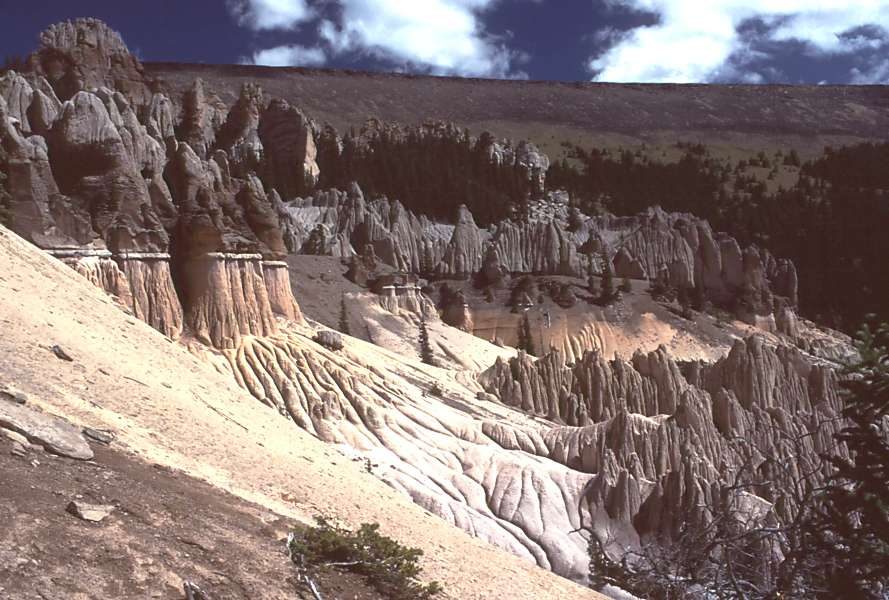 122 mi MountainLa Garita Caldera
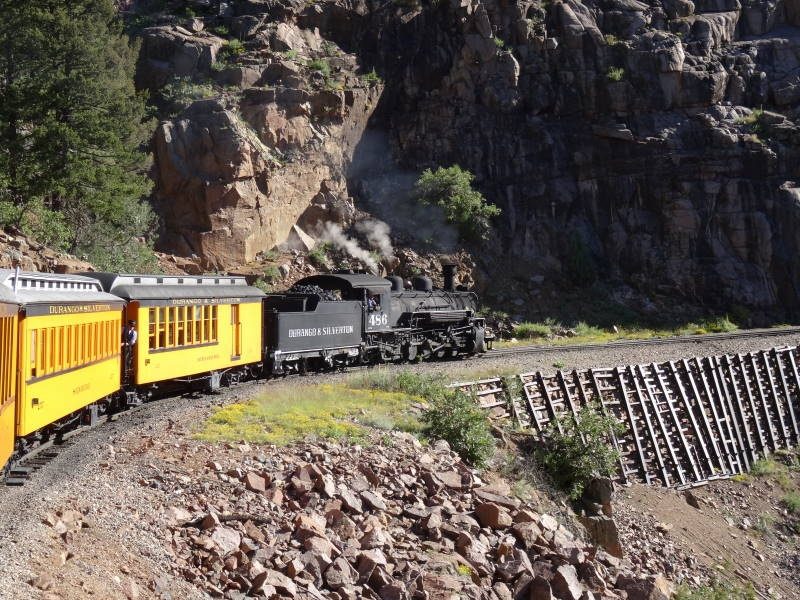 61 mi Scenic railwayDurango and Silverton Narrow Gauge Railroad
 41 mi Scenic railwayCumbres and Toltec Scenic Railroad
 34 mi Ancient siteChimney Rock National Monument65 mi Ski areaTelluride Ski Area161 runs · 3,803 ft vertical
 65 mi National forestUncompahgre National Forest
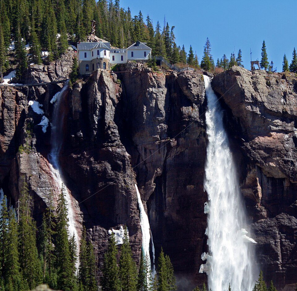 62 mi WaterfallBridal Veil Falls58 mi Ski areaPurgatory Resort92 runs · 1,963 ft vertical
Photo credits
La Garita Caldera: en:User:G. Thomas, Public domain · Durango and Silverton Narrow Gauge Railroad: pixelFire, CC BY-SA 3.0 · Cumbres and Toltec Scenic Railroad: Drew Jacksich from San Jose, California, CC BY 2.0 · Chimney Rock National Monument: U.S. Department of Agriculture, Public domain · Uncompahgre National Forest: Unknown authorUnknown author, CC BY-SA 3.0 · Bridal Veil Falls: Terry Foote (talk), CC BY-SA 3.0


Your questions on Wolf Creek
What town is Wolf Creek Ski Area near?
South Fork, CO, about 16 miles northeast.
What is the closest airport to Wolf Creek Ski Area?
San Luis Valley Regional Airport/Bergman Field (ALS), about 51 miles away. The nearest big hub is City of Colorado Springs Municipal (COS), about 147 miles.
Where should I stay near Wolf Creek Ski Area?
South Fork (16 mi, 23 places to stay), Pagosa Springs (18 mi, 26 places to stay) and Del Norte (28 mi, 8 places to stay).
Tips from people in South Fork
Be the first to share a tip in South Fork’s Town Square.
Sources: National Park Service · ski areas © OpenSkiMap / OpenStreetMap contributors · Wikidata · Wikipedia readership · NOAA climate normals · U.S. Census.