
Pawnee National Grassland
Pawnee National Grassland is a United States National Grassland located in northeastern Colorado on the Colorado Eastern Plains. Find it 21 mi northeast of Briggsdale. For mild weather, aim for May, June and September (71–83°F highs).

A park & preserve, 21 mi northeast of Briggsdale
Plan where you’ll sleep
The nearest town with many places to stay is Kimball, 34 miles northeast. Where to stay ↓
Winters are cold
January nights drop to 14°, with about 19" of snow a year. When to go ↓
A day trip from Denver
Denver is about 86 miles southwest (straight-line). Where to stay ↓
Best months: May, Jun and Sep
May, June and September are the mild months, with highs of 71–83°. When to go ↓
Written from NOAA 1991–2020 normals, Overture places to stay, Census town figures and Wikipedia.
A month-by-month look
Here is how the weather at Pawnee National Grassland changes month by month.
Pawnee National Grassland
Pawnee National Grassland is a United States National Grassland located in northeastern Colorado on the Colorado Eastern Plains. The grassland is located in the South Platte River basin in remote northern and extreme northeastern Weld County between Greeley and Sterling. It comprises two parcels totaling 193,060 acres (78,130 ha) largely between State Highway 14 and the Wyoming border. The larger eastern parcel lies adjacent to the borders of both Nebraska and Wyoming. It is administered in conjunction with the Arapaho-Roosevelt National Forest from the U.S. Forest Service office in Fort Collins, with a local ranger district office in Greeley.
- Type
- Park & preserve
- Wikipedia readers
- 6.2K a year
Staying near Pawnee National Grassland
Places to stay start in Kimball (9).
Kimball
The closest town with somewhere to stay.
2,271 people
34 mi northeast of Pawnee National Grassland
Compare 3 towns
| Town | From Pawnee National Grassland | Drive | Places to stay | People | Typical home | Safety |
|---|---|---|---|---|---|---|
| Kimball | 34 mi northeast | 50 min | 9 4 hotels · 2 motels · 3 RV parks | 2,271 | $112K | — |
| Pine Bluffs | 26 mi north | 40 min | 2 1 hotel · 1 RV park | 1,111 | $338K | B |
| Briggsdale | 21 mi southwest | 30 min | 1 1 hotel | 88 | $269K | — |
Day trip from
Straight-line miles.
Getting there
Nearest airports with airline service
While you are near Pawnee National Grassland
More places people know lie within 70 miles.
 58 mi Stadium & arenaBlue Arena
 70 mi MuseumQuebec-One Missile Alert Facility
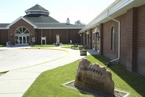 50 mi MuseumCheyenne Frontier Days Old West Museum
 50 mi GardenCheyenne Botanic Gardens
 61 mi MuseumVintage Aero Flying Museum
Photo credits
Blue Arena: Icebourg, Public domain · Quebec-One Missile Alert Facility: Jayron32, CC BY-SA 4.0 · Cheyenne Frontier Days Old West Museum: Mark Goebel from Taos, New Mexico, USA, CC BY 2.0 · Cheyenne Botanic Gardens: Shane Smith,, Public domain · Vintage Aero Flying Museum: LanceBarber at English Wikipedia, Public domain


Planning a visit to Pawnee National Grassland
What town is Pawnee National Grassland near?
Briggsdale, CO, about 21 miles southwest.
When is the best time to visit Pawnee National Grassland?
May, June and September, with highs of 71–83°.
How far is Pawnee National Grassland from Aurora and Denver?
About 85 miles southwest of Aurora and about 86 miles southwest of Denver, as the crow flies.
What is the closest airport to Pawnee National Grassland?
Cheyenne Regional Jerry Olson Field (CYS), about 49 miles away. The nearest big hub is Denver (DEN), about 75 miles.
Where should I stay near Pawnee National Grassland?
Kimball (34 mi, 9 places to stay).
Ask people in Briggsdale
Nobody has posted a tip yet; ask or answer in Briggsdale’s Town Square.
Sources: National Park Service · ski areas © OpenSkiMap / OpenStreetMap contributors · Wikidata · Wikipedia readership · NOAA climate normals · U.S. Census.