
Paisley Caves
The Paisley Caves or the Paisley Five Mile Point Caves complex is a system of eight caves in an arid, desolate region of south-central Oregon, United States north of the present-day city of Paisley, Oregon. Highs of 75°F make June the mildest time to go.

A cave, 5 mi north of Paisley
Plan where you’ll sleep
No town within 30 miles has many hotels or campgrounds. Look at the towns below, or plan to camp. Where to stay ↓
No airline airport nearby
The closest airport with airline service is Roberts Field (RDM), 107 miles away.
Best month: Jun
June is the mild month, with a high of 75°. When to go ↓
Written from NOAA 1991–2020 normals, Overture places to stay, Census town figures, Wikidata and Wikipedia.
Highs and lows by month
Below are typical highs and lows near Paisley Caves.
Paisley Caves
The Paisley Caves or the Paisley Five Mile Point Caves complex is a system of eight caves in an arid, desolate region of south-central Oregon, United States north of the present-day city of Paisley, Oregon. The caves are located in the Summer Lake basin at 4,520 feet (1,380 m) elevation and face west, carved into a ridge of Miocene and Pliocene era basalts mixed with soft volcanic tuffs and breccias by Pleistocene-era waves from Summer Lake. One of the caves may contain archaeological evidence of the oldest definitively-dated human presence in North America. The site was first studied by Luther Cressman in the 1930s.
- Type
- Cave
- Listed
- National Register of Historic Places (2014)
- Wikipedia readers
- 18K a year
Places to stay near Paisley Caves
Towns within 30 miles, best bases first.
Compare 3 towns
| Town | From Paisley Caves | Drive | Places to stay | People | Typical home |
|---|---|---|---|---|---|
| Paisley | 5 mi south | 5 min | 1 1 hotel | 248 | $220K |
| Silver Lake | 36 mi northwest | 55 min | 1 1 RV park | 206 | — |
| Bly | 36 mi southwest | 55 min | 1 1 hotel | 150 | — |
Getting there
Nearest airports with airline service
More near Paisley Caves
Places worth adding lie within 70 miles.
 70 mi MuseumTrain Mountain Railroad39 mi Ski areaWarner Canyon Ski Area21 runs · 757 ft vertical
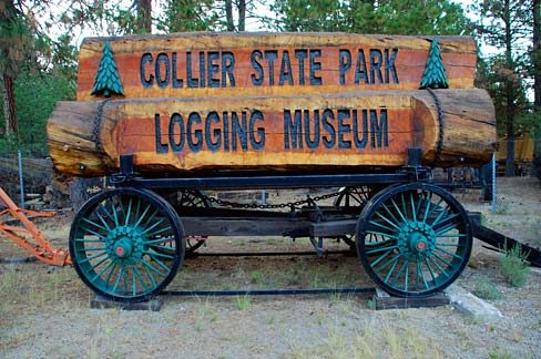 68 mi MuseumCollier Memorial State Park
 48 mi MuseumFort Rock Valley Historical Homestead Museum
Photo credits
Train Mountain Railroad: Tom703, CC BY-SA 3.0 · Collier Memorial State Park: Gary Halvorson, Oregon State Archives, Attribution · Fort Rock Valley Historical Homestead Museum: United States Department of Transportation, Public domain


A visit to Paisley Caves: questions
What town is Paisley Caves near?
Paisley, OR, about 5 miles south.
When is the best time to visit Paisley Caves?
June, with a high of 75°.
What is the closest airport to Paisley Caves?
Roberts Field (RDM), about 107 miles away. The nearest big hub is Portland (PDX), about 220 miles.
Ask people in Paisley
Share what you know in Paisley’s Town Square.
Sources: National Park Service · ski areas © OpenSkiMap / OpenStreetMap contributors · Wikidata · Wikipedia readership · NOAA climate normals · U.S. Census.