Mount Mazama
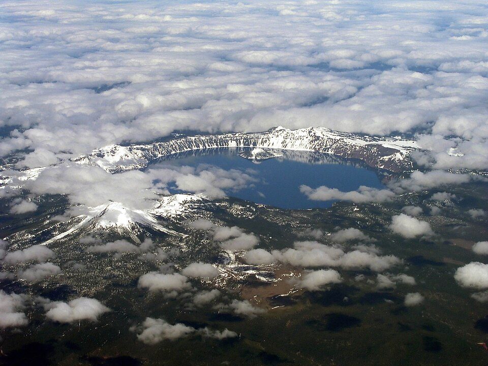
Mount Mazama (Klamath: Tum-sum-ne) is a complex volcano in the western U.S. state of Oregon, in a segment of the Cascade Volcanic Arc and Cascade Range. It lies 15 mi north of Fort Klamath. Further out, Crater Lake is 3.2 mi away.

A mountain, 15 mi north of Fort Klamath
Plan where you’ll sleep
The nearest town with many places to stay is Fort Klamath, 15 miles south. Where to stay ↓
One of the most looked-up attractions in the U.S.
About 81K people a year read its Wikipedia article, more than for 96% of the 7,799 attractions we track.
Best months: Jul and Aug
July and August are the mild months, with highs of 83–84°. When to go ↓
Written from NOAA 1991–2020 normals, Overture places to stay, Census town figures, Wikidata and Wikipedia.
Month by month
Here are the months at Mount Mazama, with their weather.
Mount Mazama
Mount Mazama (Klamath: Tum-sum-ne) is a complex volcano in the western U.S. state of Oregon, in a segment of the Cascade Volcanic Arc and Cascade Range. The volcano is in Klamath County, in the southern Cascades, 60 miles (97 km) north of the Oregon–California border. Its collapse, due to the eruption of magma emptying the underlying magma chamber, formed a caldera that holds Crater Lake (Giiwas in the Klamath language). Mount Mazama originally had an elevation of approximately 12,000 feet (3,700 m), but following its climactic eruption this was reduced to 8,157 feet (2,486 m). Crater Lake is 1,943 feet (592 m) deep, the deepest freshwater body in the United States and the second deepest in North America after Great Slave Lake in Canada.
- Type
- Mountain
- Elevation
- 8,159 ft
- Wikipedia readers
- 81K a year
Towns to stay in near Mount Mazama
Nearest for a night are Fort Klamath (5) and Chemult (5).
Fort Klamath
The closest town with somewhere to stay.
155 people
15 mi south of Mount Mazama
Compare 5 towns
| Town | From Mount Mazama | Drive | Places to stay | People | Typical home |
|---|---|---|---|---|---|
| Fort Klamath | 15 mi south | 25 min | 5 1 hotel · 1 inn or B&B · 2 lodges & cabins · 1 campground | 155 | $251K |
| Chemult | 26 mi northeast | 40 min | 5 3 motels · 1 lodge or cabins · 1 campground | 21 | — |
| Oregon Shores | 27 mi south | 40 min | 6 2 hotels · 1 lodge or cabins · 2 campgrounds · 1 RV park | 428 | — |
| Prospect | 23 mi southwest | 35 min | 3 3 campgrounds | 723 | $326K |
| Chiloquin | 26 mi southeast | 40 min | 4 1 hotel · 2 inns & B&Bs · 1 RV park | 770 | $94K |
Getting there
Nearest airports with airline service
Next door to Mount Mazama
These well-known sights sit within 70 miles.
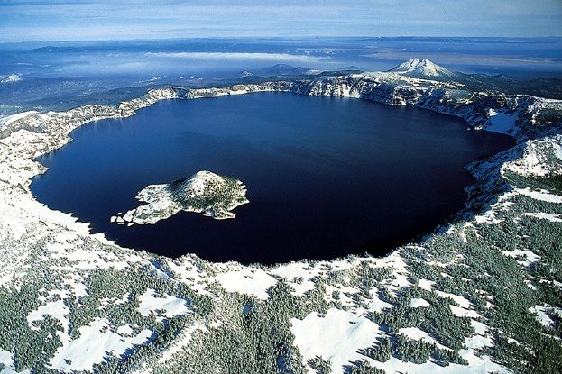 13 mi National ParkCrater Lake National Park632K visitors a year
 68 mi MountainNewberry Volcano
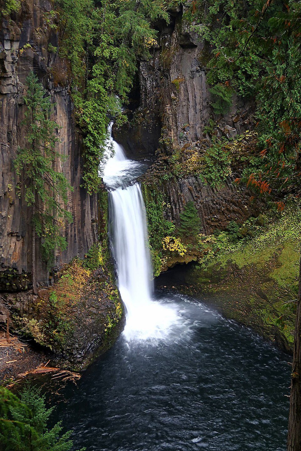 230 mi WaterfallToketee Falls
 327 mi MuseumTrain Mountain Railroad68 mi Park & preserveNewberry National Volcanic Monument
 66 mi Ski areaMount Ashland39 runs · 1,160 ft vertical
 70 mi Zoo & aquariumWildlife Safari
 60 mi City parkLithia Park
Photo credits
Crater Lake National Park: Zainubrazvi, CC BY-SA 3.0 · Newberry Volcano: USGS photo by Lyn Topinka, Public domain · Toketee Falls: Alexlockhart, CC BY-SA 4.0 · Train Mountain Railroad: Tom703, CC BY-SA 3.0 · Newberry National Volcanic Monument: USGS photo by Lyn Topinka, Public domain · Mount Ashland: Alex Lockhart, Public domain · Wildlife Safari: Justin Brockie from Wolcott, Connecticut, USA, CC BY 2.0 · Lithia Park: Unknown, CC BY-SA 3.0


Good to know about Mount Mazama
What town is Mount Mazama near?
Fort Klamath, OR, about 15 miles south.
When is the best time to visit Mount Mazama?
July and August, with highs of 83–84°.
What is the closest airport to Mount Mazama?
Rogue Valley International-Medford (MFR), about 55 miles away. The nearest big hub is Portland (PDX), about 186 miles.
Where should I stay near Mount Mazama?
Fort Klamath (15 mi, 5 places to stay), Chemult (26 mi, 5 places to stay) and Oregon Shores (27 mi, 6 places to stay).
Inside knowledge from Fort Klamath
Share what you know in Fort Klamath’s Town Square.
Sources: National Park Service · ski areas © OpenSkiMap / OpenStreetMap contributors · Wikidata · Wikipedia readership · NOAA climate normals · U.S. Census.