Lost Maples State Natural Area
Lost Maples State Natural Area is a 2,906-acre (1,176 ha) area of hills and canyons on the upper Sabinal River in Bandera and Real Counties, Texas, United States. Its setting is 13 mi northeast of Leakey. Records date it to 1979.
A park & preserve, 13 mi northeast of Leakey
Summers are hot
July and August highs run 94–95°, and about 102 days a year reach 90°. When to go ↓
Leakey is the nearest base
Leakey is 13 miles southwest, with 11 places to stay. Where to stay ↓
A day trip from San Antonio
San Antonio is about 68 miles east (straight-line). Where to stay ↓
Best months: Feb, Mar, Apr, Oct and Nov
February, March, April, October and November are the mild months, with highs of 67–81°. When to go ↓
Established in 1979
Lost Maples State Natural Area dates from 1979. About ↓
Written from NOAA 1991–2020 normals, Overture places to stay, Census town figures, Wikidata and Wikipedia.
Weather through the year
Here are the months at Lost Maples State Natural Area, with their weather.
Lost Maples State Natural Area
Lost Maples State Natural Area is a 2,906-acre (1,176 ha) area of hills and canyons on the upper Sabinal River in Bandera and Real Counties, Texas, United States. It is designated a Natural Area, rather than a State Park, which means the primary focus is the maintenance and protection of the property's natural state. Accordingly, access and recreational activities may be restricted if the Texas Parks & Wildlife Department (TPWD) deems such action necessary to protect the environment. The park opened to the public in 1979.
- Type
- Park & preserve
- Established
- 1979
- Listed
- National Natural Landmark (1980)
- Wikipedia readers
- 8.8K a year
Towns to stay in near Lost Maples State Natural Area
The closest towns with hotels, motels or campgrounds are Leakey (11) and Utopia (10).
Leakey
The closest town with somewhere to stay.
328 people
13 mi southwest of Lost Maples State Natural Area
Compare 5 towns
| Town | From Lost Maples State Natural Area | Drive | Places to stay | People | Typical home |
|---|---|---|---|---|---|
| Leakey | 13 mi southwest | 20 min | 11 2 hotels · 2 inns & B&Bs · 6 lodges & cabins · 1 RV park | 328 | $96K |
| Utopia 23% vacation homes | 14 mi south | 20 min | 10 3 hotels · 1 inn or B&B · 3 lodges & cabins · 1 campground · 2 RV parks | 169 | — |
| Ingram | 27 mi northeast | 40 min | 13 2 hotels · 1 inn or B&B · 3 lodges & cabins · 5 campgrounds · 2 RV parks | 1,846 | $198K |
| Camp Wood | 28 mi west | 40 min | 6 1 hotel · 1 motel · 2 lodges & cabins · 2 campgrounds | 509 | $78K |
| Barksdale | 28 mi west | 40 min | 1 1 lodge or cabins | — | — |
Getting there
Nearest airports with airline service
More to see nearby
You can reach each of these within 67 miles.
 60 mi Theme parkSix Flags Fiesta Texas
 64 mi National Historical ParkLyndon B. Johnson National Historical Park38K visitors a year
 59 mi Theme parkSeaWorld San Antonio
 53 mi MuseumNational Museum of the Pacific War
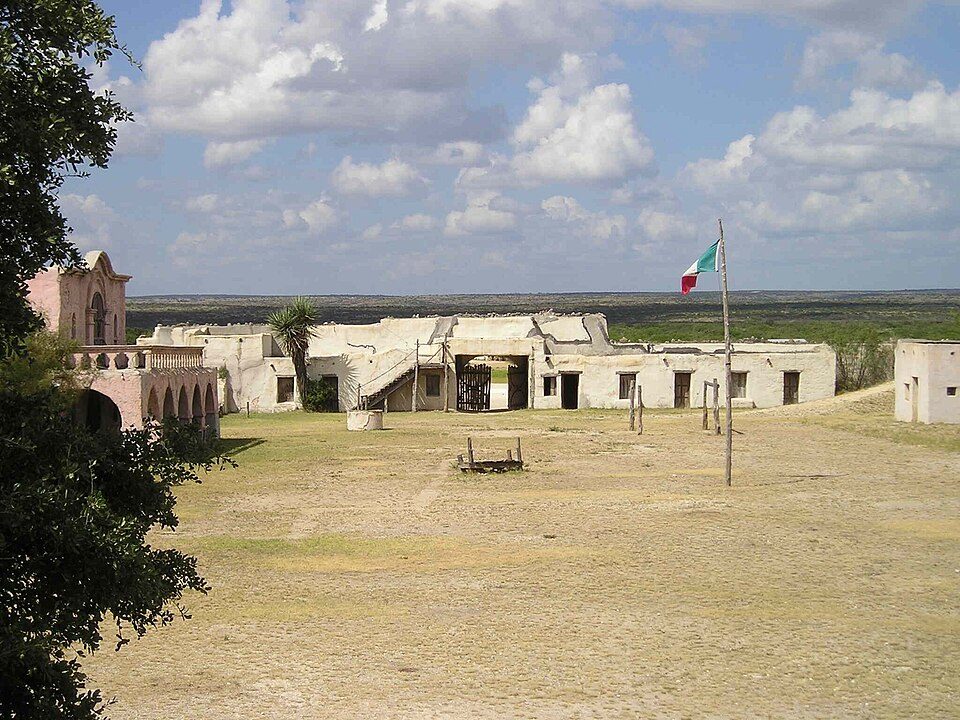 56 mi MuseumAlamo Village
 67 mi MuseumFort Mason60 mi Theme parkWhite Water Bay
 44 mi TheatreGrand Opera House
Photo credits
Six Flags Fiesta Texas: Chris Hagerman, CC BY-SA 3.0 · Lyndon B. Johnson National Historical Park: National Park Service, Public domain · SeaWorld San Antonio: TheConduqtor, CC BY-SA 3.0 · National Museum of the Pacific War: Ernest Mettendorf, Public domain · Alamo Village: Lutz Fischer-Lamprecht, CC BY-SA 4.0 · Fort Mason: Pi3.124, CC BY-SA 3.0 · Grand Opera House: Larry D. Moore, CC BY 4.0


Visiting Lost Maples State Natural Area: the answers
What town is Lost Maples State Natural Area near?
Leakey, TX, about 13 miles southwest.
When is the best time to visit Lost Maples State Natural Area?
February, March, April, October and November, with highs of 67–81°.
How far is Lost Maples State Natural Area from San Antonio?
About 68 miles east of San Antonio, as the crow flies.
What is the closest airport to Lost Maples State Natural Area?
San Antonio (SAT), about 70 miles away.
Where should I stay near Lost Maples State Natural Area?
Leakey (13 mi, 11 places to stay), Utopia (14 mi, 10 places to stay) and Ingram (27 mi, 13 places to stay).
Locals’ advice in Leakey
Tips will appear here once someone posts in Leakey’s Town Square.
Sources: National Park Service · ski areas © OpenSkiMap / OpenStreetMap contributors · Wikidata · Wikipedia readership · NOAA climate normals · U.S. Census.