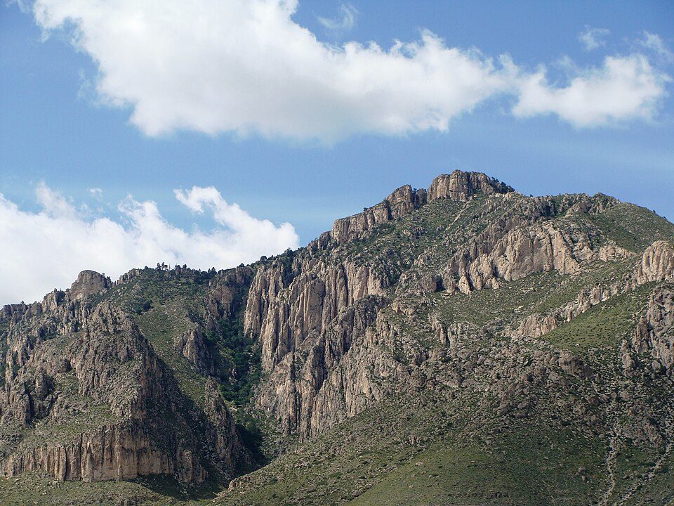
Guadalupe Peak
Guadalupe Peak, also known as Signal Peak, is the highest natural point in Texas, with an elevation of 8,751 feet (2,667 m) above sea level. On the map, it sits 35 mi southwest of Whites City. Close by, Guadalupe Mountains is 1.8 mi away.

A mountain, 35 mi southwest of Whites City
Plan where you’ll sleep
The nearest town with many places to stay is Whites City, 35 miles northeast. Where to stay ↓
Summers are hot
June, July and August highs run 94–95°, and about 121 days a year reach 90°. When to go ↓
A day trip from El Paso
El Paso is about 92 miles west (straight-line). Where to stay ↓
Best months: Mar, Apr and Oct
March, April and October are the mild months, with highs of 71–79°. When to go ↓
Written from NOAA 1991–2020 normals, Overture places to stay, Census town figures, Wikidata and Wikipedia.
Picking a season
The weather near Guadalupe Peak shifts through the year, as below.
Guadalupe Peak
Guadalupe Peak, also known as Signal Peak, is the highest natural point in Texas, with an elevation of 8,751 feet (2,667 m) above sea level. It is located in Guadalupe Mountains National Park, and is part of the Guadalupe Mountains range in southeastern New Mexico and West Texas. The mountain is about 90 miles (140 km) east of El Paso and about 50 miles (80 km) southwest of Carlsbad, New Mexico. The peak rises more than 3,000 feet (910 m) above the arid floor of the Chihuahuan Desert.
- Type
- Mountain
- Elevation
- 8,750 ft
- Wikipedia readers
- 61K a year
Nights near Guadalupe Peak
The closest lodging is in Carlsbad (57) and Whites City (5).
Carlsbad
The closest town with somewhere to stay.
32,524 people
51 mi northeast of Guadalupe Peak
Compare 3 towns
| Town | From Guadalupe Peak | Drive | Places to stay | People | Typical home | Safety |
|---|---|---|---|---|---|---|
| Carlsbad | 51 mi northeast | 1.5 hr | 57 25 hotels · 9 motels · 2 inns & B&Bs · 2 lodges & cabins · 1 campground · 18 RV parks | 32,524 | $200K | D |
| Whites City | 35 mi northeast | 50 min | 5 3 hotels · 1 campground · 1 RV park | — | — | — |
| Loving | 52 mi northeast | 1.5 hr | 2 1 hotel · 1 RV park | 1,391 | $172K | — |
Getting there
Nearest airports with airline service
Places to add to Guadalupe Peak
Each of these is within 70 miles.
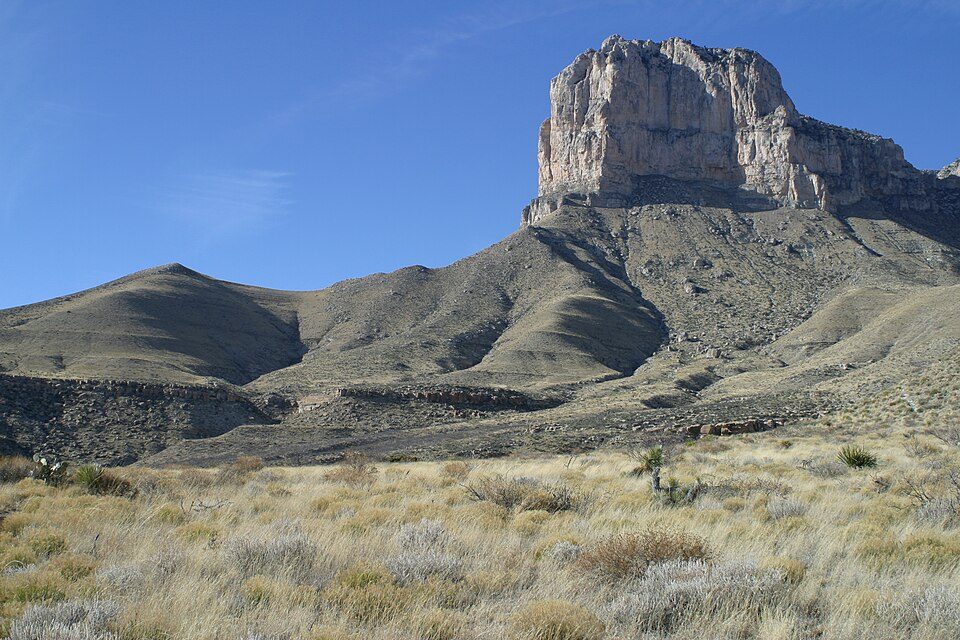 12 mi National ParkGuadalupe Mountains National Park206K visitors a year
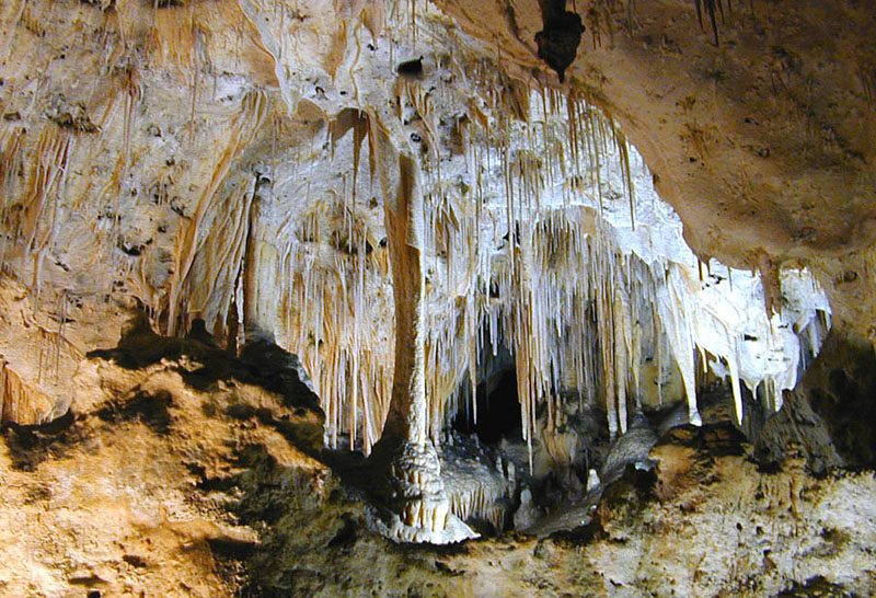 31 mi National ParkCarlsbad Caverns National Park411K visitors a year
 229 mi CaveLechuguilla Cave
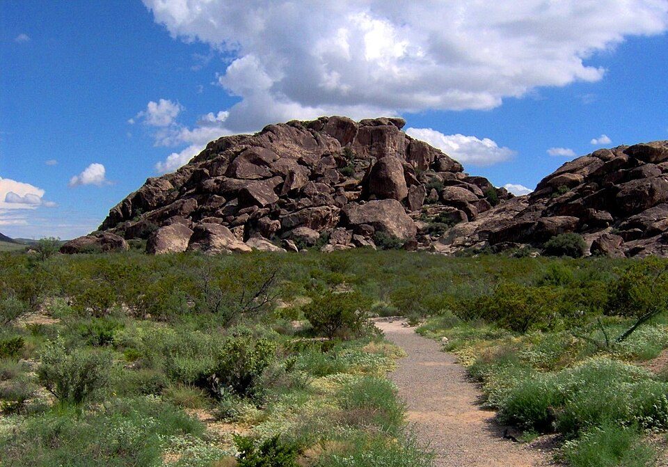 69 mi Ancient siteHueco Tanks
 51 mi GardenLiving Desert Zoo and Gardens State Park
 31 mi TheatreBat Flight Amphitheater
Photo credits
Guadalupe Mountains National Park: Leaflet, CC BY-SA 3.0 · Carlsbad Caverns National Park: Eric Guinther, User:Marshman, CC BY-SA 3.0 · Lechuguilla Cave: Dave Bunnell / Under Earth Images, CC BY-SA 2.5 · Hueco Tanks: Brian Stansberry, CC BY 3.0 · Living Desert Zoo and Gardens State Park: J Dykstra, CC BY-SA 3.0 · Bat Flight Amphitheater: Daniel Mayer, CC BY-SA 3.0


Guadalupe Peak: what to know
What town is Guadalupe Peak near?
Whites City, NM, about 35 miles northeast.
When is the best time to visit Guadalupe Peak?
March, April and October, with highs of 71–79°.
How far is Guadalupe Peak from El Paso?
About 92 miles west of El Paso, as the crow flies.
What is the closest airport to Guadalupe Peak?
Cavern City Air Terminal (CNM), about 47 miles away. The nearest big hub is El Paso (ELP), about 89 miles.
Where should I stay near Guadalupe Peak?
Carlsbad (51 mi, 57 places to stay) and Whites City (35 mi, 5 places to stay).
What locals in Whites City say
People in Whites City have not posted tips yet; their Town Square is open.
Sources: National Park Service · ski areas © OpenSkiMap / OpenStreetMap contributors · Wikidata · Wikipedia readership · NOAA climate normals · U.S. Census.