Blanchard Springs Caverns
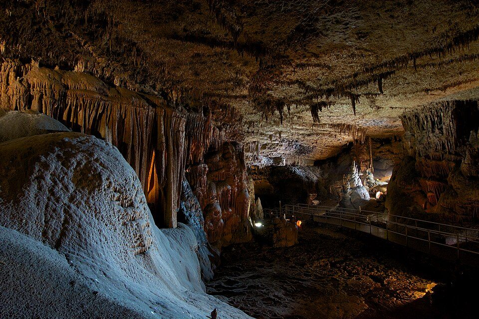
Blanchard Springs Caverns is a cave system located in the Ozark–St. Francis National Forest in Stone County in northern Arkansas, USA, 2 miles (3.2 km) off Highway 14 a short distance north of Mountain View. It is 3 mi east of Fifty-Six. For mild weather, aim for April, May, September and October (70–82°F highs).

A cave, 3 mi east of Fifty-Six
Mountain View is the nearest base
Mountain View is 8 miles southeast, with 28 places to stay. Where to stay ↓
Best months: Apr, May, Sep and Oct
April, May, September and October are the mild months, with highs of 70–82°. When to go ↓
Written from NOAA 1991–2020 normals, Overture places to stay, Census town figures and Wikipedia.
The weather by month
Below are typical highs and lows near Blanchard Springs Caverns.
Blanchard Springs Caverns
Blanchard Springs Caverns is a cave system located in the Ozark–St. Francis National Forest in Stone County in northern Arkansas, USA, 2 miles (3.2 km) off Highway 14 a short distance north of Mountain View. It is the only tourist cave owned by the United States Forest Service and the only one owned by the federal government outside the National Park System. Blanchard Springs Caverns is a three-level cave system, all of which can be viewed on guided tours.
- Type
- Cave
- Wikipedia readers
- 6.9K a year
Towns to stay in near Blanchard Springs Caverns
Nearest for a night are Mountain View (28) and Calico Rock (13).
Mountain View
The closest town with somewhere to stay.
2,940 people
8 mi southeast of Blanchard Springs Caverns
Compare 8 towns
| Town | From Blanchard Springs Caverns | Drive | Places to stay | People | Typical home | Safety |
|---|---|---|---|---|---|---|
| Mountain View | 8 mi southeast | 10 min | 28 5 hotels · 2 motels · 5 inns & B&Bs · 7 lodges & cabins · 3 campgrounds · 6 RV parks | 2,940 | $204K | C |
| Calico Rock | 11 mi north | 15 min | 13 5 hotels · 1 motel · 2 inns & B&Bs · 4 lodges & cabins · 1 RV park | 2,003 | $94K | — |
| Mount Olive 34% vacation homes | 6 mi northeast | 10 min | 2 1 lodge or cabins · 1 RV park | — | — | — |
| Norfork 24% vacation homes | 18 mi north | 25 min | 8 1 hotel · 1 inn or B&B · 4 lodges & cabins · 1 campground · 1 RV park | 482 | $182K | — |
| Mountain Home | 28 mi northwest | 40 min | 23 14 hotels · 2 motels · 2 inns & B&Bs · 1 lodge or cabins · 4 RV parks | 13,373 | $170K | C− |
| Salesville | 20 mi north | 30 min | 7 1 hotel · 3 lodges & cabins · 1 campground · 2 RV parks | 524 | $116K | — |
| Fifty-Six | 3 mi west | 5 min | 1 1 hotel | 163 | $177K | — |
| Henderson 45% vacation homes | 29 mi north | 45 min | 17 6 hotels · 1 motel · 3 lodges & cabins · 4 campgrounds · 3 RV parks | 415 | $189K | — |
Getting there
Nearest airports with airline service
Worth adding to a visit
Within 70 miles you can add these well-known places.
 35 mi National RiverBuffalo National River1.4M visitors a year
 54 mi MuseumJacksonport State Park
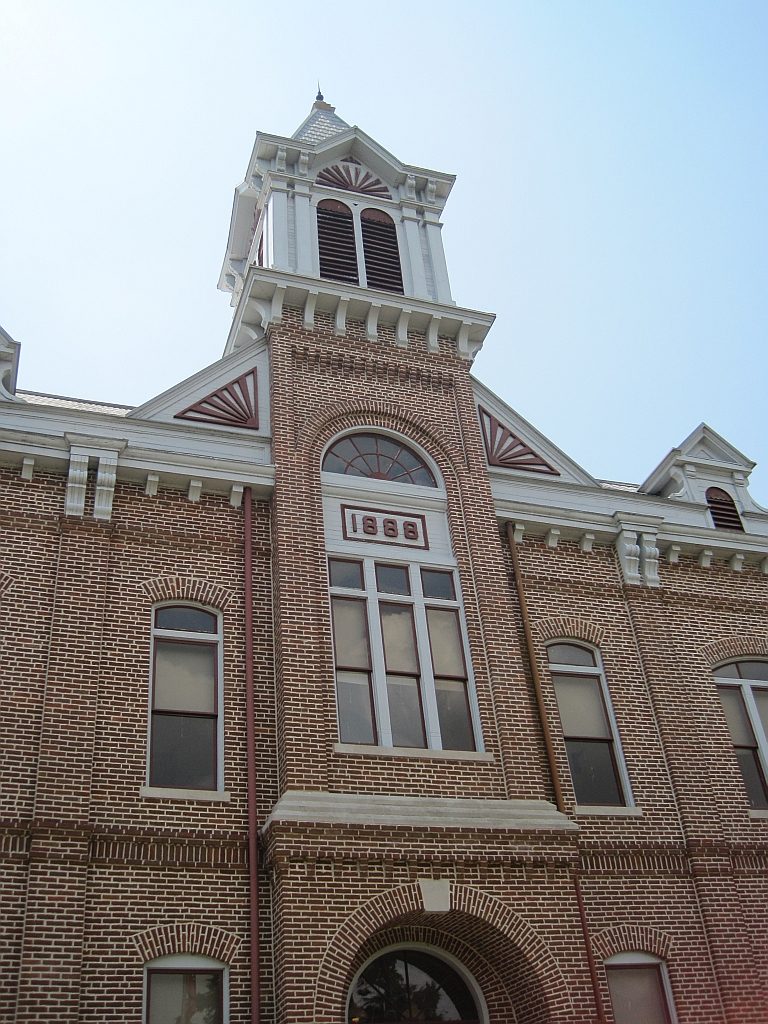 60 mi MuseumPowhatan Historic State Park
 62 mi MuseumFaulkner County Museum
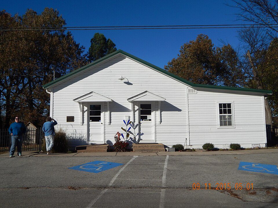 70 mi MuseumEddie Mae Herron Center & Museum
Photo credits
Buffalo National River: Mattsrealm, CC BY-SA 4.0 · Jacksonport State Park: Jma661, CC BY-SA 3.0 · Powhatan Historic State Park: Thomas R Machnitzki ([email protected]), CC BY 3.0 · Faulkner County Museum: L. Allen Brewer, CC BY 2.0 · Eddie Mae Herron Center & Museum: Asimov72455, CC BY-SA 3.0


Visiting Blanchard Springs Caverns
What town is Blanchard Springs Caverns near?
Fifty-Six, AR, about 3 miles west.
When is the best time to visit Blanchard Springs Caverns?
April, May, September and October, with highs of 70–82°.
What is the closest airport to Blanchard Springs Caverns?
Boone County (HRO), about 58 miles away. The nearest big hub is Frederick W. Smith (MEM), about 139 miles.
Where should I stay near Blanchard Springs Caverns?
Mountain View (8 mi, 28 places to stay), Calico Rock (11 mi, 13 places to stay) and Norfork (18 mi, 8 places to stay).
Tips from Fifty-Six
Start the conversation in Fifty-Six’s Town Square.
Sources: National Park Service · ski areas © OpenSkiMap / OpenStreetMap contributors · Wikidata · Wikipedia readership · NOAA climate normals · U.S. Census.