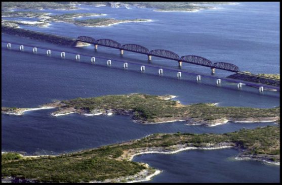
Amistad National Recreation Area
Amistad National Recreation Area is a national recreation area managed by National Park Service (NPS) that includes the area around the Amistad Reservoir at the confluence of the Rio Grande, the Devils River, and the Pecos River near Del Rio. Its setting is 2 mi west of Lake View. It comes under the National Park Service. In 2025 it counted 734K visits.
A national recreation area, 2 mi west of Lake View
No airline airport nearby
The closest airport with airline service is San Angelo Regional Mathis Field (SJT), 134 miles away.
Summers are hot
July and August highs run 97–98°, and about 137 days a year reach 90°. When to go ↓
Visits fell 12% in 2025
The National Park Service counted 734,293 visitors in 2025, down from 832,294 the year before. Visitors ↓
2 towns sit inside the park
Lake View and Box Canyon sit inside the park’s boundary. Where to stay ↓
Lake View is the nearest base
Lake View is 2 miles east, with 7 places to stay. Where to stay ↓
Written from National Park Service visitor counts, NOAA 1991–2020 normals, Overture places to stay, Census town figures, Wikidata and Wikipedia. Updated when the Park Service posts a new month.
When it’s busy, and the weather
This is the year at Amistad, in visitors and weather.
Amistad National Recreation Area
Amistad National Recreation Area is a national recreation area managed by National Park Service (NPS) that includes the area around the Amistad Reservoir at the confluence of the Rio Grande, the Devils River, and the Pecos River near Del Rio in Val Verde County, Texas. The reservoir was created by the Amistad Dam (Presa de la Amistad in Spanish), completed in 1969, located on the Rio Grande at the United States-Mexico border across from the city of Ciudad Acuña in the Mexican state of Coahuila. Amistad, Spanish for "friendship," refers broadly to the close relationship and shared history between Ciudad Acuña and Del Rio.
- Type
- National Recreation Area
- Established
- 1965
- Area
- 91 square miles
- Elevation
- 1,145 ft
- Run by
- National Park Service
- Wikipedia readers
- 2.2K a year
- Official site
- nps.gov/amis
How to visit
Towns to stay in near Amistad National Recreation Area
Close by, places to stay are in Del Rio (26) and Lake View (7).
Del Rio
The closest town with somewhere to stay.
34,496 people
9 mi southeast of Amistad National Recreation Area Visitor Center · 7 mi to the park
Box Canyon
19 people · 42% vacation homes
11 mi northwest of Amistad National Recreation Area Visitor Center
Laughlin AFB
1,595 people
15 mi southeast of Amistad National Recreation Area Visitor Center · 11 mi to the park
Compare 5 towns
| Town | From the visitor center | Drive | Places to stay | People | Typical home | Safety |
|---|---|---|---|---|---|---|
| Del Rio | 9 mi southeast | 15 min | 26 15 hotels · 3 motels · 3 inns & B&Bs · 1 lodge or cabins · 1 campground · 3 RV parks | 34,496 | $160K | B− |
| Lake View | inside the park | 5 min | 7 2 lodges & cabins · 2 campgrounds · 3 RV parks | 349 | $172K | — |
| Box Canyon 42% vacation homes | inside the park | 15 min | 1 1 lodge or cabins | 19 | — | — |
| Laughlin AFB | 15 mi southeast | 20 min | 1 1 hotel | 1,595 | — | — |
| Fort Clark Springs | 36 mi east | 55 min | 1 1 RV park | 1,048 | $67K | — |
Getting there
Nearest airports with airline service, from the visitor center
What else is near Amistad
A wider trip can take in these, within 40 miles.
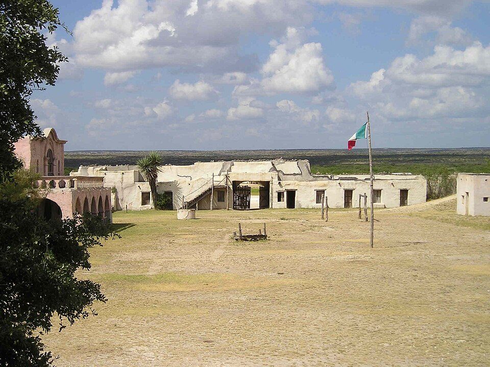


Photo credits
Alamo Village: Lutz Fischer-Lamprecht, CC BY-SA 4.0 · Whitehead Memorial Museum: Billy Hathorn at English Wikipedia, CC BY-SA 3.0


How busy: 734,293 in 2025
The count runs from 2016 up to 2025.
Quick answers on Amistad
What town is Amistad National Recreation Area near?
Lake View, TX, about 2 miles east.
When is the best time to visit Amistad National Recreation Area?
February, October, November and December, with highs of 64–83°. April is the busiest month (about 93,194 visitors).
How many people visit Amistad National Recreation Area each year?
734,293 in 2025, according to the National Park Service. The record is 1,424,139, set in 2020.
What is the closest airport to Amistad National Recreation Area?
San Angelo Regional Mathis Field (SJT), about 134 miles away. The nearest big hub is San Antonio (SAT), about 152 miles.
Where should I stay near Amistad National Recreation Area?
Del Rio (9 mi, 26 places to stay) and Lake View (2 mi, 7 places to stay).
Questions for Lake View
There are no tips yet, so start one in Lake View’s Town Square.
Sources: National Park Service · ski areas © OpenSkiMap / OpenStreetMap contributors · Wikidata · Wikipedia readership · National Park Service visitor use statistics · NOAA climate normals · U.S. Census.