Hardy’s post office opened in 1883, and 11% of its homes were built before 1940
17 places in town are on the National Register, among them two historic districts with 34 buildings between them. Below: 1 old photo or paper, maps from 1914 on, and the census since 1900.
In the early 1950s, the Horrell and Clay families both had grocery stores there. Conway Horn ran a general mercantile store. Charles Cone ran the Western Auto Store. Two places to eat were Bonnie's Cafe and Mrs. Rogers' sundries store. Arthur Snow was a pharmacist and owned a drugstore. The agent for the Frisco Railroad was Virgil L. Walker, Jr. Dink Booth was the barber. The Thomsons ran the movie theater, and Ben Dalton published a newspaper. Ottie Cate ran a poultry and ice house, and Bill Shaver had the Standard Oil service station. Tom Walker was in charge of the local bank, and Woodrow Wilson ran a Mobil service station. "Peavine" Clouse was the city marshal. "Guinea" Gray was a local painter, and Clifford Brummet had the contract to carry the mail between the post office and the arriving trains. He also had a farm near Hardy. Arthur Garner sold real estate. Dewey Dark…
Nothing in the archives for these yearsWeddings on Main Street, storms, parades, school pictures, the old store. If it’s in your family album, it belongs here.
The Hardy post office opened in 1883, the earliest record of the town by name (U.S. post office records).
What is on the National Register in Hardy?
17 listings: 14 buildings, 2 historic districts, the Woodland Courts and the Hardy Downtown Historic District, with 34 contributing buildings, and 1 site. 53 historic buildings in all.
Founding dates: Wikidata, Wikipedia, the U.S. post office records of Blevins & Helbock (CC0) and the Census. Homes by year built: Census ACS 2020–24. National Register of Historic Places: National Park Service (list of May 22, 2026). Old photos, postcards and papers: Wikimedia Commons, the Library of Congress and other public archives, credited on each item’s page. Maps: U.S. Geological Survey historical topographic maps (via Esri) and Sanborn fire-insurance maps (Library of Congress). History text and census tables: Wikipedia (CC BY-SA 4.0). Places that used to be: USGS Geographic Names Information System (2021). How TownRatings grades history →
From Wikimedia Commons (18), the National Register of Historic Places (17), Wikipedia, U.S. Geological Survey historical maps, U.S. Census counts (via Wikipedia), the US Post Offices dataset (Blevins & Helbock), the USGS Geographic Names Information System and Sanborn fire insurance maps (Library of Congress). Archive images are copied here with their credits and licenses, shown on each photo’s page. Refreshed monthly.


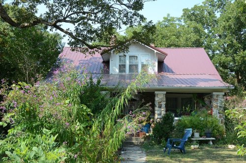


 2015
 2015
 2015
 2015
 2015
 2015
 2015
 2015
 2015
 2015
 2015
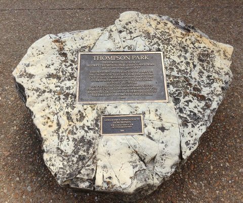 2013
 2013
 2013
 2013
 2013
 2005


