Highway 79 Bridge (Boundary Increase and Additional Documentation)
Also known as Site #MO0058
About Highway 79 Bridge (Boundary Increase and Additional Documentation)
Highway 79 Bridge (Boundary Increase and Additional Documentation), at US 79 over White R., was added to the National Register of Historic Places on Sep 28, 2015. The Register lists it for its engineering, at the local level. The listing covers 12 acres.
Finding Highway 79 Bridge (Boundary Increase and Additional Documentation)
US 79 over White R., Clarendon


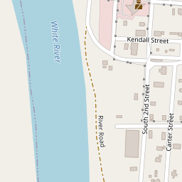


No other Register listing is within a short walk. The nearest are under Around it.
10 more Register listings within a mile
★ National Historic Landmark · D district · B building · S site. Each opens its own page.
Memories of Highway 79 Bridge (Boundary Increase and Additional Documentation)
The record says what it is. Neighbors know what it means.
Your answer becomes a post in Town Square.
Questions about Highway 79 Bridge (Boundary Increase and Additional Documentation)
Is Highway 79 Bridge (Boundary Increase and Additional Documentation) on the National Register of Historic Places?
Yes. It was added on Sep 28, 2015 (Register number 15000629).
Is Highway 79 Bridge (Boundary Increase and Additional Documentation) a National Historic Landmark?
No. It is on the National Register; Arkansas has 20 National Historic Landmarks. The nearest is Louisiana Purchase Survey Marker, 15.9 miles away.
Can you visit Highway 79 Bridge (Boundary Increase and Additional Documentation)?
Our record doesn’t say whether it is open to visitors. Many listed buildings are private, so it may only be seen from the street.
Sources: National Park Service, National Register of Historic Places (05/22/2026). Map tiles © OpenStreetMap contributors.