Skyline was first counted by the census in 1990, and 1 of its places is on the National Register
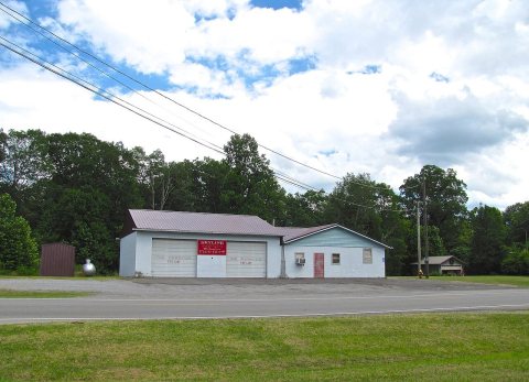
Most of Skyline was built recently: 7% of its homes predate 1940 and the median home dates from 1980. Its Register listing is the Skyline Commissary. Below: maps from 1936 on and the census since 1990.
Skyline began in 1934 as a cooperative farming experiment known as "Cumberland Farms" under President Franklin Roosevelt's Federal Emergency Relief Administration. This was one of 43 such projects attempted nationally in depressed areas. It was soon renamed "Skyline Farms" to avoid confusion with another project in neighboring Tennessee. The experiment lasted for a decade before being sold off to private buyers in 1944.
The current town of Skyline is located about a mile north of the original farming colony.
Founding dates: Wikidata, Wikipedia, the U.S. post office records of Blevins & Helbock (CC0) and the Census. Homes by year built: Census ACS 2020–24. National Register of Historic Places: National Park Service (list of May 22, 2026). Old photos, postcards and papers: Wikimedia Commons, the Library of Congress and other public archives, credited on each item’s page. Maps: U.S. Geological Survey historical topographic maps (via Esri) and Sanborn fire-insurance maps (Library of Congress). History text and census tables: Wikipedia (CC BY-SA 4.0). Places that used to be: USGS Geographic Names Information System (2021). How TownRatings grades history →
From Wikimedia Commons (5), Wikidata (1), the National Register of Historic Places (1), Wikipedia, U.S. Geological Survey historical maps, U.S. Census counts (via Wikipedia), the US Post Offices dataset (Blevins & Helbock) and the USGS Geographic Names Information System. Archive images are copied here with their credits and licenses, shown on each photo’s page. Refreshed monthly.


 2017
 2017
 2017
 2017
 2017