Wigfield Farm
Look for Wigfield Farm, an attraction, 200 m southwest of Worsbrough. Barnsley College operates it. 29 other places to visit are within 15 km, led by Yorkshire Sculpture Park (11 km).
Attraction near Worsbrough
Just outside Worsbrough
Wigfield Farm is 200 m southwest of Worsbrough. Towns near it ↓
Written from OpenStreetMap, Wikidata, the ONS built-up areas and Met Office 1991–2020 averages.
Choosing a month
If warmth matters, go June to September: Worsbrough reaches 18–21°C.
Wigfield Farm
Attraction.
It is run by Barnsley College.
- Type
- Attraction
- Run by
- Barnsley College
- Town
- 200 m southwest of Worsbrough
- Official site
- barnsley.ac.uk/shops-services/wigfield-farm
The way to Wigfield Farm
Orange marks Wigfield Farm, and the numbered points match the list of places below.
© OpenStreetMap contributors · ONS built-up area 2022
Where to base yourself
The most populous of the 8 is Barnsley, at 71,394. Each of these towns lists it on its own page of things to do.
Worsbrough
Barnsley
Birdwell
Dodworth
Compare the 8 towns
| Town | Where Wigfield Farm is | People | Places to visit |
|---|---|---|---|
| Worsbrough | 200 m northeast of it | 8,840 | 10 |
| Barnsley | 1 km north of it | 71,394 | 11 |
| Birdwell | 1.4 km south of it | 3,363 | 11 |
| Dodworth | 2 km northwest of it | 5,981 | 10 |
| Hoyland | 2.7 km southeast of it | 15,527 | 10 |
| Upper Tankersley | 3.1 km south of it | 914 | 7 |
| Barugh Green and Redbrook | 3.6 km northwest of it | 7,545 | 10 |
| Wombwell | 3.9 km east of it | 16,758 | 10 |
Next door to Wigfield Farm
29 more lie within 15 km, 3 museums, 2 castles and 2 historic houses among them.
 MuseumYorkshire Sculpture Park11 km away · 300K visitors a year2
 CastleWentworth Castle2.6 km away3
 CastleSandal Castle14 km away4
 Abbey or priory · English HeritageMonk Bretton Priory3.9 km away5
 Historic houseWentworth Woodhouse7.9 km away6
 Historic house · National TrustNostell Priory15 km away7
 MuseumCannon Hall8.6 km away8
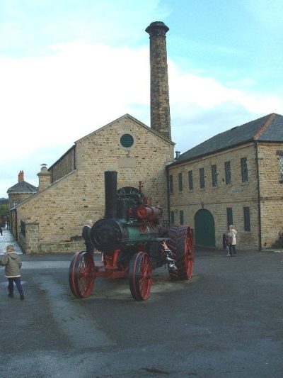 MuseumElsecar Heritage Centre5.6 km away
Within 15 km, close and well known first. Numbers match the map.
Questions about Wigfield Farm
Where is Wigfield Farm?
Wigfield Farm is 200 m southwest of Worsbrough, South Yorkshire.
What is Wigfield Farm?
Attraction.
Who runs Wigfield Farm?
Barnsley College.
When is the best time to visit Wigfield Farm?
June to September are the warmest months in Worsbrough, with afternoon highs of 18–21°C (Met Office 1991–2020 averages).
What else is there to see near Wigfield Farm?
Within 15 km: Yorkshire Sculpture Park (11 km), Wentworth Castle (2.6 km), Sandal Castle (14 km) and Monk Bretton Priory (3.9 km).
Places: OpenStreetMap (© OpenStreetMap contributors, Open Database Licence) and Wikidata (CC0), placed in the ONS 2022 built-up area (Open Government Licence v3.0). Visitor counts are the latest Wikidata gives, with their year.
Photos: each place’s Wikidata image, from Wikimedia Commons under the licence below (our copy, resized).
Photo credits (8)
- Yorkshire Sculpture Park: Nigel Homer, CC BY-SA 2.0, Wikimedia Commons
- Wentworth Castle: Klaus with K. Blue fringing removed by Digon3 13:34, 24 August 2007 (UTC), CC BY-SA 3.0, Wikimedia Commons
- Sandal Castle: Abcdef123456 at English Wikipedia, CC BY 3.0, Wikimedia Commons
- Monk Bretton Priory: Tony Grist, CC0, Wikimedia Commons
- Wentworth Woodhouse: Jeff Pearson, CC BY-SA 2.0, Wikimedia Commons
- Nostell Priory: Wehha, CC BY-SA 3.0, Wikimedia Commons
- Cannon Hall: Dave Gorman, Public domain, Wikimedia Commons
- Elsecar Heritage Centre: Nigel Homer, CC BY-SA 2.0, Wikimedia Commons
Contains public sector information licensed under the Open Government Licence v3.0. Contains HM Land Registry data © Crown copyright and database right 2026. Contains OS data © Crown copyright and database right 2026 (ONS boundaries). Northern Ireland: Source: NISRA; contains Land & Property Services data and Ordnance Survey of Northern Ireland information, © Crown copyright, licensed under the Open Government Licence v3.0. Scotland: contains National Records of Scotland data, Registers of Scotland data and SEPA data, © Crown copyright / © SEPA 2025, licensed under the Open Government Licence v3.0.