
The Grange
The Grange is a grade I listed country house. Its location is 3 km northwest of Old Alresford. It is cared for by English Heritage.
Historic house near Old Alresford
Just outside Old Alresford
The Grange is 3 km northwest of Old Alresford. Towns near it ↓
Cared for by English Heritage
One of the places English Heritage looks after; members usually get in free. About ↓
Scheduled monument
On the official list of protected heritage; Old Alresford has 16 listed buildings in all, on its History page. About ↓
Written from OpenStreetMap, Wikidata, the ONS built-up areas and Met Office 1991–2020 averages.
The seasons here
In Old Alresford the warm season is May to September, with highs of 17–22°C.
The Grange
Articles on it exist in 2 languages. Add Winchester Cathedral, 11 km away, to a visit; it leads 29 places within 15 km.
- Type
- Historic house
- Run by
- English Heritage
- Listed
- Scheduled monument
- Wikipedias
- Covered in 2 languages
- Town
- 3 km northwest of Old Alresford
Where The Grange is
The orange dot is The Grange; the numbers are the places near it, as listed below.
© OpenStreetMap contributors · ONS built-up area 2022
Bases for a visit
Of these 4 towns, the largest is New Alresford (5,340 people). The towns whose pages list it: the one it is in, those within 5 km of it, then larger towns further out.
Old Alresford
New Alresford
Itchen Abbas
Micheldever
Compare the 4 towns
| Town | Where The Grange is | People | Places to visit |
|---|---|---|---|
| Old Alresford | 3 km southeast of it | 279 | 1 |
| New Alresford | 3.7 km southeast of it | 5,340 | 4 |
| Itchen Abbas | 3.8 km southwest of it | 519 | 7 |
| Micheldever | 5.6 km northwest of it | 448 | 0 |
Each has its own grades, prices and things to do.
Also near The Grange
Also close at hand are 2 castles, 2 museums and 2 historic houses, among 29 within 15 km.
 CathedralWinchester Cathedral11 km away2
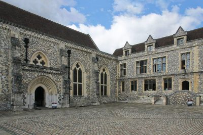 CastleWinchester Castle11 km away3
 Castle · English HeritageWolvesey Castle10 km away4
 MuseumJane Austen's House Museum15 km away5ChurchChurchOld Minster11 km away6
 Historic houseAvington Park House4.8 km away7
 MuseumGurkha Museum11 km away8
 Historic house · National TrustHinton Ampner9.3 km away
Within 15 km, close and well known first. Numbers match the map.
Asked about The Grange
Where is The Grange?
The Grange is 3 km northwest of Old Alresford, Hampshire.
What is The Grange?
Grade I listed country house in Northington, Hampshire, England, UK.
Who runs The Grange?
English Heritage, so members usually get in free; check opening times before you go.
When is the best time to visit The Grange?
May to September are the warmest months in Old Alresford, with afternoon highs of 17–22°C (Met Office 1991–2020 averages).
Is The Grange a listed building?
Yes: scheduled monument.
What else is there to see near The Grange?
Within 15 km: Winchester Cathedral (11 km), Winchester Castle (11 km), Wolvesey Castle (10 km) and Jane Austen's House Museum (15 km).
Places: OpenStreetMap (© OpenStreetMap contributors, Open Database Licence) and Wikidata (CC0), placed in the ONS 2022 built-up area (Open Government Licence v3.0). Visitor counts are the latest Wikidata gives, with their year.
Photos: each place’s Wikidata image, from Wikimedia Commons under the licence below (our copy, resized).
Photo credits (8)
- The Grange: Mpntod at English Wikipedia, CC BY-SA 2.5, Wikimedia Commons
- Winchester Cathedral: http://www.wyrdlight.com Author: Antony McCallum, CC BY 3.0, Wikimedia Commons
- Winchester Castle: Martin Kraft, CC BY-SA 3.0, Wikimedia Commons
- Wolvesey Castle: Simon Burchell, CC BY-SA 4.0, Wikimedia Commons
- Jane Austen's House Museum: Simon Burchell, CC BY-SA 4.0, Wikimedia Commons
- Avington Park House: Mike Searle, CC BY-SA 2.0, Wikimedia Commons
- Gurkha Museum: Anwpwiki, CC BY-SA 4.0, Wikimedia Commons
- Hinton Ampner: Rwendland, CC BY-SA 3.0, Wikimedia Commons
Contains public sector information licensed under the Open Government Licence v3.0. Contains HM Land Registry data © Crown copyright and database right 2026. Contains OS data © Crown copyright and database right 2026 (ONS boundaries). Northern Ireland: Source: NISRA; contains Land & Property Services data and Ordnance Survey of Northern Ireland information, © Crown copyright, licensed under the Open Government Licence v3.0. Scotland: contains National Records of Scotland data, Registers of Scotland data and SEPA data, © Crown copyright / © SEPA 2025, licensed under the Open Government Licence v3.0.