
South Hill Park
South Hill Park is an arts centre, theatre and cinema in a former mansion in Bracknell. Its status is a Grade II listed building. Our list has 65 more places within 15 km; first among them is Windsor Castle, at 14 km.
Historic house in Bracknell
One of the best-known places to visit in England, Scotland, Wales and Northern Ireland
#682 of the 8,556 museums, castles, gardens and other attractions we list, by how widely it is covered (2 Wikipedias). About ↓
Inside Bracknell
South Hill Park is inside Bracknell’s built-up area, with 3 more places to visit within 5 km. Towns near it ↓
Grade II listed building
On the official list of protected heritage; Bracknell has 41 listed buildings in all, on its History page. About ↓
Written from OpenStreetMap, Wikidata, the ONS built-up areas and Met Office 1991–2020 averages.
Choosing a month
Afternoons in Bracknell reach 18–23°C from May to September.
South Hill Park
It welcomes about 250K visitors a year. There are Wikipedia articles on it in 2 languages.
- Type
- Historic house
- Listed
- Grade II listed building
- Visitors
- 250K visitors a year
- Wikipedias
- Covered in 2 languages
- Town
- in Bracknell
- Official site
- southhillpark.org.uk
The way to South Hill Park
Find South Hill Park in orange; each number is a place listed below.
© OpenStreetMap contributors · The dashed line is Bracknell’s built-up area. · ONS built-up area 2022
Nearby towns
By population, Bracknell leads the 8 with 78,662. Its own town leads; the rest list it too, closest first.
Bracknell
Crowthorne
Ascot
North Ascot
Compare the 8 towns
| Town | Where South Hill Park is | People | Places to visit |
|---|---|---|---|
| Bracknell | It’s in town | 78,662 | 5 |
| Crowthorne | 1.9 km southwest of it | 15,196 | 5 |
| Ascot | 3.2 km east of it | 24,003 | 20 |
| North Ascot | 3.3 km east of it | 434 | 7 |
| Binfield | 3.7 km northwest of it | 4,851 | 2 |
| Newell Green | 3.8 km north of it | 1,871 | 3 |
| Wokingham | 4 km west of it | 50,320 | 8 |
| Winkfield Row | 4.1 km northeast of it | 1,756 | 7 |
Pair South Hill Park with these
A visit can add 4 historic houses, 2 castles and a theme park, from 65 places within 15 km.
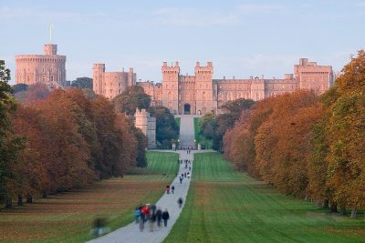 CastleWindsor Castle14 km away2
 Historic houseBagshot Park Mansion4.6 km away3
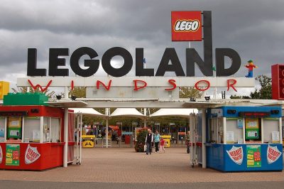 Big drawTheme parkLegoland Windsor10 km away · 2.3M visitors a year (2024)4
 Garden · National TrustRunnymede14 km away5
 Historic houseFrogmore House14 km away6
 Historic houseCumberland Lodge11 km away7CastleCastleFort Belvedere9.6 km away8
 Historic houseSunninghill Park7.8 km away
Within 15 km, close and well known first. Numbers match the map.
South Hill Park: what to know
Where is South Hill Park?
South Hill Park is in Bracknell, Berkshire, inside the town’s built-up area.
What is South Hill Park?
Arts centre, theatre and cinema in a former mansion in Bracknell, England.
How many people visit South Hill Park?
About 250K visitors a year.
When is the best time to visit South Hill Park?
May to September are the warmest months in Bracknell, with afternoon highs of 18–23°C (Met Office 1991–2020 averages).
Is South Hill Park a listed building?
Yes: Grade II listed building.
What else is there to see near South Hill Park?
Within 15 km: Windsor Castle (14 km), Bagshot Park Mansion (4.6 km), Legoland Windsor (10 km) and Runnymede (14 km).
Places: OpenStreetMap (© OpenStreetMap contributors, Open Database Licence) and Wikidata (CC0), placed in the ONS 2022 built-up area (Open Government Licence v3.0). Visitor counts are the latest Wikidata gives, with their year.
Photos: each place’s Wikidata image, from Wikimedia Commons under the licence below (our copy, resized).
Photo credits (8)
- South Hill Park: Garrick Hywel Darts, CC BY-SA 4.0, Wikimedia Commons
- Windsor Castle: Diliff, CC BY 2.5, Wikimedia Commons
- Bagshot Park Mansion: Public domain, Wikimedia Commons
- Legoland Windsor: Rob Young profile, CC BY 2.0, Wikimedia Commons
- Runnymede: Wyrdlight, CC BY 3.0, Wikimedia Commons
- Frogmore House: Gill Hicks, CC BY-SA 2.0, Wikimedia Commons
- Cumberland Lodge: The original uploader was Jadriaen at English Wikipedia., CC BY-SA 2.5, Wikimedia Commons
- Sunninghill Park: Dee Earley, CC BY-SA 3.0, Wikimedia Commons
Contains public sector information licensed under the Open Government Licence v3.0. Contains HM Land Registry data © Crown copyright and database right 2026. Contains OS data © Crown copyright and database right 2026 (ONS boundaries). Northern Ireland: Source: NISRA; contains Land & Property Services data and Ordnance Survey of Northern Ireland information, © Crown copyright, licensed under the Open Government Licence v3.0. Scotland: contains National Records of Scotland data, Registers of Scotland data and SEPA data, © Crown copyright / © SEPA 2025, licensed under the Open Government Licence v3.0.