Saint Mary's Augustinian Priory
Set 1.1 km northwest of Enniskillen, Saint Mary's Augustinian Priory is an abbey or priory. Look also at Enniskillen Castle, 2.8 km away, first of 14 more within 15 km.
Abbey or priory near Enniskillen
Just outside Enniskillen
Saint Mary's Augustinian Priory is 1.1 km northwest of Enniskillen. Towns near it ↓
Written from OpenStreetMap, Wikidata, NISRA’s settlement limits and Met Office 1991–2020 averages.
Seasons and weather
The warmest stretch in Enniskillen is June to August, at 18–19°C in the afternoon.
Saint Mary's Augustinian Priory
Abbey or priory.
- Type
- Abbey or priory
- Town
- 1.1 km northwest of Enniskillen
Finding Saint Mary's Augustinian Priory
Use the numbers to match each place near Saint Mary's Augustinian Priory with the list.
© OpenStreetMap contributors · NISRA settlement development limit 2015
The nearest towns to Saint Mary's Augustinian Priory
Each town here links to its own guide.
Enniskillen
Worth adding to a visit
Within 15 km you can add 5 castles, 2 historic houses and a cathedral.
 CastleEnniskillen Castle2.8 km away2
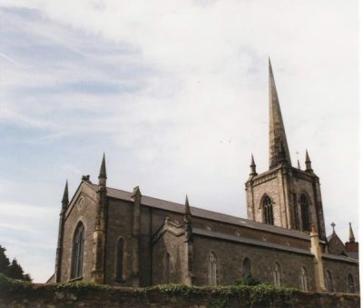 CathedralSt. Macartin's Cathedral2.8 km away3
 Historic house · National TrustCastle Coole5.3 km away4
 CastlePortora Castle1.6 km away5CastleCastleMonea Castle6.3 km away6Historic houseHistoric house · National TrustFlorence Court House13 km away7CastleCastleTully Castle14 km away8CastleCastleBelle Isle Castle13 km away
Within 15 km, close and well known first. Numbers match the map.
A visit to Saint Mary's Augustinian Priory: questions
Where is Saint Mary's Augustinian Priory?
Saint Mary's Augustinian Priory is 1.1 km northwest of Enniskillen, Fermanagh and Omagh.
What is Saint Mary's Augustinian Priory?
Abbey or priory.
When is the best time to visit Saint Mary's Augustinian Priory?
June to August are the warmest months in Enniskillen, with afternoon highs of 18–19°C (Met Office 1991–2020 averages).
What else is there to see near Saint Mary's Augustinian Priory?
Within 15 km: Enniskillen Castle (2.8 km), St. Macartin's Cathedral (2.8 km), Castle Coole (5.3 km) and Portora Castle (1.6 km).
Places: OpenStreetMap (© OpenStreetMap contributors, Open Database Licence) and Wikidata (CC0), placed in NISRA’s Settlement Development Limits 2015 (Open Government Licence v3.0). Visitor counts are the latest Wikidata gives, with their year.
Photos: each place’s Wikidata image, from Wikimedia Commons under the licence below (our copy, resized).
Photo credits (4)
- Enniskillen Castle: Raymond Millar, CC BY-SA 2.0, Wikimedia Commons
- St. Macartin's Cathedral: Rosemary Nelson, CC BY-SA 2.0, Wikimedia Commons
- Castle Coole: Daisymoo90?, CC BY-SA 3.0, Wikimedia Commons
- Portora Castle: Kenneth Allen, CC BY-SA 2.0, Wikimedia Commons
Contains public sector information licensed under the Open Government Licence v3.0. Contains HM Land Registry data © Crown copyright and database right 2026. Contains OS data © Crown copyright and database right 2026 (ONS boundaries). Northern Ireland: Source: NISRA; contains Land & Property Services data and Ordnance Survey of Northern Ireland information, © Crown copyright, licensed under the Open Government Licence v3.0. Scotland: contains National Records of Scotland data, Registers of Scotland data and SEPA data, © Crown copyright / © SEPA 2025, licensed under the Open Government Licence v3.0.